Ollerton, Cheshire

Ollerton, Cheshire

Coordinates: 53°17′14″N 2°20′11″W / 53.287251°N 2.336489°W / 53.287251; -2.336489

Ollerton
Ollerton is located in Cheshire
Ollerton

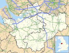
 Ollerton shown within Cheshire
Population 323 (2001)
OS grid reference SJ776767
Parish Ollerton
Unitary authority Cheshire East
Ceremonial county Cheshire
Region North West
Country England
Sovereign state United Kingdom
Post town KNUTSFORD
Postcode district WA16
Dialling code 01565
Police Cheshire
Fire Cheshire
Ambulance North West
EU Parliament North West England
UK Parliament Tatton
List of places: UK • England • Cheshire

Ollerton is a village in the Borough of Cheshire East and the ceremonial county of Cheshire, England. It is situated approximately 2 miles (3.2 km) south east of the town of Knutsford, and has a population of 323.[1]

Local services are limited, and include a church which is within Marthall, pub and several postboxes. Other services such as the primary school, post office and shop have closed down, due to many residents using services in Knutsford. Ollerton combined with the adjacent village of Marthall, has a joint parish council, elected every 3 years, though having very limited and symbolic powers. The villages share the new village hall in Marthall, which was constructed in November 2009.

Ollerton is thought to have come from the name Owlerton and is named in the Domesday Book.

See also

References

External links


Wikimedia Foundation. 2010.

Игры ⚽ Поможем решить контрольную работу

Look at other dictionaries:

  • Ollerton Hall — is a country house in the village of Ollerton, Cheshire, England. Its nucleus dates from the 17th century, originally on an H plan, followed by a succession of rambling extensions .[1] A plaque over the entrance is inscribed with the… …   Wikipedia

  • Ollerton (disambiguation) — Ollerton is a town in the English county of Nottinghamshire. New Ollerton is nearby Additionally Ollerton can refer to the settlements of: Ollerton, Cheshire Ollerton, Shropshire Ollerton Fold, Lancashire This disambiguation page lists articles… …   Wikipedia

  • Cheshire — Grafschaft Cheshire Geografie Status Zeremonielle Grafschaft Region: North West England Fläche 2.343 …   Deutsch Wikipedia

  • Ollerton — Recorded in the spellings of Allerton, and occasionally Ollerton, this is an English surname. It is locational from any of the various places so called including Allerton in Lancashire, Chapel Allerton in the West Riding of Yorkshire, and… …   Surnames reference

  • Civil parishes in Cheshire — A map of Cheshire, showing the Boroughs : (1) Cheshire West and Chester; (2) Cheshire East; (3) Warrington; and (4) Halton. A civil parish is a subnational entity, forming the lowest unit of local government in England. There are 332 civil… …   Wikipedia

  • Marbury, Cheshire — Not to be confused with Marbury in the civil parish of Anderton with Marbury. Coordinates: 53°00′25″N 2°39′22″W / 53.007°N 2.656°W / …   Wikipedia

  • Acton, Cheshire — For the village in Vale Royal, see Acton Bridge. Coordinates: 53°04′23″N 2°32′55″W / 53.073117°N 2.548588°W / 53.073117 …   Wikipedia

  • Cholmondeley, Cheshire — Coordinates: 53°03′26″N 2°41′30″W / 53.057088°N 2.691637°W / 53.057088; 2.691637 …   Wikipedia

  • Doddington, Cheshire — Coordinates: 53°01′37″N 2°26′17″W / 53.027°N 2.438°W / 53.027; 2.438 …   Wikipedia

  • Moston, Cheshire East — Coordinates: 53°09′08″N 2°24′44″W / 53.152126°N 2.412290°W / 53.152126; 2.412290 …   Wikipedia

Share the article and excerpts

Direct link
Do a right-click on the link above
and select “Copy Link”