- Chorley, Cholmondeley
-
Coordinates: 53°03′20″N 2°38′13″W / 53.05545°N 2.63703°W
Chorley 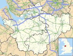
 Chorley
Chorley shown within CheshireOS grid reference SJ574511 Parish Chorley Unitary authority Cheshire East Ceremonial county Cheshire Region North West Country England Sovereign state United Kingdom Police Cheshire Fire Cheshire Ambulance North West EU Parliament North West England List of places: UK • England • Cheshire Chorley is a hamlet (at SJ574511) and civil parish in the unitary authority of Cheshire East and the ceremonial county of Cheshire, England. The hamlet lies 5 miles to the west of Nantwich and 6 miles to the north east of Malpas. Nearby villages include Faddiley, Norbury, Ravensmoor and Wrenbury. The River Weaver runs north–south through the parish, and the A49 runs north–south immediately to the west.
According to the 2001 census, the parish had a population of 100.[1]
It should not be confused with the civil parish of Chorley near the town of Alderley Edge, also in Cheshire East.
Education
See also: List of schools in Cheshire EastChorley civil parish falls within the catchment areas of Bickerton Holy Trinity CE Primary School in Bickerton and Bishop Heber High School in Malpas.[2][3]
References
- ^ Neighbourhood Statistics: Chorley CP (accessed 12 August 2007)
- ^ Cheshire County Council: Interactive Mapping: Bickerton Holy Trinity CE Primary School (accessed 25 May 2008)
- ^ Cheshire County Council: Interactive Mapping: Bishop Heber High School (accessed 25 May 2008)
External links
Ceremonial county of Cheshire Unitary authorities Major settlements Rivers Topics - History
- Museums
Coordinates: 53°03′20″N 2°38′13″W / 53.05545°N 2.63703°W
Categories:- Civil parishes in Cheshire
- Villages in Cheshire
- Cheshire geography stubs

Wikimedia Foundation. 2010.