- Durrington, West Sussex
-
Coordinates: 50°50′09″N 0°24′45″W / 50.83573°N 0.4124°W
Durrington 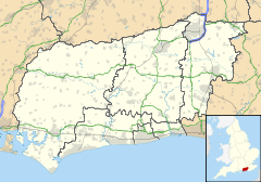
 Durrington
Durrington shown within West SussexOS grid reference TQ118052 District Worthing Borough Shire county West Sussex Region South East Country England Sovereign state United Kingdom Post town WORTHING Postcode district BN13 Dialling code 01903 Police Sussex Fire West Sussex Ambulance South East Coast EU Parliament South East England UK Parliament Worthing West List of places: UK • England • West Sussex Durrington is a neighbourhood of the Borough of Worthing in West Sussex, England. It is situated near the A27 road, 2.3 miles (3.7 km) northwest of the town centre.
Durrington means 'Dēora's farmstead', Dēora presumably being the name of a Saxon settler.[1] In common with many neighbouring settlements during the Saxon era, the local people also had land in the Weald, which would have been used for seasonal pasture for animals. Their land was at 'Dēoringa wīc' (modern-day Drungewick, in the parish of Loxwood).[1]
Durrington was first recorded in 934 as a Saxon estate. In that year, King Athelstan granted some of the land to one of his thegns. By the time of the Domesday survey in 1086, Robert le Sauvage—lord of the manor of nearby Broadwater—held the land.[2][3] The civil and ecclesiastical parish was smaller than the Saxon estate: it extended for about 2 miles (3.2 km) from north to south and 0.7 miles (1.1 km) from east to west.[2]
The Domesday survey recorded that Durrington had "a church, eight acres of meadow and a wood of ten hogs".[3][4] The church had existed since Saxon times, no later than the 11th century, but little is known of it: the structure was probably built of plaster, wattle and daub and thatch, in common with other churches of the era.[5] It was dedicated to St Nicholas.[6] In about 1265, the church was rebuilt and rededicated to Thomas Becket.[5][6][7] The new design, a simple two-cell building, had a 56 by 29 feet (17 × 8.8 m) nave and a 23 by 19 feet (7.0 × 5.8 m) chancel separated by a rood screen, above which was a crucifix.[5] There was also a wall-mounted stone pulpit, a stone altar,[8] a series of tall, pointed windows high in the walls,[5] an unadorned stone font and a short wooden steeple—little more than an extended belfry—extending from the nave roof.[9] The new church was still a chapelry of St Andrew's Church at nearby West Tarring: this meant that it was served and administered by clergy from that church, and most of the parish's tithes were paid to St Andrew's. It was not an independent parish church.[2]
In 1643, during the English Civil War, St Symphorian's Church—Durrington's Anglican church—was partially destroyed by Roundhead soldiers after the Royalist vicar had supposedly tried to gain support for the Royalist cause amongst his parishioners. The church remained ruined until 1915 when a new church was built, which included some of the original stones.
Durrington was also the location of the first civil partnership formed under the Civil Partnership Act 2004, taking place on the 5th December 2005 between Matthew Roche and Christopher Cramp at St Barnabas' Hospice.
Durrington today
In 1992, the annual Durrington festival was founded by residents Dave Butler and Dave Collard. The festival is "a week long celebration of what Durrington has to offer". The festival committee, composed of local residents and led by Peter Bloxham, aims to "provide opportunities for a diverse range of performers, groups, charities and business to promote what is good about living and working in Durrington". The latest festival (June 2009) featured "music, theatre, flowers and faith". It was one week long and culminated in a carnival, fayre and fireworks display at Pond Lane Recreation Park.
References
- ^ a b Glover, Judith (1997), Sussex Place-Names: Their Origins and Meanings Countryside Books ISBN 978-1853064845
- ^ a b c Salzman, L. F. (ed) (1980). "A History of the County of Sussex: Volume 6 Part 1: Bramber Rape (Southern Part). Durrington". Victoria County History of Sussex. British History Online. pp. 81–85. https://www.british-history.ac.uk/report.aspx?compid=18220. Retrieved 9 January 2010.
- ^ a b Evans 1977, p. 7.
- ^ Wales 1999, p. 81.
- ^ a b c d Evans 1977, p. 8.
- ^ a b Elleray 1998, p. 50.
- ^ "Heritage Gateway Listed Buildings Online: Church of St Symphorian, Durrington Hill (west side), Durrington, Worthing, West Sussex". Heritage Gateway website. Heritage Gateway (English Heritage, Institute of Historic Building Conservation and ALGAO:England). 2006. http://www.heritagegateway.org.uk/Gateway/Results_Single.aspx?uid=302255&resourceID=5. Retrieved 9 January 2010.
- ^ Evans 1977, p. 9.
- ^ Evans 1977, p. 10.
External links
 Media related to Durrington, West Sussex at Wikimedia Commons
Topics History · Maritime history · Public services · Royal visits · Sport
Politics Local elections · Constituencies: East Worthing and Shoreham · Worthing West · MPs: Tim Loughton · Peter Bottomley
Transport Transport in Worthing · Railway stations: East Worthing · Worthing · West Worthing · Durrington-on-Sea · Goring-by-Sea · Roads: A24 · A27 · A259 · Stagecoach in the South Downs · Compass Bus
Education Schools in Worthing · Current: Worthing College · Northbrook College · Chatsmore High School · Davison High School · Durrington High School · St Andrew's High School · Worthing High School · Former: St Ronan's School
Buildings Listed buildings · Castle Goring · Dome Cinema · High Salvington Windmill · Park Crescent · Vintners Parrot · Worthing Hospital · Worthing Pier · St Paul's Church, Worthing
Religion Places of worship · Operational churches: Christ Church · St Andrew's, West Tarring · St Andrew's, Worthing · St Botolph's · St George's · St Mary's, Broadwater · St Mary's, Goring-by-Sea · St Mary of the Angels · St Symphorian's · Worthing Tabernacle · Other: St Paul's · Skeleton Army
Sport and Leisure Worthing F.C. · Worthing United F.C. · Worthing Thunder · Worthing Golf Club · Leisure Centre · Museum and Art Gallery · Connaught Theatre · Worthing Symphony Orchestra · International Birdman · End of the Pier Film Festival · Beach House Park · Manor Sports Ground
Geography Cissbury Ring · Highdown Gardens · Teville Stream · Titnore Wood
Neighbourhoods
and districtsBroadwater · Cote · Durrington · Findon Valley · Goring-by-Sea · Heene · High Salvington · Offington · Salvington · West Tarring · Worthing
Categories:- Worthing
- Villages in West Sussex
- Places in West Sussex listed in the Domesday Book

Wikimedia Foundation. 2010.