- Interstate 271
-
Interstate 271
Cleveland Outerbelt East 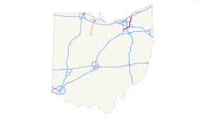
Route information Maintained by Ohio DOT Length: 46.06 mi[1] (74.13 km) Existed: 1972 – present Major junctions South end:  I-71 in Medina Township
 I-77 / SR 21 in Richfield

 I-480 / SR 14 in Cleveland
North end:  I-90 in Willoughby Hills
Highway system Auxiliary route of the Interstate Highway System
Main • Auxiliary • BusinessOhio highways
Interstates • U.S. Routes • State Routes←  I-270
I-270SR 273  →
→Interstate 271 (I-271) is an auxiliary interstate highway in the suburbs of Cleveland and Akron in the U.S. state of Ohio. The highway is officially designated the "Cleveland Outerbelt East", but rarely referred to by that name.
Contents
Route description
The highway runs from a junction with I-71 in Medina Township to I-90 in Willoughby Hills, intersecting I-480 (and running jointly with it for a short stretch). The width varies from point to point, but is mostly four to six lanes wide south of I-480 and eight to twelve lanes wide north of I-480; there it is divided into express and local lanes.
The local-express lanes begin at the southern interchange of US-422 and continue northward slightly beyond the end of I-271. The northbound express lanes allow access to all exits (excluding Chagrin Boulevard, Harvard Road, and SR 175, a southbound-only exit). The southbound express lanes bypass all exits and only have one combined exit for Chagrin Boulevard (east US-422), Harvard Road, Richmond Road (SR 175) and US-422 (west) interchange.
I-290 was to have followed the northern end of I-271. I-271 itself was to have followed I-480N and I-480 westward to I-71.[2]
Interstate 271 does not have a direct interchange with Interstate 80 – one of only a few examples of Interstate Highways that cross but do not intersect. Another example is in Chicago where Interstate 57 crosses Interstate 294 but does not intersect with it. The 271/480 section is the only instance of a concurrency of two three-digit Interstate Highways.
History
For many years, the interchange with State Route 8 was only partially complete. The northbound exit and southbound entrance ramps connected with both directions of State Route 8, but southbound I-271 could only access State Route 8 southbound (though later both directions were accessible[3]), and only northbound State Route 8 could access I-271 northbound. To compensate for the missing movements, a half-diamond was built at State Route 82. The I-271/State Route 8 interchange underwent reconstruction in 2008–2009 that turned it into a complete interchange allowing all movements.[4][5][6]
Similarly, travelers going to and from the north on I-271 had to take surface streets to get to and from the west on I-480 in Cuyahoga County.[citation needed] This link is now covered by unsigned I-480N.
Exit list
County Location Mile[7] # Destinations Notes Medina Medina Twp. 0.00 I-71 south – ColumbusSouthbound exit and northbound entrance 3.52 3  SR 94 (Ridge Road) to I-71 north
Summit Richfield 9.52 9 Brecksville Road Northbound exit and southbound entrance 10.15 10 
 I-77 / SR 21 to I-80 / Ohio Tpk. – Cleveland, Akron
Northbound exit to I-77 south / SR 21 south is via exit 9; no southbound exit to I-77 north / SR 21 north 12.59 12  SR 303 (Streetsboro Road) – Richfield, Peninsula
Macedonia 18.44 18  SR 8 – Boston Heights, Akron
19.22 19  SR 82 (East Aurora Road) – Macedonia, Twinsburg
Southbound exit and northbound entrance Cuyahoga Oakwood 21.84 21 I-480 east / SR 14 east – YoungstownSouth end of I-480 / SR 14 overlap; southbound exit and northbound entrance Bedford 23.28 23 SR 14 west (Broadway Avenue) / Forbes RoadNorth end of SR 14 overlap Bedford Heights 25.87 26A Rockside Road Signed as exit 26 southbound 25.87 26B I-480 west – Cleveland, ToledoNorth end of I-480 overlap; northbound exit and southbound entrance 27.01 27A  US 422 east – Warren
South end of US 422 overlap 27.94 27B I-480 west (via I-480N west) – ToledoSouthbound exit and northbound entrance 27.94 27B Miles Road Northbound exit and southbound entrance 28.08 28A  SR 175 (Richmond Road) / Emery Road
Southbound exit and northbound entrance, remaining movements are via exit 27B northbound Orange 29.01 28B Harvard Road Beachwood 29.96 29  US 422 west (West Chagrin Boulevard) / SR 87 east (West Chagrin Boulevard)
North end of US 422 overlap Lyndhurst 32.92 32 Cedar Road, Brainard Road Mayfield Heights 34.98 34  US 322 (Mayfield Road)
Highland Heights 36.31 36 Wilson Mills Road Lake Willoughby Hills 40.22 40AB I-90 – Cleveland, ErieNorthbound exit and southbound entrance References
- ^ Route Log - Auxiliary Routes of the Eisenhower National System Of Interstate and Defense Highways - Table 2
- ^ Ohio Department of Highways (via Roadfan.com). "1957-1958 Biennial Report excerpt". http://www.roadfan.com/clevmap.html. Retrieved 2008-04-02.
- ^ "Northern Summit County". Roadfan.com.
- ^ State Route 8 Phase I Project Overview. State Route 8 Connection. Ohio Department of Transportation District 4.
- ^ Armon, Rick (2009-07-30). "New Route 8 Ramp Eases Congestion". Akron Beacon Journal. http://infoweb.newsbank.com/iw-search/we/InfoWeb?p_action=doc&p_topdoc=1&p_docnum=1&p_sort=YMD_date:D&p_product=NewsBank&p_text_direct-0=document_id=(%20129CAF791B1194A8%20)&p_docid=129CAF791B1194A8&p_theme=aggregated5&p_queryname=129CAF791B1194A8&f_openurl=yes&p_nbid=T6DA5FFVMTI1Mzc0NTkyNC40MTcwNjk6MToxMjoxOTguMzAuMjI4LjA&&p_multi=ABJB. Retrieved 2009-09-23.
- ^ "I-271 Southbound Ramp to SR-8 southbound is now OPEN". State Route 8 Connection, Ohio Department of Transportation District 4, 2009-09-04.
- ^ Mileages retrieved from Technical Services Straight Line Diagrams
External links
Auxiliary routes of Interstate 71  Categories:
- Three-digit Interstate Highways
- Interstate Highways in Ohio
- Cleveland area expressways


Wikimedia Foundation. 2010.