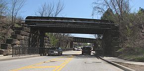
- Ohio State Route 303
-
State Route 303 Route information Maintained by ODOT Length: 75.78 mi[1] (121.96 km) Existed: 1933 – present Major junctions West end:  US 20 in Wakeman
 I-71 in Brunswick
East end:  SR 82 near Windham
Location Counties: Huron, Lorain, Medina, Summit, Portage, Trumbull Highway system Ohio highways
Interstates • U.S. Routes • State Routes←  SR 302
SR 304  →
→State Route 303 is an east–west state highway in northern portion of the U.S. state of Ohio. Its western terminus is at U.S. Route 20 in Wakeman, and its eastern terminus is 1.28 miles (2.06 km) east of Windham.[2][3] Signage photos from 2003[4] showed that the route apparently ended at State Route 534 and was co-signed with State Route 82 (this concurrency would be less than ½ mile). In fact, before the construction of the Ohio Turnpike, State Route 303 did intersect with State Route 534, as seen in highway maps from 1940.[5][6] However the Technical Straight Line Diagram for State Route 303 in Trumbull County[2] shows that SR 303 now ends at State Route 82, and signs now reflect that fact.
State Route 303 passes through Cuyahoga Valley National Park. East of Richfield, a widened section of road with left turn lanes that apparently go nowhere reveals the former site of the Richfield Coliseum.
Contents
Major intersections
County Location Mile Destinations Notes Huron Wakeman 0.00  US 20
US 20Western terminus of SR 303. Lorain Camden Township 5.68  SR 511
Pittsfield Township 10.16  SR 58
SR 58LaGrange 15.32  SR 301
Grafton Township 20.39  SR 83
SR 83
 SR 57
SR 57Beginning of SR 57 concurrence. 22.52  SR 57
SR 57End of SR 57 concurrence. Medina Liverpool Township 25.68  SR 252
Brunswick 29.95  US 42
US 4232.18  I-71
I-71Junction with I-71 southbound. 32.21  I-71
I-71Junction with I-71 northbound. Hinckley Township 34.99  SR 3
SR 3
 SR 94
SR 94Beginning of SR 94 concurrence. 35.98  SR 94
SR 94End of SR 94 concurrence. Summit Richfield 39.76  SR 176
Richfield Township 43.21  I-271
I-271Boston Heights 48.64  SR 8
SR 8Hudson 51.39  SR 91
SR 91Portage Streetsboro 56.11  SR 14
SR 14Beginning of SR 14 concurrence. 56.58  SR 14
SR 14End of SR 14 concurrence. Shalersville Township 62.59  SR 44
SR 44Freedom Township 66.91  SR 700
67.08  SR 88
SR 88Beginning of SR 88 concurrence. 67.61  SR 88
SR 88End of SR 88 concurrence. Trumbull Braceville Township 75.78  SR 82
SR 82Eastern terminus of SR 303. 1.000 mi = 1.609 km; 1.000 km = 0.621 mi History
- 1933 – Original route established; originally routed from Richfield to Hudson along its current alignment[7].
- 1934 – Extended east to Streetsboro via a previously unnumbered road[7].
- 1938 – Extended west to Wakeman via previously unnumbered roads from Wakeman to Pittsfield and from Belden to Richfield, and along the alignment of former State Route 200 from Pittsfield to Belden; also extended east to a point four miles (6 km) east of Windham.[7]
- circa 1954 – Its eastern terminus was moved less than ½ mile west of State Route 534 on State Route 82 when the Ohio Turnpike was constructed.[8]
References
- ^ Ohio Department of Transportation. "Technical Services Straight Line Diagrams". http://www.odotonline.org/techservapps/SLD/default.htm. Retrieved April 30, 2010.
- ^ a b Technical Straight Line Diagram for State Route 303 in Trumbull County. Retrieved 3 January 2007.
- ^ Note: State Route 303 forms the northern boundary of Windham at its easternmost boundary, the Trumbull-Portage County Line. Therefore, the distance as computed from the county line in the Technical Straight Line Diagram is the same as that from the village limits of Windham. See also: Image:Map of Portage County Ohio With Municipal and Township Labels.PNG
- ^ End photos of Ohio 303
- ^ Ohio County Highway Maps 1940, at RailsandTrails.com. Retrieved 3 January 2007.
- ^ 1940 Ohio Highway Map (MrSID (.sid) format). Ohio Highway Maps. Ohio Department of Transportation (1940). Retrieved on 3 April 2008.
- ^ a b c Route 303 (The Unofficial Ohio State Highways Web Site) by John Simpson
- ^ 1953 and 1955 Ohio Highway Maps (MrSID (.sid) format). Ohio Highway Maps. Ohio Department of Transportation (1953, 1955). Retrieved on 23 July 2008.
External links
Categories:- State highways in Ohio
- Transportation in Huron County, Ohio
- Transportation in Lorain County, Ohio
- Transportation in Medina County, Ohio
- Transportation in Summit County, Ohio
- Transportation in Portage County, Ohio
- Transportation in Trumbull County, Ohio
Wikimedia Foundation. 2010.


