- Bedford Heights, Ohio
Infobox Settlement
official_name = Bedford Heights, Ohio
settlement_type =City
nickname =
motto =
imagesize =
image_caption =
image_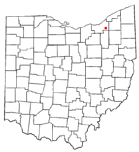
mapsize = 250px
map_caption = Location of Bedford Heights in Ohio
mapsize1 = 250px
map_caption1 = Location of Bedford Heights in Cuyahoga Countysubdivision_type = Country
subdivision_name =United States
subdivision_type1 = State
subdivision_name1 =Ohio
subdivision_type2 = County
subdivision_name2 = Cuyahogagovernment_footnotes =
government_type =
leader_title =Mayor
leader_name = Fletcher Berger
leader_title1 =
leader_name1 =
established_title =
established_date =unit_pref = Imperial
area_footnotes =
area_magnitude =
area_total_km2 = 11.7
area_land_km2 = 11.7
area_water_km2 = 0.0
area_total_sq_mi = 4.5
area_land_sq_mi = 4.5
area_water_sq_mi = 0.0population_as_of = 2000
population_footnotes =
population_total = 11375
population_density_km2 = 968.1
population_density_sq_mi = 2507.4timezone = Eastern (EST)
utc_offset = -5
timezone_DST = EDT
utc_offset_DST = -4
elevation_footnotes = GR|3
elevation_m = 317
elevation_ft = 1040
latd = 41 |latm = 24 |lats = 17 |latNS = N
longd = 81 |longm = 30 |longs = 23 |longEW = Wpostal_code_type =
ZIP code s
postal_code = 44128, 44146
area_code = 216
blank_name = FIPS code
blank_info = 39-04920GR|2
blank1_name = GNIS feature ID
blank1_info = 1048505GR|3
website = http://www.bedfordheights.gov/
footnotes =Bedford Heights is a city in Cuyahoga County,
Ohio ,United States . The population was 11,375 at the 2000 census.Geography
Bedford Heights is located at coor dms|41|24|17|N|81|30|23|W|city (41.404821, -81.506409)GR|1.
According to the
United States Census Bureau , the city has a total area of 4.5square mile s (11.8km² ), all of it land.Demographics
As of the
census GR|2 of 2000, there were 11,375 people, 5,119 households, and 3,004 families residing in the city. Thepopulation density was 2,507.4 people per square mile (967.4/km²). There were 5,577 housing units at an average density of 1,229.4/sq mi (474.3/km²). The racial makeup of the city was 27.89% White, 67.42% African American, 0.20% Native American, 1.90% Asian, 0.01% Pacific Islander, 0.54% from other races, and 2.04% from two or more races. Hispanic or Latino of any race were 1.60% of the population. The second largest ancestry reported by residents of Bedford Heights, after African-American, is Italian. [ [http://www.epodunk.com/cgi-bin/genealogyInfo.php?locIndex=16330 Bedford Heights - Bedford Heights - Ancestry & family history - ePodunk ] ]There were 5,119 households out of which 24.8% had children under the age of 18 living with them, 36.5% were married couples living together, 18.3% had a female householder with no husband present, and 41.3% were non-families. 36.0% of all households were made up of individuals and 9.8% had someone living alone who was 65 years of age or older. The average household size was 2.21 and the average family size was 2.87.
In the city the population was spread out with 21.9% under the age of 18, 8.6% from 18 to 24, 29.8% from 25 to 44, 26.5% from 45 to 64, and 13.2% who were 65 years of age or older. The median age was 39 years. For every 100 females there were 86.9 males. For every 100 females age 18 and over, there were 83.7 males.
The median income for a household in the city was $37,861, and the median income for a family was $47,328. Males had a median income of $33,599 versus $29,167 for females. The
per capita income for the city was $21,791. About 6.8% of families and 7.6% of the population were below thepoverty line , including 13.2% of those under age 18 and 4.6% of those age 65 or over.urrounding Communities
Geographic Location
Northwest = North Randall
North = Warrensville Heights
Northeast = Orange
West = Maple Heights
Center = Bedford Heights
East = Solon
Southwest = Bedford
South = OakwoodReferences
External links
* [http://www.bedfordheights.gov/ City of Bedford Heights official site]
Wikimedia Foundation. 2010.