- Montmorenci, Indiana
-
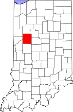
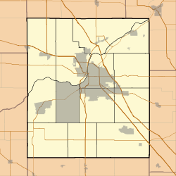
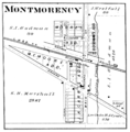
Montmorenci — Unincorporated community — Montmorenci's grain elevators silhouetted at dusk Tippecanoe County's location in Indiana Location in Tippecanoe County Coordinates: 40°28′27″N 087°01′46″W / 40.47417°N 87.02944°W Country United States State Indiana County Tippecanoe Township Shelby Elevation[1] 692 ft (211 m) ZIP code 47906 GNIS feature ID 0439370[2] Montmorenci is a unincorporated community in Tippecanoe County, Indiana. Older maps sometimes spell the name Montmorency or Montmorencie. It is part of the Lafayette, Indiana Metropolitan Statistical Area.
Contents
Geography
Montmorenci is located at 40°28'28" North, 87°01'46" West (40.474444, -87.029444) in Shelby Township, at the intersection of U.S. Routes 52 and 231. It has an elevation of approximately 697 feet. The correct ZIP code for Montmorenci is 47962 - it still has its own post office.
Education
Benton Community School Corporation
References
- ^ "US Board on Geographic Names". United States Geological Survey. 2007-10-25. http://geonames.usgs.gov. Retrieved 2008-01-31.
- ^ "Montmorenci, Indiana". Geographic Names Information System, U.S. Geological Survey. http://geonames.usgs.gov/pls/gnispublic/f?p=gnispq:3:::NO::P3_FID:0439370. Retrieved 2009-10-17.
External links
- Montmorenci, Indiana is at coordinates 40°28′28″N 87°01′46″W / 40.474444°N 87.029444°WCoordinates: 40°28′28″N 87°01′46″W / 40.474444°N 87.029444°W
Municipalities and communities of Tippecanoe County, Indiana Cities Towns Battle Ground | Clarks Hill | Dayton | Otterbein‡ | Shadeland
Townships Unincorporated
communitiesAmericus | Ash Grove | Buck Creek | Cairo | Colburn | Concord | Monitor | Monroe | Montmorenci | North Crane | Odell | Pettit | Romney | South Raub | Stockwell | Westpoint
Ghost towns Footnotes ‡This populated place also has portions in an adjacent county or counties
Categories:- Populated places in Tippecanoe County, Indiana
- Unincorporated communities in Indiana
- Lafayette, Indiana metropolitan area
Wikimedia Foundation. 2010.


