- Battle Ground, Indiana
Infobox Settlement
official_name = Battle Ground
nickname =
settlement_type = Town
motto =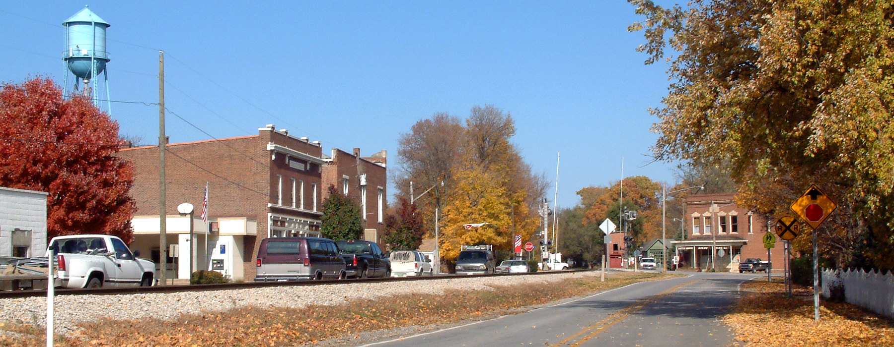
imagesize =
image_caption =
flag_size =
image_
seal_size =
image_shield =
shield_size =
flag_size =
image_
seal_size =
image_shield =
shield_size =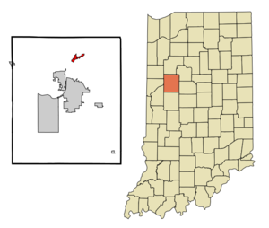
mapsize = 250x200px
map_caption =
mapsize1 =
map_caption1 =
subdivision_type = Country
subdivision_name =United States
subdivision_type1 = State
subdivision_name1 =Indiana
subdivision_type2 = County
subdivision_name2 = Tippecanoe
subdivision_type3 = Township
subdivision_name3 = Tippecanoegovernment_type =
leader_title = Council President
leader_name = Steve Egly
established_title = Founded
established_date =1867
established_title2 =
established_date2 =
area_total_sq_mi = 1.1
area_magnitude =
area_total_km2 = 3.0
area_land_sq_mi = 1.1
area_land_km2 = 3.0
area_water_sq_mi = 0.0
area_water_km2 = 0.0
population_as_of = 2000
population_note =
population_total = 1323
population_metro = 190386
population_urban =
population_density_km2 = 444.2
population_density_sq_mi = 1152.5
timezone = EST
utc_offset = -5
timezone_DST = EDT
utc_offset_DST = -4
latd = 40 |latm = 30 |lats = 36 |latNS = N
longd = 86 |longm = 50 |longs = 18 |longEW = W
elevation_m = 179
elevation_ft = 587
elevation_footnotes = cite web|url=Gnis3|430580|title=USGS detail on Battle Ground|accessdate=2007-10-03]
postal_code_type = ZIP code
postal_code = 47920
area_code = 765
website = [http://www.battleground.in.gov/ www.battleground.in.gov]
blank_name = FIPS code
blank_info = 18-03718GR|2
blank1_name = GNIS feature ID
blank1_info = 0430580GR|3
footnotes =Battle Ground is a town in Tippecanoe Township, Tippecanoe County in the
U.S. state ofIndiana . The population was 1,323 at the 2000 census. It is near the site of theBattle of Tippecanoe .History
In the late summer and fall of 1811,
William Henry Harrison , then Governor of theIndiana Territory , organized a military expedition against the increasing menace of the federation of Indian tribes being formed by theShawnee brothers,Tecumseh andTenskwatawa , also known as the Prophet. WithProphetstown as his objective, General Harrison marched fromVincennes, Indiana , at the head of a small army of about one thousand men. General Harrison met with representatives of the Prophet onNovember 6 1811 , when he arrived at Prophetstown, and told them of the demands he brought in the name of his government. General Harrison was to meet with the Prophet and his council the next day about the demands of the government. General Harrison then set up his encampment on a ridge about a mile northwest of Prophet’s Town. Fearing the cunning and treachery of the Prophet, General Harrison placed his troops in battle formation , instructed his men to sleep fully clothed, and assigned a large detail of men for sentinel duty. On the morning of November 7, 1811, after 4 o’clock AM, the camp was attacked by the Prophet. After a fierce battle, General Harrison and his army defeated the Prophet’s Indian confederation at theBattle of Tippecanoe , and all but ended the Indian wars in the Midwest.Battle Ground was consolidated in 1867 with the Town of Harrisonville. The governments of both towns decided to name the consolidation Battle Ground. The Town of Battle Ground was named for the Battle of Tippecanoe and the Town of Harrisonville was named after William Henry Harrison, commander of the American forces of the Battle of Tippecanoe. The Tippecanoe battlefield monument was erected in 1908 and dedicated to the men that served and were killed in the Battle of Tippecanoe. The Tippecanoe Battlefield is a National historic landmark, which has a museum and recreation area.
Geography
Battle Ground is located at coor dms|40|30|36|N|86|50|18|W|city (40.510110, -86.838220) in Tippecanoe Township, one and a quarter miles northwest of the
Wabash River . Its elevation is approximately 585 feet. The small Harrison Creek begins near Battle Ground and flows east, while Burnett Creek skirts the town's western edge and flows southwest.According to the
United States Census Bureau , the town has a total area of 1.1square mile s (3.0km² ), all of it land.Demographics
As of the
census GR|2 of 2000, there were 1,323 people, 470 households, and 375 families residing in the town. Thepopulation density was 1,152.5 people per square mile (444.2/km²). There were 486 housing units at an average density of 423.4/sq mi (163.2/km²). The racial makeup of the town was 98.79% White, 0.15% African American, 0.08% Native American, 0.15% Asian, 0.30% from other races, and 0.53% from two or more races. Hispanic or Latino of any race were 1.51% of the population.There were 470 households out of which 46.8% had children under the age of 18 living with them, 68.1% were married couples living together, 9.1% had a female householder with no husband present, and 20.2% were non-families. 17.4% of all households were made up of individuals and 5.7% had someone living alone who was 65 years of age or older. The average household size was 2.81 and the average family size was 3.18.
In the town the population was spread out with 31.6% under the age of 18, 5.8% from 18 to 24, 35.3% from 25 to 44, 21.7% from 45 to 64, and 5.6% who were 65 years of age or older. The median age was 34 years. For every 100 females there were 93.7 males. For every 100 females age 18 and over, there were 91.3 males.
The median income for a household in the town was $52,857, and the median income for a family was $60,125. Males had a median income of $39,167 versus $26,667 for females. The
per capita income for the town was $18,012. About 5.2% of families and 5.0% of the population were below thepoverty line , including 6.2% of those under age 18 and 8.8% of those age 65 or over.chools
Battle Ground Elementary School and Battle Ground Middle School both lie inside of the town. Students from these schools continue on to Harrison High School for 9th-12th grade.
References
External links
* [http://www.battleground.in.gov/ Official Webpage]
* [http://www.tcha.mus.in.us/ Tippecanoe County Historical Association]
Wikimedia Foundation. 2010.