- Monroe, Tippecanoe County, Indiana
-
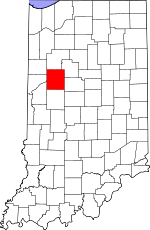
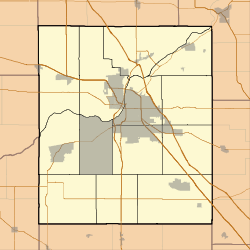
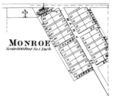
Monroe — Unincorporated town — Tippecanoe County's location in Indiana Location in Tippecanoe County Coordinates: 40°17′11″N 086°44′07″W / 40.28639°N 86.73528°W Country United States State Indiana County Tippecanoe Township Lauramie Elevation[1] 784 ft (239 m) ZIP code 47905 GNIS feature ID 0439339[2] Monroe is a small town in Tippecanoe County, Indiana. It is part of the Lafayette, Indiana Metropolitan Statistical Area.
Geography
Monroe is located at 40°17'14" North, 86°44'07" West (40.287222, -86.735278)[3] in Lauramie Township and has an elevation of approximately 785 feet.
References
- ^ "US Board on Geographic Names". United States Geological Survey. 2007-10-25. http://geonames.usgs.gov. Retrieved 2008-01-31.
- ^ "Monroe, Tippecanoe County, Indiana". Geographic Names Information System, U.S. Geological Survey. http://geonames.usgs.gov/pls/gnispublic/f?p=gnispq:3:::NO::P3_FID:0439339. Retrieved 2009-10-17.
- ^ "US Gazetteer files: 2010, 2000, and 1990". United States Census Bureau. 2011-02-12. http://www.census.gov/geo/www/gazetteer/gazette.html. Retrieved 2011-04-23.
External links
- Monroe, Tippecanoe County, Indiana is at coordinates 40°17′14″N 86°44′07″W / 40.287222°N 86.735278°WCoordinates: 40°17′14″N 86°44′07″W / 40.287222°N 86.735278°W
Municipalities and communities of Tippecanoe County, Indiana Cities Towns Battle Ground | Clarks Hill | Dayton | Otterbein‡ | Shadeland
Townships Unincorporated
communitiesAmericus | Ash Grove | Buck Creek | Cairo | Colburn | Concord | Monitor | Monroe | Montmorenci | North Crane | Odell | Pettit | Romney | South Raub | Stockwell | Westpoint
Ghost towns Footnotes ‡This populated place also has portions in an adjacent county or counties
Categories:- Populated places in Tippecanoe County, Indiana
- Unincorporated communities in Indiana
- Lafayette, Indiana metropolitan area
- Indiana geography stubs
Wikimedia Foundation. 2010.


