- Oklahoma State Highway 44
-
- This page is about the present-day State Highway 44. The historic SH-44 was renumbered to SH-74 and is covered in that article.
State Highway 44

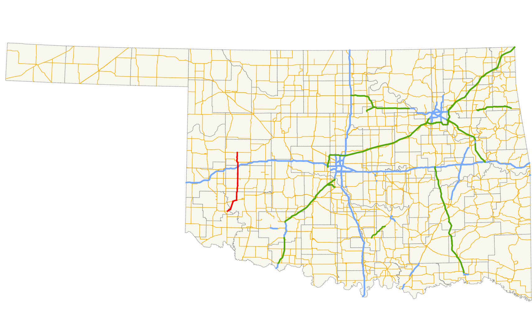
Route information Maintained by ODOT Length: 59.5 mi (95.8 km) Major junctions South end:  US-283 north of Blair
North end:  SH-33 in Butler
Highway system Oklahoma State Highways
Oklahoma turnpike system←  I-44
I-44SH-45  →
→State Highway 44 (abbreviated SH-44 or OK-44) is a state highway in the western portion of the U.S. state of Oklahoma. It runs for 59.5 miles[1] (95.8 km) from near Blair in Greer Co. to Butler in Custer Co. It is not to be confused with Interstate 44. The highway has one lettered spur route, SH-44A.
Contents
Route description
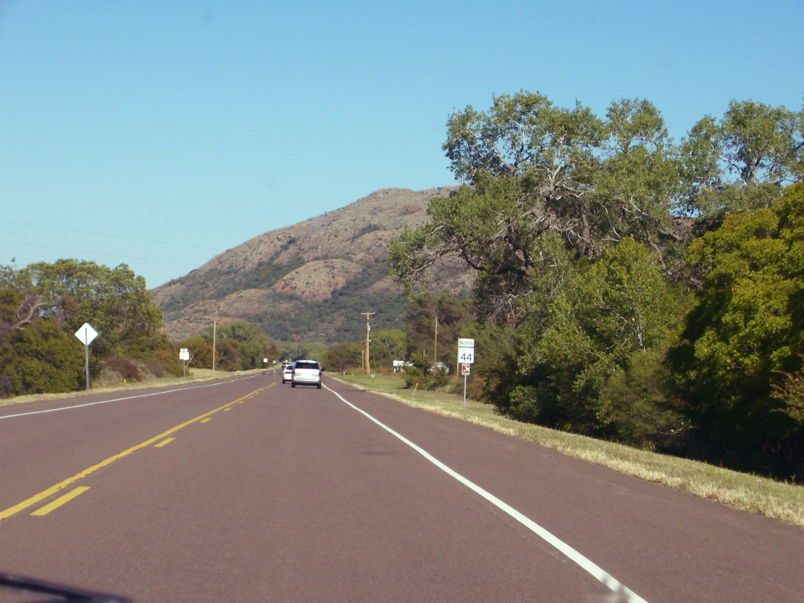
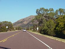 SH-44 begins in the Quartz Mountains of southwest Oklahoma.
State Highway 44 begins at an intersection with US-283 in the Quartz Mountains, just northwest of Byrd Mountain in Greer County.[2] From the terminus, SH-44 heads northeast, crossing the North Fork of the Red River into Kiowa County. Just after crossing the river, the highway spawns its only spur route, SH-44A. The road continues through the Quartz Mountains, passing in between Williams Peak and King Mountain. The route then follows the south shore of Lake Altus-Lugert, passing between the lakeshore and Mount Lugert.[2] As SH-44 leaves the mountains, it passes through the unincorporated place of Lugert, from which both the lake and the mountain get their name. The highway then heads north-northwest until it reaches SH-9 on the east side of Lone Wolf. It follows SH-9 to the east before splitting off along a due north course. The highway curves northeast to cross Elm Creek, the turns back to the north just after crossing into Washita County.[2]
The first town that SH-44 encounters in Washita County is Sentinel, where it meets SH-55. The highway continues north, paralleling a railroad track, before crossing over it about 2.5 miles (4.0 km) north of Sentinel and resuming its due north course.[2] West-northwest of Dill City, Oklahoma, SH-44 intersects SH-152. About 4 miles (6.4 km) north of this junction, SH-44 passes along the east side of Burns Flat. The next highway junction is an interchange with Interstate 40, at exit 53. After the interchange, SH-44 crosses Turkey Creek and runs through the small town of Foss. Just north of town, the highway passes into Custer County.[2]
In Custer County, Highway 44 meets up with SH-73. The two routes form a brief concurrency, splitting up when they reach Foss State Park. SH-44 hugs the east side of Foss Lake, then runs across its dam. Four miles (6.4 km) north of where it exits the park, SH-44 ends in Butler at State Highway 33.[2]
History
The current iteration of State Highway 44 was first added to the Oklahoma State Highway system on April 14, 1932.[3] The highway as originally designated was a split route; its southern section began at SH-34 in Eldorado, and proceeded northeast to end at US-62 west of Altus. Another section of SH-44 began at the route's current southern terminus and ended at SH-41 in Dill (present-day SH-152 in Dill City). A third section of highway began concurrent with SH-33 west of Custer City, and proceeded east through that town through Thomas. It then turned north on what is now SH-58 and followed what is now that highway's route to Cleo Springs. Thereafter, SH-44 began following SH-8. At Driftwood, SH-44 turned east on an independent alignment roughly corresponding to today's SH-11. The highway's northern terminus was US-81 in Medford, where SH-11 took over the alignment.[4]
In 1934, the section of highway between SH-33 and Canton was made part of US-270, and SH-44's northernmost section was truncated to Canton. At the same time, the section of road east of Driftwood became part of SH-11, so its northern terminus was truncated to US-60 in Fairview.[5] On March 29, 1937, the majority of the northern section of route was transferred to SH-58.[3][6]
On December 14, 1942, SH-44 was extended north of Dill for the first time, bringing it to a southern terminus at US-66 south of Foss.[3][7]
SH-44 was first made a contiguous route at the beginning of the summer of 1962. On May 6, the two sections of SH-44 were joined by means of a concurrency with US-62 to Altus, where it turned north along US-283, which it followed to the present-day southern terminus.[3][8] Around the same time, changes were brewing at the north end of the highway. SH-44 was extended north to Butler on September 4, 1963.[3] At this time, SH-44 ran from SH-34 in Eldorado to Butler.
The southernmost portion of SH-44 would soon undergo changes. On July 7, 1975, State Highway 6 was introduced over the portion of highway between Eldorado and the current southern terminus.[3] On January 5, 1987, the portion of SH-44 made redundant by SH-6 was removed from the highway, truncating it to its current southern terminus.[3]
By 2002, a new five-lane alignment of US-283/SH-6 had been created between Blair and Granite. SH-44 was extended along a portion of former US-283/SH-6 to meet the new alignment about one mile (1.6 km) north of Blair. By May 2004, US-283 had been rerouted along the old alignment and SH-44 truncated back to its current southern terminus.[1]
Junction list
County Location Mile[1] Destinations Notes Greer 0.0 US-283Southern terminus Kiowa 1.0  SH-44A
Southern terminus of SH-44A Lone Wolf 11.4  SH-9
SH-9Western end of SH-9 concurrency 14.6 SH-9Eastern end of SH-9 concurrency Washita Sentinel 25.5  SH-55
SH-55Southern end of SH-55 concurrency 25.7 SH-55Northern end of SH-55 concurrency 34.9  SH-152
45.5  I-40
I-40I-40 exit 53 Custer 50.1  SH-73
SH-73Southern end of SH-73 concurrency Foss S.P. 51.9 SH-73Northern end of SH-73 concurrency Butler 59.5 SH-33Northern terminus 1.000 mi = 1.609 km; 1.000 km = 0.621 mi
Concurrency terminus • Closed/Former • Incomplete access • UnopenedSH-44A

State Highway 44's one lettered spur route is SH-44A. This route branches off from SH-44 in the Quartz Mountains and connects to the Quartz Mountains Conference Center and the southern end of Lake Altus-Lugert.
References
- ^ a b c Stuve, Eric. "OK-44". OKHighways. http://www.okhighways.com/ok44.html. Retrieved 2006-09-28.
- ^ a b c d e f DeLorme (2006). Oklahoma Atlas and Gazetteer (Map). 1:200,000.
- ^ a b c d e f g Oklahoma Department of Transportation. "Memorial Dedication and Revision History, SH 44". http://www.okladot.state.ok.us/memorial/legal/sh44.htm. Retrieved 2010-04-07.
- ^ Oklahoma Department of Highways. Map Showing Condition of Improvement of the State Highway System (Map) (August 1933 ed.). http://www.odot.org/hqdiv/p-r-div/maps/state-maps/pdfs/1933.pdf. Retrieved 2010-04-08.
- ^ Oklahoma Department of Highways. Map Showing Condition of Improvement of the State Highway System and Landing Fields (Map) (October 1935 ed.). http://www.odot.org/hqdiv/p-r-div/maps/state-maps/pdfs/1935.pdf. Retrieved 2010-04-08.
- ^ Oklahoma Department of Highways. Map Showing Condition of Improvement of the State Highway System (Map) (April 1938 ed.). http://www.odot.org/hqdiv/p-r-div/maps/state-maps/pdfs/1938.pdf. Retrieved 2010-04-08.
- ^ Oklahoma Department of Highways. Map Showing Condition of Improvement of the State Highway System (Map) (June 1944 ed.). http://www.odot.org/hqdiv/p-r-div/maps/state-maps/pdfs/1944.pdf. Retrieved 2010-04-08.
- ^ Oklahoma Department of Highways. Oklahoma 1963 (Map). http://www.odot.org/hqdiv/p-r-div/maps/state-maps/pdfs/1963.pdf. Retrieved 2010-04-08.
External links
Categories:- State highways in Oklahoma


Wikimedia Foundation. 2010.