- Oklahoma State Highway 45
-
State Highway 45
Route information Maintained by ODOT Length: 64.7 mi (104.1 km) Existed: 1926[1] – present Major junctions West end:  SH-14 in Waynoka (concurrent with US-281)
East end: 

 US-60/US-64/US-81 north of Enid
Highway system Oklahoma State Highways
Oklahoma turnpike system←  SH-44
SH-44SH-46  →
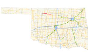
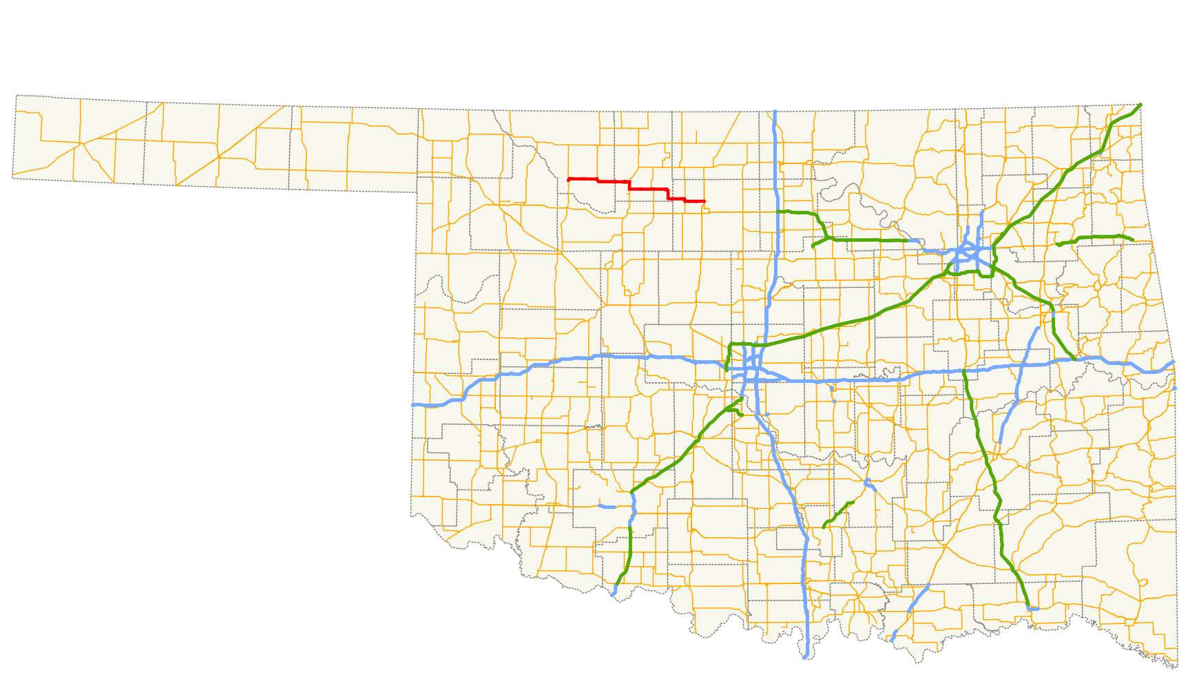
→State Highway 45 (SH-45 or OK-45) is a state highway in Oklahoma. It runs 64.7 miles (104.1 km) west-to-east through Woods, Alfalfa and Garfield counties.[2]
Contents
Route description
SH-45 begins at the US-281/SH-14 junction in Waynoka. US-281 and SH-45 share a concurrency for the first 12 miles (19 km) east of Waynoka, then US-281 turns to the north, leaving SH-45 to continue to the east, 12 miles (19 km) to Carmen.
Two miles east of Carmen, SH-34 joins SH-8 for a three-mile (5 km) concurrency to the south, where SH-43 resumes its eastward travel. SH-58 joins SH-43 for a one-mile (1.6 km) concurrency just south of the town of Helena, and at Goltry, SH-45 jogs south a few miles before turning back to the east and heading for its junction with SH-132 at Carrier.
Continuing to the east, SH-45 travels eight more miles from Carrier, before reaching its terminus at US-60/64/81 at the north edge of Enid.
History
SH-45 was first added to the state highway system between May 1926 and November 1927. The original routing of the highway was from Waynoka to SH-8 in Carmen.[1]
Before 1963, the section of present-day SH-45 between SH-58 and SH-132 was part of the original SH-38.[3] In 1963, all of this SH-38 west of Carrier was renumbered to SH-45 (a north–south section of SH-38 that connected Carrier to US-60 became part of a SH-132 extension). The same year, SH-45 was extended westward to Waynoka.[4] In either 1971 or 1972, the highway was extended eastward to its present terminus on the northern outskirts of Enid.[5] No major changes have occurred since.
Junction list
County Location Mile[2] Destinations Notes Woods Waynoka 0.0  US-281/SH-14
Western terminus. Southern terminus of SH-14. 12.1 US-281Alfalfa 26.1  SH-8
SH-829.1 SH-8Helena 38.1  SH-58
SH-5839.1 SH-58Garfield Carrier 56.0  SH-132
56.8 SH-132Enid 64.7 US-60/64/81Eastern terminus 1.000 mi = 1.609 km; 1.000 km = 0.621 mi References
- ^ a b Oklahoma State Highway Department. Oklahoma State Highway System (Map) (1927 ed.). http://www.okladot.state.ok.us/hqdiv/p-r-div/maps/state-maps/pdfs/1927.pdf. Retrieved 2008-04-18.
- ^ a b Stuve, Eric. "OK-45". OKHighways. http://www.okhighways.com/ok45.html. Retrieved 2006-09-20.
- ^ Oklahoma Department of Highways. Oklahoma 1962 (Map). http://www.odot.org/hqdiv/p-r-div/maps/state-maps/pdfs/1962.pdf. Retrieved 2008-03-12.
- ^ Oklahoma Department of Highways. Oklahoma 1963 (Map). http://www.odot.org/hqdiv/p-r-div/maps/state-maps/pdfs/1963.pdf. Retrieved 2008-03-13.
- ^ Oklahoma Department of Highways. 1972 Highway Map of Oklahoma (Map). http://www.odot.org/hqdiv/p-r-div/maps/state-maps/pdfs/1972.pdf. Retrieved 2008-03-13.
External links
Categories:- State highways in Oklahoma

Wikimedia Foundation. 2010.