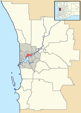
- Osborne Park, Western Australia
-
Osborne Park
Perth, Western AustraliaPopulation: 3,109[1] Postcode: 6017 Location: 8 km (5 mi) from Perth LGA: City of Stirling State District: Balcatta, Scarborough Federal Division: Stirling, Curtin Suburbs around Osborne Park: Innaloo Stirling Balcatta Woodlands Osborne Park Tuart Hill and Joondanna Herdsman Glendalough Mount Hawthorn Coordinates: 31°53′53″S 115°48′43″E / 31.898°S 115.812°E
Osborne Park is a suburb of Perth, Western Australia. Its Local Government Area is the City of Stirling.
Osborne Park was named after William Osborne, a butcher who owned an abattoir on Wanneroo Road and was elected to the Perth Road Board (the City of Stirling's predecessor), in 1875.[2]
The suburb was originally full of market gardens, due to rich peaty soil from the swamps between Lake Monger and Herdsman Lake.[3] The area was popular among Chinese and Italian settlers.[4] The suburb was founded by a private trading concern and had a tram service in the early 1900s through an extension of the Perth tram system from the end of the Leederville line.[3] The suburb is now served by Glendalough train station on the Joondalup line.
Osborne Park became a residential suburb after World War II, but by the 1980s, it was predominantly an industrial area, with only the north-eastern area still residential.[4] Many warehouses and small businesses are located in Osborne Park, as well as larger retailers such as Harvey Norman, Officeworks, IGA formaley Supa Valu and Action Supermarkets. The Acts 2 Bible College of Mission and Evangelisation is also located here.
Main Street in Osborne Park is the Cafe, Shopping and Business strip hosting Cafes such as Amaretto, Cafe Bellini, Siderno and Villa Picasso. The Osborne Park shopping centre consists of major tenant IGA, Australia Post, Flight Centre, Montello Gourmet Deli, Benny's Meats Butcher, Salvia Hair design, Capellis Mens hair, Shoes Repairs/Cobler. Next to the Osborne Park Shopping Centre is a family owned Osborne Park Hotel/Pub/Restaurant and Harry Brownes Liquor Store and Drive through Bottle Mart.
References
- ^ Australian Bureau of Statistics (25 October 2007). "Osborne Park (State Suburb)". 2006 Census QuickStats. http://www.censusdata.abs.gov.au/ABSNavigation/prenav/LocationSearch?collection=Census&period=2006&areacode=SSC52106&producttype=QuickStats&breadcrumb=PL&action=401. Retrieved 2008-03-02.
- ^ Western Australian Land Information Authority. "History of metropolitan suburb names". http://www.landgate.wa.gov.au/corporate.nsf/web/History+of+metropolitan+suburb+names. Retrieved 2008-03-02.
- ^ a b Battye (Ed.), J.S. (1912). The Cyclopedia of Western Australia 1912-1913. Perth, Western Australia: The Cyclopedia Company. ISBN 978-1-921081-38-5.
- ^ a b "Suburbs: Osborne Park". City of Stirling. http://www.stirling.wa.gov.au/home/council/Suburbs/Osborne+Park.htm. Retrieved 2008-03-02.
Suburbs of the City of Stirling | Perth | Western Australia Coastal Carine · Churchlands · Doubleview · Gwelup · Innaloo · Karrinyup · North Beach · Scarborough · Trigg · Watermans Bay · Wembley Downs¹ · Woodlands

Central Balcatta · Balga · Dianella · Glendalough · Hamersley · Herdsman · Joondanna · Mirrabooka · Nollamara · Osborne Park · Stirling · Tuart Hill · Westminster · Yokine
South Eastern Categories:- Suburbs of Perth, Western Australia
- Perth, Western Australia geography stubs
Wikimedia Foundation. 2010.

