- Joondalup railway line
-
Joondalup Railway Line Legend

Continues to Mandurah line 

Esplanade 


0.0km Perth Underground 


William Street Tunnel 


Roe Street Tunnel 
Graham Farmer Freeway (Hamilton Interchange) 
Loftus St/Thomas St 
3.2km Leederville 
Lake Monger Drive/Vincent Street Neutral Section Hillman Substation 
Powis Street 
5.4km Glendalough Scarborough Beach Road Hutton Street 9.0km Stirling Cedric Street Karrinyup Road Erindale Road Reid Highway Beach Road 14.5km Warwick Warwick Road 17.8km Greenwood Hepburn Avenue 19km Whitfords 19.5km Whitfords Avenue 

Whitfords Siding 
Ocean Reef Road Neutral Section Edgewater Substation 23.0km Edgewater Mitchell Freeway (southbound) Joondalup Drive/Hodges Drive 26.0km Joondalup Station Square Joondalup Drive Shenton Avenue Mitchell Freeway (southbound) 29.2km Currambine Burns Beach Road 33.2km Clarkson Neutral Section Hester Avenue 


Nowergup Depot 

40.7 km Butler (Proposed) Transperth Railway Lines Armadale / Thornlie Fremantle Joondalup Mandurah Midland List of Transperth stations The Joondalup Line is a suburban railway line in Perth, Australia. It runs through Perth’s northern suburbs, mostly traversing the median strip of the Mitchell Freeway, and connects between Perth and Clarkson, and services the regional hub of Joondalup via the Joondalup station.
Contents
History
For more details on this topic, see Northern Suburbs Transit System.The line to Joondalup was completed on 20 December 1992 as a major capital works project started by the Dowding Labor government.[1] A realignment of the entire bus system was undertaken whereby the new train stations became bus interchanges. The extension to Currambine was completed in March 1993.[1] Initially, service frequencies were similar to those for the Fremantle line as lower passenger numbers were anticipated, however overcrowding saw the doubling of services between Whitfords and Perth on weekdays. Services were reverted to Fremantle Line frequencies between 9 a.m. and 2 p.m. on 28 June 2009 due to low passenger numbers on those services.[2]
On 5 October 2004, the Clarkson extension, part of the Gallop government's New MetroRail project, was opened to the public, connecting the outer northern suburbs to the city for the first time. [3] Previously, catching a bus to Joondalup which took approximately 30-40 minutes was the only option. The Nowergup railway depot was also built.
On 29 January, 2005, Greenwood was opened to alleviate pressure at the adjacent Whitfords and Warwick stations.[3]
On 8 August 2005, the line, which previously ran through onto the Armadale line, was separated to the far western end of the Perth station, and no longer provided a through service.
On 15 October 2007, Clarkson line trains began running to Perth Underground and Esplanade stations via new tunnels under central Perth.
On 23 December 2007, the opening of the Mandurah Line saw the Clarkson and Mandurah lines form a north-south corridor, providing a through service from Clarkson to Mandurah.
Extensions
For more details on this topic, see Northern Suburbs Transit System#Clarkson to Butler extension.It has been announced that the Joondalup line will be extended from Clarkson to Butler, with services to Butler expected by the end of 2014. Preliminary earthworks are currently underway, with construction of the rail line expected to begin in 2011. [4] There are also early plans of extending the line with another 3 stations northwards once the new suburb of Alkimos is built. [5] It will also be extended to Yanchep and have a station on the eastern edge of the Jindowie development.
Train stations
Most of the trains operating on this line are Transperth B-series trains purchased for the Clarkson-Mandurah run, although some shuttle services (W pattern) between Whitfords and Cockburn Central are made up of Transperth A-series EMUs.
- Red denotes Perth CBD stations.
- Green denotes Clarkson line stations.
- Black denotes termini.
Name of Station Code Zone Serving Suburbs Pattern stops at this station Transfers Joondalup Line Esplanade REE 1, FTZ Perth All C W Bus transfers at Esplanade Busport Through to Mandurah Line
Perth Underground MPH 1, FTZ Perth, Northbridge All C W Platform transfer to Armadale / Thornlie Line, Fremantle Line, Midland Line
Transwa Australind service to Bunbury
Bus transfers at Wellington Street bus stationLeederville JLE 1 Leederville, West Leederville All W Glendalough JGH 1 Glendalough, Osborne Park All W Bus transfers Stirling JSG 2 Innaloo, Osborne Park, Stirling All C W Bus transfers, CircleRoute Warwick JWK 2 Carine, Duncraig, Hamersley, Warwick All C W Bus transfers Greenwood JGD 2 Duncraig, Greenwood, Kingsley, Padbury All C Whitfords JWS 3 Craigie, Kingsley, Padbury, Woodvale All C W Bus transfers Edgewater JER 3 Beldon, Edgewater, Heathridge All C Joondalup JJP 3 Joondalup All C Bus transfers Currambine JCE 4 Currambine, Joondalup, Kinross All C Clarkson JCN 4 Clarkson All C Bus transfers Proposed stations
An extension of the line to the north to Butler was proposed in November 2009. [6]
Stopping Patterns
- All - all stops to Clarkson.
- C - express to Stirling, then all stops to Clarkson.
- W - all stops except Greenwood, to Whitfords.
- P - Reverse of W all stops except Greenwood to Perth, terminating at Platform 1 of Perth Station .
-
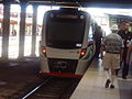
Whitfords shuttle waiting to depart at platform 5 (now departs from Platform 1)
-
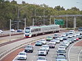
A B Series EMU en route to Perth during the morning peak
-
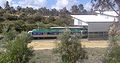
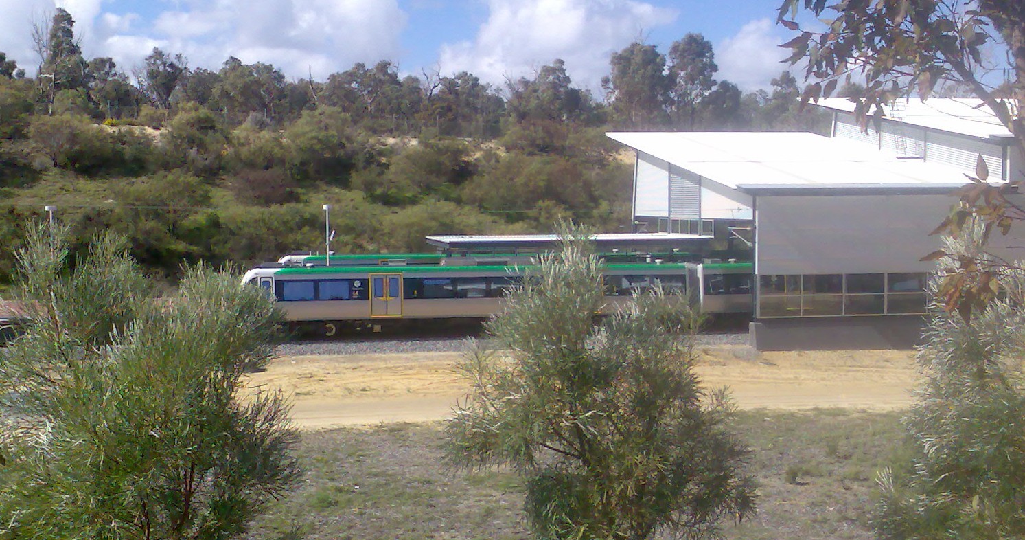
Clarkson Train Station Looking East through the fence at the North point.
See also
References
- ^ a b "History at a Glance, 1976-2000". Public Transport Authority. Archived from the original on 2007-04-30. http://web.archive.org/web/20070430031424/http://www.pta.wa.gov.au/scripts/viewarticle.asp?NID=1823. Retrieved 2007-06-05.
- ^ "Off-peak train service reduction 'minor'". Public Transport Authority. http://www.pta.wa.gov.au/scripts/viewarticle.asp?NID=2694. Retrieved 2009-07-06.[dead link]
- ^ a b "History at a Glance, 2001 to Present". Public Transport Authority. Archived from the original on 2007-04-30. http://web.archive.org/web/20070430031344/http://www.pta.wa.gov.au/scripts/viewarticle.asp?NID=1824. Retrieved 2007-07-07.
- ^ "Media Statements". Public Transport Authority. http://www.pta.wa.gov.au/Default.aspx?id=721&tabid=121. Retrieved 2009-11-28.
- ^ http://internet.landcorp.com.au/portal/page/portal/alkm1/features
- ^ http://www.railway-technology.com/news/news71022.html?mxmroi=6219191/2427103/false The line has just commenced construction and is expected to be ready by 2014.
Categories:- Railway lines in Perth, Western Australia


Wikimedia Foundation. 2010.