- Graham Farmer Freeway
-
Graham Farmer Freeway 

Entering eastern end under Lord Street Length 7 km (4 mi) Direction West-East From  Mitchell Freeway, Northbridge, Perth
via East Perth To  Orrong Road, Burswood, Perth
Established 2000 Major junctions Loftus Street, Lord Street, East Parade, Great Eastern Highway for full list see
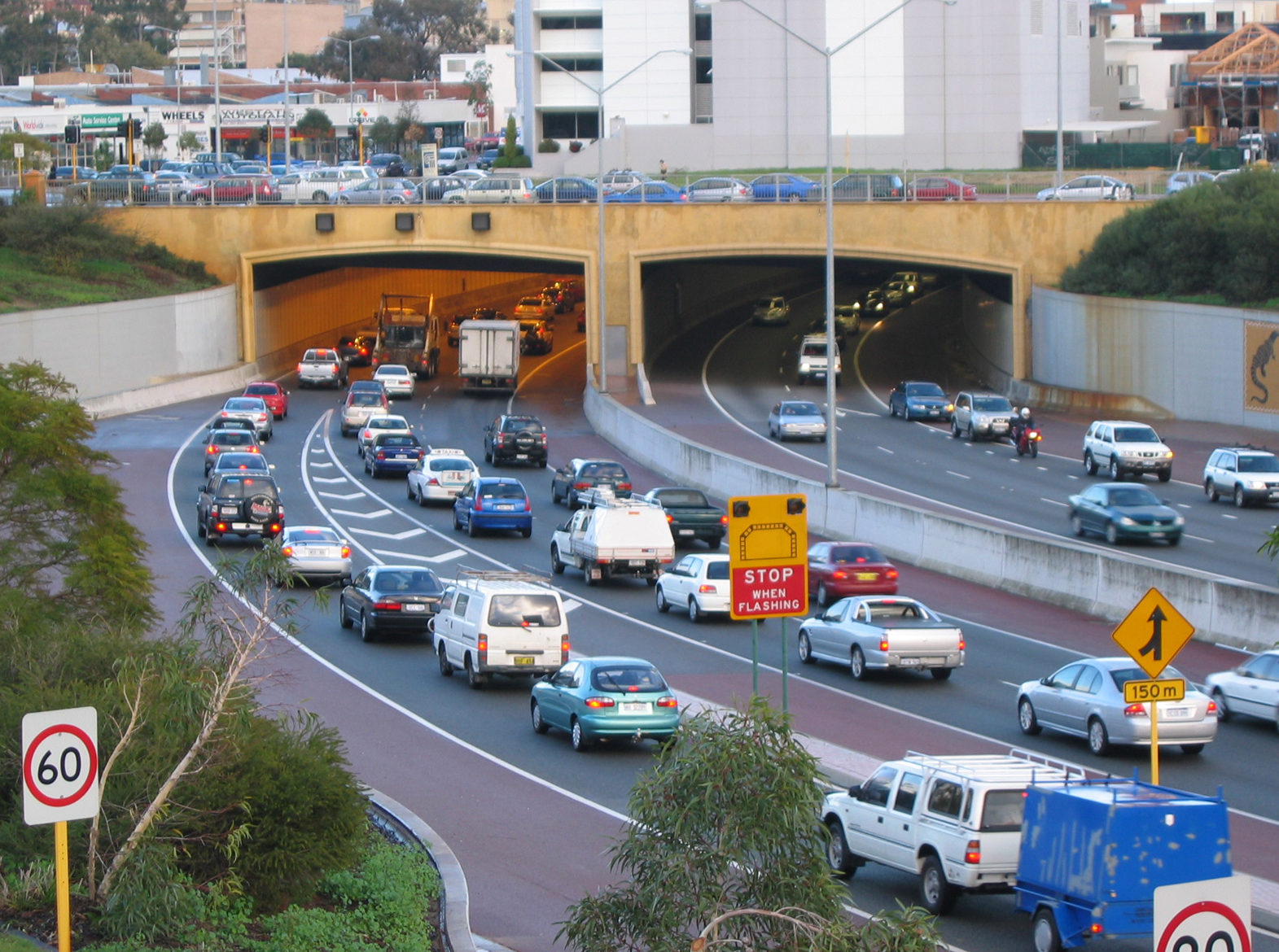
Major IntersectionsThe Graham Farmer Freeway is a major part of the metropolitan road infrastructure in Perth, Western Australia. It is 7 kilometres (4.3 mi) long and links Rivervale and East Perth with West Perth, bypassing Perth's central business district. It was named after the Australian rules footballer, Graham "Polly" Farmer, who played between 1953 and 1971 in both the West Australian and Victorian Football Leagues.
The freeway incorporates Western Australia's only freeway tunnel, the Northbridge Tunnel. The 1.6-kilometre (1 mi) tunnel has two traffic lanes and an emergency stopping lane in each direction, with an escape passageway between the carriageways. The tunnel is colloquially known as the "Polly Pipe", a reference to the freeway's namesake, also humorous because "Poly Pipe" is a colloquial reference to plastic pipes (commonly made from polyethylene or polyvinyl chloride materials) used in reticulation and plumbing.[1] Both tunnel portals feature public art installations. At the western end, there is a pictorial history of Northbridge, and at the eastern end, the Aboriginal artist Ron Corbett created images based on indigenous artwork. The transportation of dangerous goods and explosives through the freeway tunnel is prohibited.[2]
The freeway crosses the Swan River over the 406-metre (1,332 ft), six lane Windan Bridge.
Contents
Construction
The freeway was constructed between 1996 and 2000, and used over 180,000 cubic metres of concrete. The project finished three months early and within budget, costing $313 million. It has been designed to have a 150 year lifespan, following the Main Roads WA specification.
Stage 1 involved construction of the tunnel and was undertaken by a Clough/Baulderstone joint venture,[3] was a finalist for the 2001 Australian Construction Achievement Award.[4]
Stage 2 included the Windan Bridge and nine other traffic and pedestrian bridge structures. This stage won an award from Austroads, the Association of Australian and New Zealand Road Transport and Traffic Authorities.[5]
Junctions
Allocation Junction Suburb 
Mitchell Freeway South[6] Northbridge Aberdeen Street[7] Northbridge 
Loftus Street[8] Northbridge and West Leederville James Street[8] Northbridge and West Leederville 
Lord Street[9] East Perth 
East Parade[10] East Perth Victoria Park Drive[10] Burswood 

Great Eastern Highway[11] Rivervale and Lathlain See also
Notes and references
- ^ Hyde, John; Hansard; 2002-05-08
- ^ Explosay Issue Number 25 (Sept 2000) ISSN 1038 - 7099 (PDF) Retrieved 13 August 2006.
- ^ Graham Farmer Freeway - Perth
- ^ Graham Farmer Freeway Stage One Retrieved 13 August 2006.
- ^ Graham Farmer Freeway Bridges - Winner category 2 Austroads PDF. Retrieved 13 August 2006.
- ^ Modified trumpet interchange; Graham Farmer Freeway merges with Mitchell Freeway North after terminating
- ^ Eastbound entry
- ^ a b Westbound exit
- ^ West and Eastbound entry
- ^ a b Diamond interchange
- ^ Modified parclo interchange; Graham Farmer Freeway continues as Orrong Road (State Route 8) after this point
 Road infrastructure in Perth
Freeways 
Highways Bridges Road infrastructure in Western AustraliaFreeways Metropolitan highways Highways and major roads Albany Highway • Brand Highway • Brockman Highway • Brookton Highway • Bussell Highway • Coalfields Road • Coolgardie-Esperance Highway • Dampier Highway • Derby Highway • Eyre Highway • Forrest Highway • Geraldton-Mount Magnet Road • Goldfields Highway • Great Eastern Highway • Great Northern Highway • Great Southern Highway • Indian Ocean Drive • Mandjoogoordap Drive • Muirs Highway • North West Coastal Highway • Old Coast Road • South Coast Highway • South Western Highway • Vasse Highway • Victoria HighwayOutback Tracks Anne Beadell Highway • Buntine Highway • Canning Stock Route • Cape Leveque Road • Connie Sue Highway • Duncan Road • Gary Highway • Gibb River Road • Great Central Road • Gunbarrel Highway • Kalumburu Road • Tanami RoadCategories:- 2000 establishments in Australia
- Highways and freeways in Perth, Western Australia
- Tunnels in Western Australia
- Tunnels completed in 2000

Wikimedia Foundation. 2010.