- Roe Highway
Infobox Australian Road
road_name = Roe Highway
route_
route_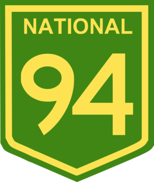
route_
photo = Roe_Highway_Thornlie_Southward_SMC.jpg
caption = Roe Highway at the Nicholson Road Exit.
length = 40
direction = Northeast-Southwest
start =
finish =
est = 1980s
through = Cannington, Kenwick, Midland,Perth Airport , Canning Vale, Leeming
route = "Midvale - Hazelmere")
exits =Great Northern Highway ,Toodyay Road ,Great Eastern Highway ,Great Eastern Highway Bypass , Kalamunda Road,Tonkin Highway , Orrong Road,Albany Highway , High Road, Nicholson Road, South Street"for full list see
Major Intersections"Roe Highway is a limited access dual carriageway in
Western Australia . It linksGreat Northern Highway and Middle Swan Road withKwinana Freeway . It is one of the key heavy vehicle routes in the Perth metropolitan area. Aside from intersections, the speed limit is 100 km/h for most of its length. South of Orrong Road and Welshpool Road, the highway is a freeway standard, with no traffic lights and grade separation. The northern half is the standard of Perth's major highways; limited access, with few grade separations and traffic lights.Roe Highway, together with
Reid Highway , is allocated State Route 3 and is part of National Highway 94 betweenGreat Eastern Highway Bypass andGreat Eastern Highway , and also part of National Highway 95 betweenGreat Northern Highway and Great Eastern Highway.History
Roe Highway was first proposed in 1955 by
Gordon Stephenson as part of what was to become the Metropolitan Region Planning Scheme. It is named in honour ofJohn Septimus Roe , firstSurveyor General of Western Australia .Work began in 1981, with the first section between the Beechboro-Gosnells Highway and Bushmead Road opening in 1983. The next section, from Bushmead Road to
Great Eastern Highway was opened in 1984. The third stage, linking Great Eastern Highway andGreat Northern Highway opened in 1988, at the same time as theGreat Eastern Highway Bypass opened. The new roads provided a limited access dual carriageway bypass of the historical Guildford and Midland districts which was much needed at the time.In 1994, the highway was extended 2 km further southwards from
Tonkin Highway to Welshpool Road. Following 7 years in hiatus, work recommenced, and in 2001 a new 4 km southwestern extension known as stage 4 was completed from Welshpool Road to the purpose-built Kenwick Link (anAlbany Highway bypass built in 1998) - most of which replaced the overtaxed William Street in Beckenham. Work on the 3 km long stage 5 was undertaken simultaneously with stage 4, bringing the highway to Nicholson Road in 2002.Stage 6, a 5 km extension from Nicholson Road to South Street was completed in 2004, with stage 7 being announced shortly afterwards. The 5 km stage 7 extension from South Street to
Kwinana Freeway was completed in 2006, and represents the southwestern terminus of Roe Highway for the foreseeable future.The 19km of road built since 1994 between Tonkin Highway and Kwinana Freeway, is to a freeway standard, and is arguably Perth's best driving road. It may in the future be upgraded to a freeway classification.
tage 8 / the Fremantle Eastern Bypass
In the 1950s, Stephenson planned for Roe Highway to continue westwards from its present terminus at
Kwinana Freeway towards Fremantle, through South Fremantle along Marine Terrace and then north to connect withStirling Highway and thePort of Fremantle . As part of the plan, in 1974Stirling Highway was extended from its then terminus north of the Swan River southwards toCanning Highway .A narrow 4 km strip of land immediately south of this intersection was proclaimed for further road construction, but as it was not part of the original Stephenson Plan it was occupied by housing built before the time of Stephenson. Over a period of approximately 20 years, Main Roads Western Australia procured most of the land in question for the future road. In 1985, the first kilometre of this road was constructed, which extended
Stirling Highway southwards fromCanning Highway to Leach Highway (known as High Street west of Carrington Street). The remaining 3 km strip of land south of High Street then became known as the Fremantle Eastern Bypass.At the southern end of the proposed Fremantle Eastern Bypass, an 8 km east-west road reservation was proclaimed. This became known as Roe Highway stage 8. This land however was lightly built up and much of it remained as urban bushland throughout the late 20th century. The Roe Highway stage 8 reservation was intended to be the final link of a major urban ring-road, as originally envisioned by Stephenson.
However, there were problems with the proposed link, a product of the changes made by governments since Stephenson's original plan. This included the deletion of the original inner Fremantle section and the proclaiming of the Fremantle Eastern Bypass. Some residents of Fremantle strongly objected to the proposed 4-lane dual carriageway Fremantle Eastern Bypass, claiming it would divide the area, damage urban woodland and impact on 3 nearby schools. Also, the proposed Roe Highway stage 8 would cut between North Lake and Bibra Lake, a location considered of high environmental value as a wetlands. The Environmental Protection Authority in its report on the proposed Roe Highway Stage 8 confirmed the high conservation status of the Beeliar Wetlands and the negative impacts a highway would have on the wetlands.
With a change of state governments in 2001, the planned Fremantle Eastern Bypass / Roe Highway stage 8 was cancelled, with a commitment by the government to sell the land reserved for the Fremantle Eastern Bypass. In doing this, the government put forward a '6-point plan' to cope with the anticipated growth of heavy vehicle traffic in and out of the Port of Fremantle, which included plans for better usage of rail, more efficient usage of trucks and a new deepwater container port near Rockingham. As promised, the Fremantle Eastern Bypass land was sold for a total of $17 million. These funds are in turn being spent on a new grade separated interchange at the intersection of
Leach Highway and Orrong Road in Welshpool.During the period for public submissions on the planned cancellation and sell-off, the plan garnered almost 100% opposition [http://www.wapc.wa.gov.au/Publications/fig4.pdf?id=466] from residents in the City of Melville, as the proposed Fremantle Eastern Bypass / Roe Highway stage 8 would have removed most trucks from
Leach Highway , which although classified as a state highway, is a more urban road. On the other hand the move was generally supported by Fremantle residents including the local sitting member, and also those concerned by the potential negative impact the proposed road would have on Bibra Lake.However, as part of the funding arrangement for Roe Highway stages 6 and 7, the federal government which provided some of the funding for those two stages has stipulated that the Roe Highway stage 8 reservation is not to be rezoned, and instead retained as an 8 km strip of urban bushland for the foreseeable future.
Junctions
Notes
References
* Hepburn, J.A. & Stephenson, G. 1955, "Plan for the metropolitan region, Perth and Fremantle, Western Australia, 1955: a report prepared for the Government of Western Australia", Government Printing Office, Perth.
*cite book | first=Leigh | last=Edmonds | title=The vital link: a history of Main Roads Western Australia 1926-1996 | publisher=University of Western Australia Press | location=Nedlands, Western Australia | year=1997 | id=ISBN 1-875560-87-4ee also
*
Highways in Australia
*Highways in Western Australia
*Freeways in Australia
*Freeways in Western AustraliaReferences
* [http://www.mainroads.wa.gov.au Main Roads WA]
* [http://www.roe7.com.au The Roe7 Project]
* [http://www.landonline.com.au/skyviewwa/content/asp/skyviewwa_index.asp?product_group_id=78 Skyview WA - Department of Land Information, Western Australia]Australian road routes table
state = Western Australia
route_shield = Australian_State_Route_3.svg
route_number = 3
from_locality = North Beach
to_locality = Leeming
via_locality1 = Middle Swan
via_locality2 = Midland
via_locality3 = Perth Airport
via_locality4 = Kenwick
via_locality5 = Canning Vale
road1 = Reid Highway
carriageway1_type = Single / Dual
lanes1 = 2 to 4
road2 = Roe Highway
carriageway2_type = Dual
lanes2 = 4
|


Wikimedia Foundation. 2010.