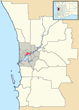
- Mirrabooka, Western Australia
-
Mirrabooka
Perth, Western AustraliaPopulation: 7,798 (2006 census)[1] Postcode: 6061 LGA: City of Stirling State District: Nollamara Federal Division: Stirling Suburbs around Mirrabooka: Girrawheen Koondoola Malaga Balga Mirrabooka Malaga Westminster and Nollamara Dianella Noranda Coordinates: 31°51′47″S 115°52′12″E / 31.863°S 115.87°E
Mirrabooka is a suburb of Perth, Western Australia. Its Local Government Area is the City of Stirling.
Mirrabooka is the Aboriginal name for the constellation most commonly known as the Southern Cross.
The suburb has expanded rapidly in recent years, with the subdivision of bushland, on which housing developments have been built, especially north of Yirrigan Drive. The Mirrabooka Square Shopping Centre has been expanded (and is expected to expand further). A new regional police station of the Western Australia Police has been opened.
Transport
The suburb is home to the Mirrabooka bus station, a hub for bus transport in the area, and is served by a number of Transperth bus routes operated by Path Transit, Including connections to Perth, Warwick Train Station, and more.
References
- ^ Australian Bureau of Statistics (25 October 2007). "Mirrabooka (State Suburb)". 2006 Census QuickStats. http://www.censusdata.abs.gov.au/ABSNavigation/prenav/LocationSearch?collection=Census&period=2006&areacode=SSC51956&producttype=QuickStats&breadcrumb=PL&action=401. Retrieved 2008-10-05.
Suburbs of the City of Stirling | Perth | Western Australia Coastal Carine · Churchlands · Doubleview · Gwelup · Innaloo · Karrinyup · North Beach · Scarborough · Trigg · Watermans Bay · Wembley Downs¹ · Woodlands

Central Balcatta · Balga · Dianella · Glendalough · Hamersley · Herdsman · Joondanna · Mirrabooka · Nollamara · Osborne Park · Stirling · Tuart Hill · Westminster · Yokine
South Eastern ¹ Suburb shared with other Local Government Areas Categories:- Suburbs of Perth, Western Australia
Wikimedia Foundation. 2010.

