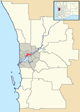
- Nollamara, Western Australia
-
Nollamara
Perth, Western AustraliaPopulation: 7,560 (2006 census)[1] Postcode: 6061 Location: 10 km (6 mi) N of Perth LGA: City of Stirling State District: Nollamara Federal Division: Stirling Suburbs around Nollamara: Balcatta Westminster Mirrabooka Balcatta Nollamara Dianella Tuart Hill Yokine Dianella Coordinates: 31°52′55″S 115°50′46″E / 31.882°S 115.846°E
Nollamara is a suburb of Perth, Western Australia. Its Local Government Area is the City of Stirling.
The name "Nollamara" is the Aboriginal word for the plant known as the Black Kangaroo Paw.
Transport
The suburb is served by a number of Transperth bus routes operated by Path Transit. The 354, 370 and 870 (Mirrabooka-Perth) covers Flinders Street and inner portions of the Suburb, the 346 (Wanneroo-Perth) and the 363, 373 and 374 (Marangaroo-Perth) covers Wanneroo Road south to Perth.
References
- ^ Australian Bureau of Statistics (25 October 2007). "Nollamara (State Suburb)". 2006 Census QuickStats. http://www.censusdata.abs.gov.au/ABSNavigation/prenav/LocationSearch?collection=Census&period=2006&areacode=SSC52041&producttype=QuickStats&breadcrumb=PL&action=401. Retrieved 2008-10-05.
Suburbs of the City of Stirling | Perth | Western Australia Coastal Carine · Churchlands · Doubleview · Gwelup · Innaloo · Karrinyup · North Beach · Scarborough · Trigg · Watermans Bay · Wembley Downs¹ · Woodlands

Central Balcatta · Balga · Dianella · Glendalough · Hamersley · Herdsman · Joondanna · Mirrabooka · Nollamara · Osborne Park · Stirling · Tuart Hill · Westminster · Yokine
South Eastern ¹ Suburb shared with other Local Government AreasCategories:- Suburbs of Perth, Western Australia
- Perth, Western Australia geography stubs
Wikimedia Foundation. 2010.

