- Ayon Island
-
Ayon 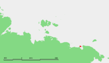
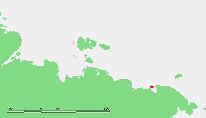
Location of Ayon in the Eastern Siberian coast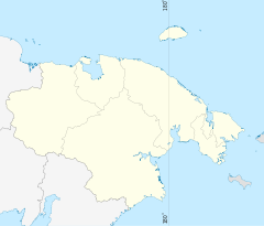
 Ayon Island (Chukotka Autonomous Okrug)
Geography Location East Siberian Sea Coordinates 69°45′N 168°30′E / 69.75°N 168.5°E Area 2,000 km2 (800 sq mi) Length 63 km (39.1 mi) Width 38 km (23.6 mi) Country RussiaOkrug Chukotka Autonomous Okrug Demographics Population 440 (as of 2006) Density 0.22 /km2 (0.57 /sq mi) Ethnic groups Chukchi Ayon Island is an island in the coast of Chukotka in the East Siberian Sea. The island itself consists mainly of low lying tundra, is populated mainly by Chukchi, who use the tundra as pasture for their reindeer herds.
Contents
Geography
It is located on the western side of the Chaunskaya Bay, directly off the Nutel'gyrgym Peninsula, at the eastern end of the Kolyma Gulf. The island is 63 km long and 38 km wide. It is generally low and flat and there are many small lakes and swamps. Ayon Island is separated from the mainland by the Malyy Chaunskiy Strait, a shallow channel which is barely 2 km wide in its narrowest spot. The bay to the south and east is Chaunskaya Guba. Administratively[1] and municipally,[1] Ayon Island belongs to Chaunsky District, part of Chukotka Autonomous Okrug of the Russian Federation.
There are two small settlements, El'vuney[2] (now abandoned)[3] and Ayon in the NW end of the island.
Etymology
The name of the island is thought to come from one of two sources. Firstly, it is suggested that it comes from the Chukchi word "Ayo", meaning "brain", as the islands shape is somewhat like a brain[2]. The second school of though is that it is derived from Chukchi meaning "coming alive", in reference to the fact that although the island is covered in ice and snow during the winter, in the summer, this melts and the island provides a good pasture for reindeer herds as well as being the home to swarms of midges and gadflies.[2]
Economy
Soviet Russia
Following the rise of communism in the Soviet Union in the first part of the twentieth century, the native herds were collectivised in 1933 into a group called "Enmitagino".[2] Such collectivisation was very successful on the island and in 1950, the collective in Ayon was turned into a formal Kolkhoz that would eventually have around 22,000 reindeer under its control.[2] In addition to reindeer herding, the new collective was also engaged in sea-hunting and the collection of furs.[4]
A polar station was established on the site of the village in 1941 and the icebreaker Krasin brought Pyotr Sidersky and a crew of seven people to man the new station.[4] This was the first time that the village site had been inhabited permanently, with indigenous people living there only during the summer when the reindeer were taken to pasture, with the exception of a few individuals who would over-winter in order to hunt.[4]
By 1944, the settlement had become increasingly permanent and there were 103 people living in 23 houses.[4]
Post-Soviet
However, following the collapse of the Soviet Union, state support was withdrawn and the herders, who had been used to being supplied with the latest technology by the state now found that not only did they have to fend for themselves with regards to the day to day herding, but that there was no guarantee that they would even receive the money they were owed for the meat they provided to the state.[2]
The result of this is that the herds have shrunk from 22,000 to only around 4,000. the result of this is that there is considerable unemployment in the town.[2] This has led to a lot of drinking, which not only has sociological effects, but the litter produced also encourages disease from which the reindeer now suffer, further reducing the size of the herd.[2]
Adjacent islands
- Ryyanranot Island (Ostrov Ryyanranot) 69°59′31″N 168°36′29″E / 69.992°N 168.608°E is a 8 km long and 1.5 km wide island located off the northern shores of Ayon Island. It is separated from it by a 1.2 km wide sound.
- Chengkuul Island (Ostrov Chengkuul) 69°55′48″N 169°13′34″E / 69.930°N 169.226°E is 10.5 km long and 1.7 km at its widest point. It is located off the northeastern coast of Ayon Island, separated from it by a 5 km wide sound. Its western end is also known as Yanrachenkool.
- Mosey Island (Ostrov Mosey) 69°38′53″N 169°14′02″E / 69.648°N 169.234°E is a small island located between the southern coast of Ayon and the continent. It is 3 km in length.
See also
References
Notes
Sources
- Petit Fute, Chukotka.
- Дума Чукотского автономного округа. Закон №33-ОЗ от 30 июня 1998 г. «Об административно-территориальном устройстве Чукотского автономного округа», в ред. Закона №73-ОЗ от 24 июня 2009 г. «О внесении изменений в Закон Чукотского автономного округа "Об административно-территориальном устройстве Чукотского автономного округа"». Вступил в силу по истечении десяти дней со дня его официального опубликования. Опубликован: "Ведомости", №7 (28), 14 мая 1999 г. (Duma of Chukotka Autonomous Okrug. Law #33-OZ of June 30, 1998 On the Administrative and Territorial Structure of Chukotka Autonomous Okrug, as amended by the Law #73-OZ of June 24, 2009 On Amending the Law of Chukotka Autonomous Okrug "On the Administrative and Territorial Structure of Chukotka Autonomous Okrug". Effective as of after ten days from the day of the official publication).
- Дума Чукотского автономного округа. Закон №46-ОЗ от 29 ноября 2004 г. «О статусе, границах и административных центрах муниципальных образований на территории Чаунского района Чукотского автономного округа», в ред. Закона №87-ОЗ от 20 октября 2010 г «О преобразовании путём объединения поселений на территории Чаунского муниципального района и внесении изменений в Закон Чукотского автономного округа "О статусе, границах и административных центрах муниципальных образований на территории Чаунского района Чукотского автономного округа"». Вступил в силу через десять дней со дня официального опубликования. Опубликован: "Ведомости", №31/1 (178/1), 10 декабря 2004 г. (Duma of Chukotka Autonomous Okrug. Law #46-OZ of November 29, 2004 On the Status, Borders, and Administrative Centers of the Municipal Formations on the Territory of Chaunsky District of Chukotka Autonomous Okrug, as amended by the Law #87-OZ of October 20, 2010 On the Transformation via Merger of the Settlements on the Territory of Chaunsky Municipal District and on Amending the Law of Chukotka Autonomous Okrug "On the Status, Borders, and Administrative Centers of the Municipal Formations on the Territory of Chaunsky District of Chukotka Autonomous Okrug". Effective as of the day which is ten days after the official publication date).
External links
Coordinates: 69°45′N 168°30′E / 69.75°N 168.5°E
 Islands of the East Siberian Sea (Russian Arctic)Anzhu Islands • Ayon Island • Bennett Island • Bolshoy Fedorovskiy • Chengkuul • De Long Islands • Glavsevmorput Island • Bolshoy Lyakhovsky Island • Henrietta Island • Jeannette Island • Kolesovsky Island • Kolesovskaya Otmel • Kotelny • Krestovyy Island • Maly Lyakhovsky Island • Medvezhyi Islands • Mikhalkino • New Siberian Islands • Novaya Sibir • Ploskiy • Routan Islands • Ryyanranot • Shalaurova • Sukhornyy • Uparovskiy • Usun Ary • Vilkitsky • Vkhodnoy • Wrangel Island • Zhokhov Island
This Chukotka Autonomous Okrug location article is a stub. You can help Wikipedia by expanding it.