- Kurtatsch an der Weinstraße
-
Kurtatsch — Comune — Gemeinde Kurtatsch an der Weinstraße
Comune di Cortaccia sulla Strada del Vino
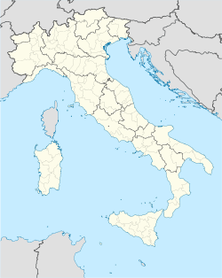
Coat of armsLocation of Kurtatsch in Italy Coordinates: 46°19′N 11°13′E / 46.317°N 11.217°E Country Italy Region Trentino-Alto Adige/Südtirol Province South Tyrol (BZ) Frazioni Entiklar (Niclara), Graun (Corona), Hofstatt, Oberfennberg (Favogna), Penon (Penone) Government – Mayor Martin Fischer Area – Total 29.4 km2 (11.4 sq mi) Elevation 333 m (1,093 ft) Population (November 2010[1]) – Total 2,249 – Density 76.5/km2 (198.1/sq mi) Demonym German: Kurtatscher
Italian: di CortacciaTime zone CET (UTC+1) – Summer (DST) CEST (UTC+2) Postal code 39040 Dialing code 0471 Website Official website Kurtatsch an der Weinstraße (Italian: Cortaccia sulla Strada del Vino) is a comune (municipality) in South Tyrol in the Italian region Trentino-Alto Adige/Südtirol, located about 30 km northeast of the city of Trento and about 25 km southwest of the city of Bolzano.
Kurtatsch borders the following municipalities: Neumarkt, Margreid, Tramin, Coredo, Roverè della Luna, Ton, Tres, and Vervò.
Contents
Coat-of-arms
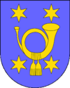
The emblem shows a or postillion hornet with tassels on azure background; at the corners are placed four six-pointed or stars. The postillon’s hornet indicates that the village was a postal station; the star represent the four villages in the municipality. The emblem was adopted in 1967.[2]
Linguistic distribution
According to the 2001 census, 96.21% of the population speak German, 3.44% Italian and 0.35% Ladin as first language.[3]
References
- ^ All demographics and other statistics: Italian statistical institute Istat.
- ^ Heraldry of the World: Kurtatsch
- ^ Oscar Benvenuto (ed.): "South Tyrol in Figures 2008", Provincial Statistics Institute of the Autonomous Province of South Tyrol, Bozen/Bolzano 2007, p. 16, table 10
External links
- Official website (German) (Italian)
Categories:
Wikimedia Foundation. 2010.


