- Otowa, Aichi
-
Otowa
音羽町Former municipality Since January 15, 2008 Currently part of Toyokawa 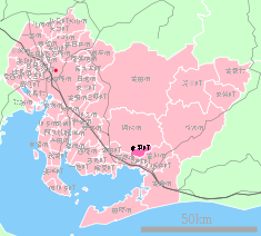
Otowa's location in Aichi, Japan.Location Country Japan Region Chūbu Prefecture Aichi District Hoi Physical characteristics Population (as of November 1, 2007) Total 8,870 Symbols Tree Azalea Flower Enkianthus subsessilis Official website: Town of Otowa Otowa (音羽町 Otowa-chō) was formerly a town located in Hoi District, Aichi, Japan. On January 15, 2008 Otowa was merged with the city of Toyokawa.
As of November 1, 2007 (the last census data prior to the merger) , the town had an estimated population of 8,870 and a population density of 299.15 persons per km². The total area was 29.65 km².
Contents
Geography
- Principal mountains: Kyōgamine (京ヶ峰), Mt. Miyaji (宮路山), Shiro-yama (城山), Mt. Kan'non (観音山)
- Principal rivers: Otowa River (音羽川), Yamakage River (山陰川)
History
- June 23, 1894 - Akasaka Village changed over to Akasaka Town (赤坂町).
- April 1, 1955 - Otowa was founded by the unification of Akasaka Town, Nagasawa Village (長沢村) and Hagi Village (萩村).
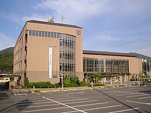
- 1981 - Otowa Town Office was moved. Symbol of Otowa was established.
- 1986 - Tōmei Expressway Otowa-Gamagori Interchange opened.
- 1987 - The rezoning of Akasaka was carried. ( - 1993)
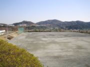
- 1992 - Otowa Town Field Park (音羽町運動公園) was completed.
- 1999 - Otowa Town Office was moved. New office and Cultural Hall ("Windia Hall") was completed.
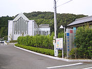
- 2000 - Otowa Town Library and Akasaka Community Center was completed.
- 2002 - Akasaka Rest House (赤坂休憩所), commonly called "Yoramaikan (よらまいかん)" was completed.
- 2005 - Ceremony to celebrate the 50th anniversary of the founding Otowa Town was held.
- January 15, 2008 - Otowa Town was incorporated into Toyokawa City.
Administration
Successive mayors
# Name Kanji Took Office Left Office 1 Watanabe Ryūji 渡邉 隆次 April 30, 1955 April 29, 1959 2 Sakakibara Buntarō 榊原 文太郎 April 30, 1959 June 10, 1962 3 Uebayashi Tahē 上林 多兵惠 July 29, 1962 December 18, 1963 4 Iyoda Isamu 伊與田 勇 January 21, 1964 January 20, 1968 5-8 Horiuchi Shigeaki 堀内 重昭 January 21, 1968 January 20, 1984 9-12 Nakamori Kōichi 中森 幸一 January 21, 1984 January 20, 2000 13-14 Utsuno Takeshi 宇都野 武 January 21, 2000 January 14, 2008 Economy
- Tokai Rika Otowa Factory
Region
Education
Primary schools
- Akasaka Primary School
- Nagasawa Primary School
- Hagi Primary School
Junior High school
- Otowa Junior High School
Social education
Ceremony Hall
- Otowa Town Cultural Hall ("Windia Hall")
Community centers
- Akasaka Community Center
- Nagasawa Community Center
- Hagi Community Center
- Akasakadai Community Center
Library
- Otowa Town Library
Athletic institution
- Otowa Town Field Park
Transportation
Railway
Road
Expressway
- Interchange - Tōmei Expressway Otowa-Gamagori Interchange
Toll road
- Toll road - Otowa-Gamagori Toll Road, commonly called "Mikawa Bay Orange Road (三河湾オレンジロード)"
National highway
- National highway - Route 1
Bus
- Tōmei Highway Bus: Otowa Bus Stop
- Otowa Town Community Bus
Local attractions
- Akasaka-juku (赤坂宿) - The thirty-sixth of the fifty-three stations of the Tōkaidō.
- Mt. Miyaji (宮路山 Miyaji-san) - It is said that Empress Jitō visited this mountain. In the autumn, maple leaves turnes red.
- Ruins of the Nagasawa Castle (長沢城址) - Today, The Nagasawa Primary School and the residential area of Kojō (古城団地 Kojō Danchi) is located in this site. The word "Kojō" means "old castle".
- Ceremony to pray for rain (雨乞い祭り amagoi matsuri) - A ceremony held in every August.
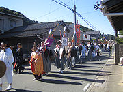
- Ceremony of the Sugimori Hachimansha (杉森八幡社祭礼) - A ceremony held in every October. In this ceremony, the daimyo's procession is reappeared.
External links
 Aichi Prefecture
Nagoya (capital city) 
Other cities Aisai | Ama | Anjō | Chiryū | Chita | Gamagōri | Handa | Hekinan | Ichinomiya | Inazawa | Inuyama | Iwakura | Kariya | Kasugai | Kitanagoya | Kiyosu | Komaki | Kōnan | Miyoshi | Nishio | Nisshin | Okazaki | Ōbu | Owariasahi | Seto | Shinshiro | Tahara | Takahama | Tokoname | Tōkai | Toyoake | Toyohashi | Toyokawa | Toyota | Tsushima | YatomiAichi District Ama District Chita District Kitashitara District Nishikasugai District Niwa District Nukata District Coordinates: 34°51′21″N 137°18′38″E / 34.85583°N 137.31056°E

This Aichi Prefecture location article is a stub. You can help Wikipedia by expanding it.

