- Observatory Circle
-
For the neighborhood, see Observatory Circle, Washington, D.C..
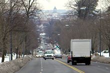
Observatory Circle is a street in Washington, D.C. It runs from Calvert Street to Massachusetts Avenue near 34th Street. The street follows an incomplete loop, forming an arc rather than a circle. Number One Observatory Circle is the official residence of the Vice President of the United States.
The inside of the arc formed by Observatory was blurred on Google Maps.[1]
See also
- List of circles in Washington, D.C.
- Observatory Circle, Washington, D.C. - article about the neighborhood
- United States Naval Observatory
References
Streets and highways of Washington, D.C. Streets 7th St. • 14th St. NW/SW • 16th St. NW • 18th St. NW • E. Capitol St. • N. Capitol St. • S. Capitol St. • H St. • Jackson Place • K St. • M St. • Madison Place • U St.Avenues,
Roads & DrivesBenning Rd. • Canal Rd. • Connecticut Ave. • Constitution Ave. • Eastern Ave. • Florida Ave. • Georgia Ave. • Independence Ave. • Klingle Road • Maine Ave. • Martin Luther King, Jr. Ave.• Massachusetts Ave. • New Hampshire Ave. • New York Ave. • Ohio Dr. • Pennsylvania Ave. • Rhode Island Ave. • Southern Ave. • Virginia Ave. • Wisconsin Ave.Circles Anna J. Cooper Circle • Barney Circle • Benjamin Banneker Circle • Columbus Circle • Dupont Circle • Garfield Circle • Grant Circle • Logan Circle • Observatory Circle • Peace Circle • Pinehurst Circle • Randle Circle • Scott Circle • Sheridan Circle • Sherman Circle • Tenley Circle • Thomas Circle • Ward Circle • Washington Circle • Westmoreland CircleHighways Coordinates: 38°55′16″N 77°04′01″W / 38.921°N 77.067°W
Categories:- Streets in Washington, D.C.
- Squares, plazas, and circles in Washington, D.C.
- Washington, D.C. geography stubs
Wikimedia Foundation. 2010.

