- Earth observation satellite
-
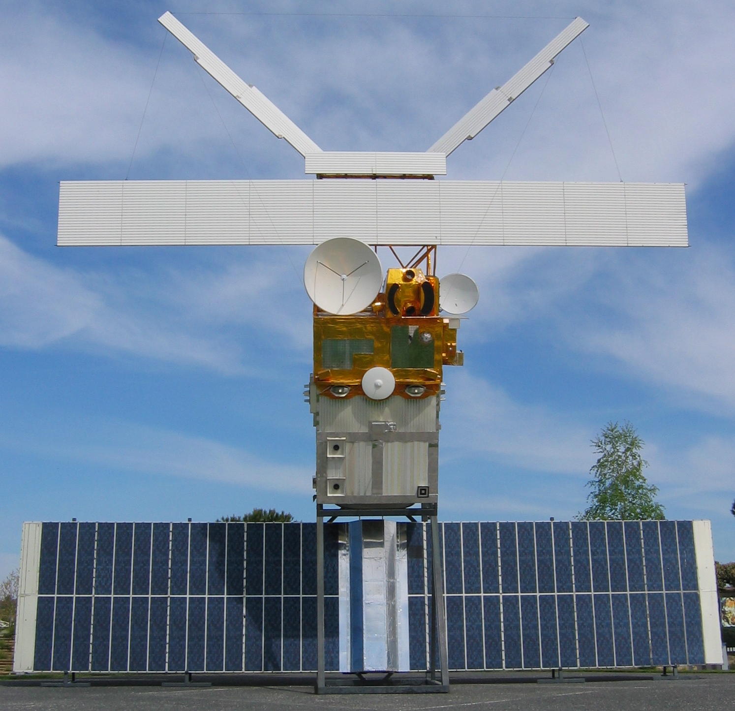
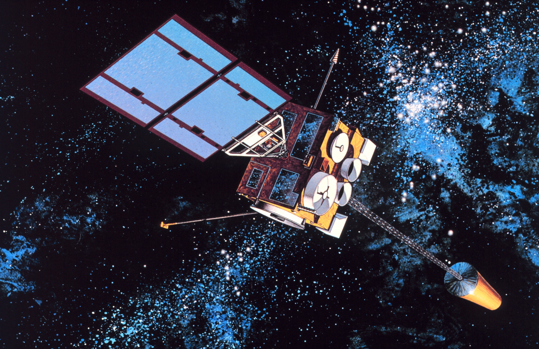
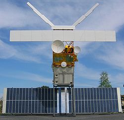 An Earth observation satellite, ERS 2
Earth observation satellites are satellites specifically designed to observe Earth from orbit, similar to reconnaissance satellites but intended for non-military uses such as environmental monitoring, meteorology, map making etc.
Most Earth observation satellites carry instruments that should be operated at a relatively low altitude. But altitudes below say 500-600 kilometers are in general avoided, though, because of the significant air-drag at such low altitudes making frequent orbit raising manoeuvres necessary. The Earth observation satellites ERS-1, ERS-2 and Envisat of European Space Agency as well as the MetOp spacecraft of the European Organisation for the Exploitation of Meteorological Satellites are all operated at altitudes of about 800 km. The Proba-1, Proba-2 and SMOS spacecraft of European Space Agency are observing the Earth from an altitude of about 700 km.
To get a (close to) global coverage with such a relatively low orbit it has to be polar or at least close to polar. As such a rather low orbit will have an orbital period of roughly 100 minutes the Earth will rotate around its polar axis with about 25 deg between successive orbits with the result that the ground track is shifted towards west with these 25 deg in longitude.
For spacecraft carrying instruments for which an altitude of 36000 km is suitable the Geostationary orbit is sometimes the preferred choice. From such an orbit one gets uninterrupted coverage of more than 1/3 of the Earth. With 3 geostationary spacecraft positioned over the equator at longitudes separated with 120 deg the whole Earth is covered except the extreme polar regions. This type of orbit is mainly used for meteorological satellites.
Contents
Weather
Main article: Weather satelliteSee also: Satellite temperature measurements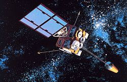 GOES-8, a United States weather satellite.
A weather satellite is a type of satellite that is primarily used to monitor the weather and climate of the Earth.[1] These meteorological satellites, however, see more than clouds and cloud systems. City lights, fires, effects of pollution, auroras, sand and dust storms, snow cover, ice mapping, boundaries of ocean currents, energy flows, etc., are other types of environmental information collected using weather satellites.
Weather satellite images helped in monitoring the volcanic ash cloud from Mount St. Helens and activity from other volcanoes such as Mount Etna.[2] Smoke from fires in the western United States such as Colorado and Utah have also been monitored.
El Niño and its effects on weather are monitored daily from satellite images. The Antarctic ozone hole is mapped from weather satellite data. Collectively, weather satellites flown by the U.S., Europe, India, China, Russia, and Japan provide nearly continuous observations for a global weather watch, used via visible light and infrared rays of the electromagnetic spectrum.
Environmental monitoring
Other environmental satellites can assist environmental monitoring by detecting changes in the Earth's vegetation, sea state, ocean color, and ice fields. By monitoring vegetation changes over time, droughts can be monitored by comparing the current vegetation state to its long term average.[3] For example, the 2002 oil spill off the northwest coast of Spain was watched carefully by the European ENVISAT, which, though not a weather satellite, flies an instrument (ASAR) which can see changes in the sea surface.
These types of satellites are almost always in Sun synchronous and "frozen" orbits. The Sun synchronous orbit is in general sufficiently close to polar to get the desired global coverage while the relatively constant geometry to the Sun mostly is an advantage for the instruments. The "frozen" orbit is selected as this is the closest to a circular orbit that is possible in the gravitational field of the Earth
Mapping
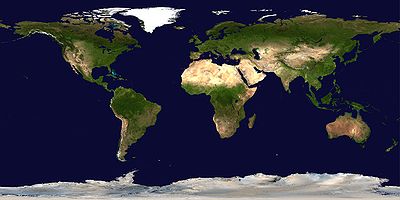 A composite satellite image of the earth, showing its entire surface, both land and ocean, in Plate carrée projection.
Terrain can be mapped from space with the use of satellites, such as RADARSAT-1[4] and TerraSAR-X.
See also
- Earth Observing System - a NASA program comprising a series of satellite missions
- List of Earth observation satellites
- Earth observation satellites transmission frequencies
References
- ^ NESDIS. Satellites. Retrieved on 2008-07-04.
- ^ NOAA. NOAA Satellites, Scientists Monitor Mt. St. Helens for Possible Eruption. Retrieved on 2008-07-04.
- ^ NASA. Drought. Retrieved on 2008-07-04.
- ^ Grunsky, E.C. The use of multi-beam RADARSAT-1 satellite imagery for terrain mapping. Retrieved on 2008-07-04.
Meteorological remote sensing systems in Earth orbit Concepts Defense Weather Satellite System · Earth observation satellite · Geographic information system (GIS) · Weather satelliteCurrent projects A-train satellitesOther satellitesCBERS · COSMIC (FORMOSAT-3) · COSMO-SkyMed · DMSP · DMC · Elektro-L · Envisat · EROS · ERS · Fengyun · FORMOSAT-2 · GOES · IKONOS · Landsat · MetOp · Meteor · Meteosat · MTSAT · NOAA-N' · QuickBird · RADARSAT-1 · RADARSAT-2 · SMOS · SPOT · TerraSAR-X · THEOSFormer projects CompletedFailedCategories:- Earth observation satellites

Wikimedia Foundation. 2010.