- Chita, Zabaykalsky Krai
-
For other uses, see Chita (disambiguation).
Chita (English)
Чита (Russian)- City[citation needed] - 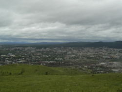
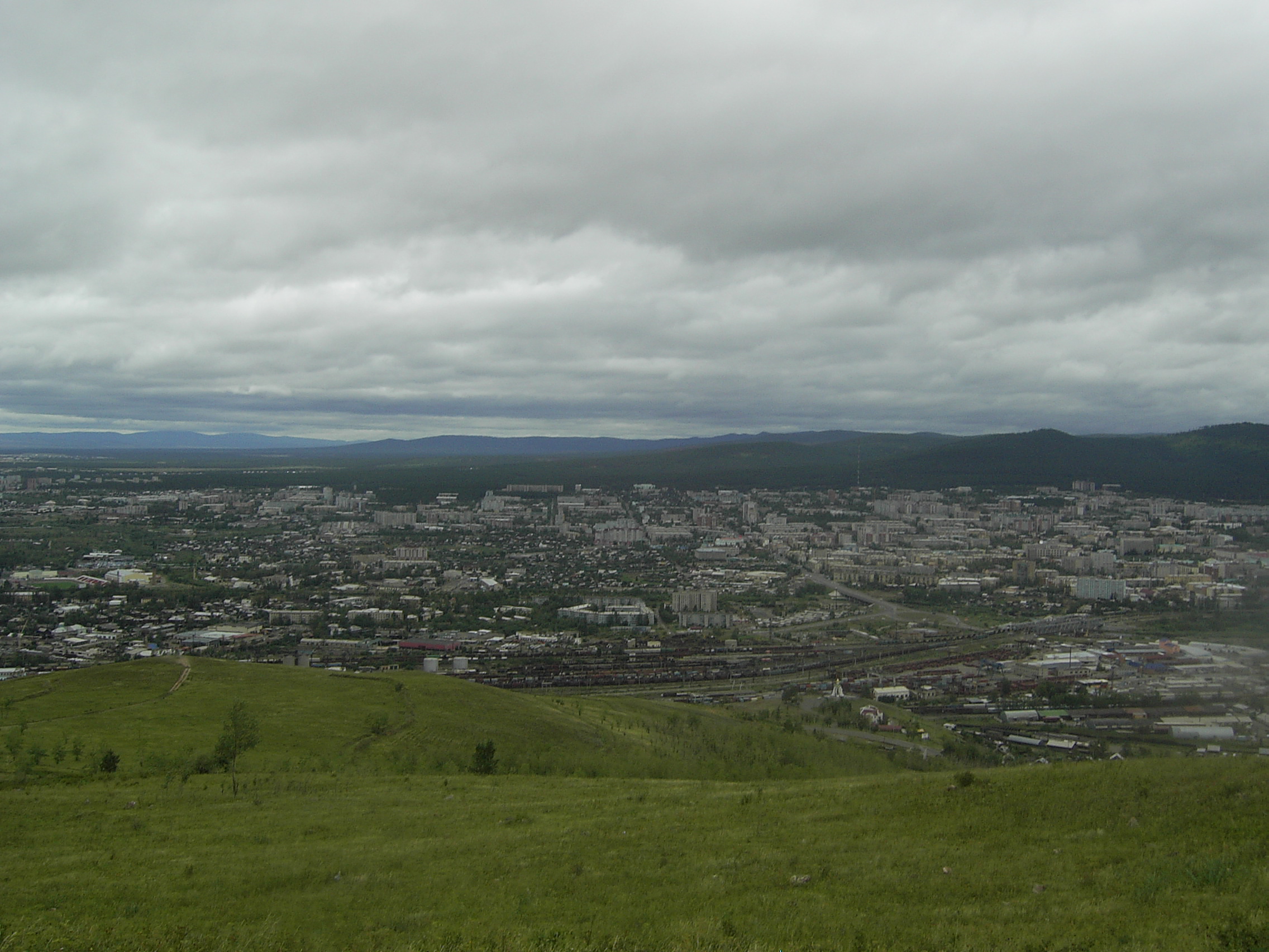
View of Chita from Titovskaya Sopka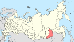
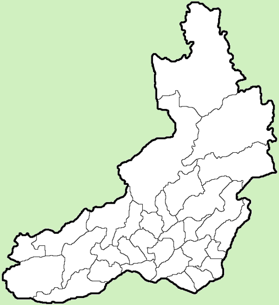
Location of Zabaykalsky Krai in Russia
 Chita
ChitaCoordinates: 52°03′N 113°28′E / 52.05°N 113.467°ECoordinates: 52°03′N 113°28′E / 52.05°N 113.467°E 

Coat of arms Flag Administrative status Country Russia Federal subject Zabaykalsky Krai Administrative center of Zabaykalsky Krai[citation needed] Municipal status Urban okrug Chita Urban Okrug[citation needed] Mayor[citation needed] Anatoly Mikhalyov[citation needed] Statistics Area 538 km2 (208 sq mi)[citation needed] Population (2010 Census,
preliminary)323,964 inhabitants[1] - Rank in 2010 56th Population (2002 Census) 316,643 inhabitants[2] - Rank in 2002 57th Density 602 /km2 (1,560 /sq mi)[3] Time zone YAKST (UTC+10:00)[4] Founded 1653[citation needed] Postal code(s) 672000–672051[citation needed] Dialing code(s) +7 3022[citation needed] Official website Chita (Russian: Чита́) is a city and the administrative center of Zabaykalsky Krai, Russia, located at the confluence of the Chitinka and Ingoda Rivers and on the Trans-Siberian Railway, 900 kilometers (560 mi) east of Irkutsk. Population: 323,964 (2010 Census preliminary results);[1] 316,643 (2002 Census);[2] 365,754 (1989 Census).[5]
The city is the headquarters of the Siberian Military District. It is served by the Chita Kadala Airport and the Chita Northwest air base.
Contents
History
Before 1825
The region was originally inhabited by local Mongolic and Turkic tribes, along with various Chinese traders for several centuries before the Russians arrived there. The settlement of Chita is known since 1653 founded by Pyotr Beketov's Cossacks, but it had been overshadowed by Nerchinsk until the 20th century. Chita was granted town status in 1851. By 1885, the population had reached 5,728, increasing to 11,480 in 1897.
1825 to 1918
After 1825 several of the Decembrists suffered exile to Chita and thus, Chita is on occasion called the "City of Exiles". Many of the Decembrists were intellectuals and members of the middle class, and consequently their arrival had a positive effect. The well-educated exiles made an effort to educate the citizens of Chita and pursue trade. Through these efforts, the city became a major trading portal in Siberia, particularly since the natural resources of the area included timber, gold and uranium.
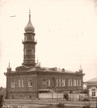
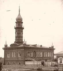 Chita Mosque
At the end of the 19th century many Muslims settled in Chita, attracted by its trading potential. These Muslims were mainly of Tatar origin. They settled down near the Jewish quarter and built a mosque. Many Tatars resident in Chita today are their descendants.
Perhaps due in part to the influence of the early revolutionary exiles, Chita was a center for worker unrest in the early years of the 20th century. After Father Gapon and his workers were massacred in St. Petersburg in January 1905, Chita became a center for worker demonstrations, which led to armed revolutionaries taking control of the city and declaring the "Chita Republic". Troops sent by the Tsar quickly crushed the new government and its leaders were severely punished on the slope of Titovskaya Hill.
1918 to 1945
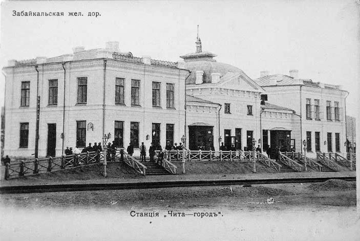
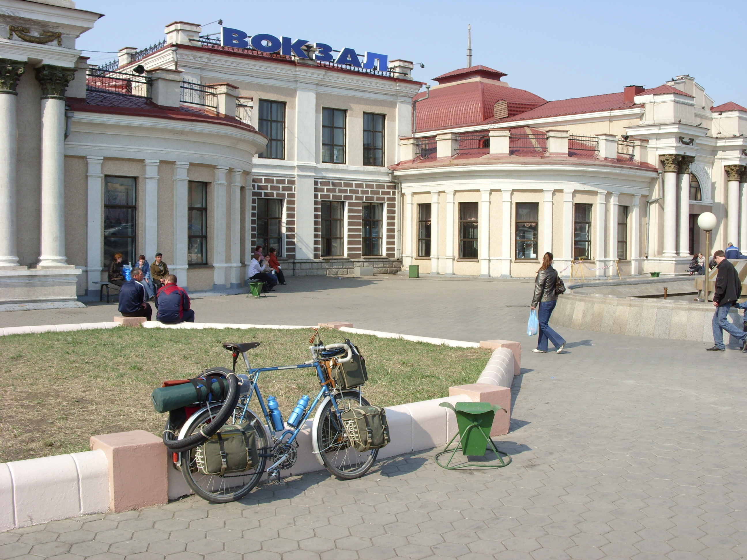
 Chita Railway Station
 Chita Railway Station today
Chita was occupied by the Japanese between 1918 and 1920. From 1920 to 1922 Chita served as the capital of the Far Eastern Republic. From the 1930s to the dissolution of the Soviet Union, Chita was a closed city. During this period, foreigners were prohibited from traveling to Chita as were many Russians. The basis for the closing of the city was apparently its proximity to China and military installations. During World War II, a significant number of Japanese soldiers were taken by the Ukrainians as prisoners of war and put to work in the construction industry. In the center of Chita you will find buildings with a definite hint of Japanese style. The buildings are not overtly Japanese, but they definitely differ from the other styles present.
Post-1945
In 1945, Pu Yi, the last Emperor of China, and some of his associates were held prisoner in the city, in a former sanatorium for officers.[6] Chita was a 'closed city' and foreigners were kept out until 1991.
Architecture
Chita is laid out in a grid pattern, which is rare in Russia. Architecturally, Chita is a clash of styles. Foremost, Chita is populated with five-story concrete buildings. In contrast to these Soviet signatures, Chita is also populated with individual homes made primarily out of wood, the equivalent of those you would see in any mountainous area.
Education
Chita is home to several higher education places:
- Chita State University
- Chita State Academy of Medicine
- Chita State University of Polytechnics
Sports
Universitet Chita compete in the Professional Rugby League, the top division of rugby union in Russia.
SKA Zabaykalets has played in the highest division of the Russian Bandy League.
Climate
Chita experiences a subarctic climate (Köppen climate classification Dwc) with very cold, very dry winters and very warm, wet summers.
Climate data for Chita Month Jan Feb Mar Apr May Jun Jul Aug Sep Oct Nov Dec Year Record high °C (°F) 0.4
(32.7)7.5
(45.5)18.3
(64.9)26.5
(79.7)34.4
(93.9)36.7
(98.1)38.0
(100.4)36.6
(97.9)30.2
(86.4)22.7
(72.9)12.7
(54.9)3.3
(37.9)38.0
(100.4)Average high °C (°F) −18.4
(−1.1)−12.1
(10.2)−1.9
(28.6)8.2
(46.8)17.0
(62.6)24.1
(75.4)25.7
(78.3)22.8
(73.0)16.1
(61.0)6.7
(44.1)−6.8
(19.8)−16.5
(2.3)5.6 Average low °C (°F) −32.5
(−26.5)−29.2
(−20.6)−19.2
(−2.6)−7
(19.4)0.4
(32.7)7.6
(45.7)11.7
(53.1)9.3
(48.7)1.8
(35.2)−7.1
(19.2)−19.8
(−3.6)−29
(−20.2)−9.3 Record low °C (°F) −49.6
(−57.3)−48
(−54.4)−45.3
(−49.5)−29.6
(−21.3)−13.3
(8.1)−5.4
(22.3)0.1
(32.2)−9.2
(15.4)−10.7
(12.7)−33.1
(−27.6)−41.1
(−42.0)−47.8
(−54.0)−49.6
(−57.3)Precipitation mm (inches) 2
(0.08)3
(0.12)3
(0.12)9
(0.35)23
(0.91)58
(2.28)102
(4.02)80
(3.15)38
(1.5)10
(0.39)6
(0.24)4
(0.16)338
(13.31)% humidity 76 73 61 47 45 58 69 74 68 62 71 77 65.1 Avg. precipitation days 7 6 7 8 9 10 7 7 6 6 8 8 89 Sunshine hours 139.5 179.2 238.7 243.0 275.9 279 248.0 226.3 213.0 189.1 135.0 108.5 2,475.2 Source no. 1: Pogoda.ru.net[7] Source no. 2: HKO Twin towns/sister cities
Chita is twinned with:
References
- ^ a b Федеральная служба государственной статистики (Federal State Statistics Service) (2011). "Предварительные итоги Всероссийской переписи населения 2010 года (Preliminary results of the 2010 All-Russian Population Census)" (in Russian). Всероссийская перепись населения 2010 года (All-Russia Population Census of 2010). Federal State Statistics Service. http://www.perepis-2010.ru/results_of_the_census/results-inform.php. Retrieved 2011-04-25.
- ^ a b Федеральная служба государственной статистики (Federal State Statistics Service) (2004-05-21). "Численность населения России, субъектов Российской Федерации в составе федеральных округов, районов, городских поселений, сельских населённых пунктов – районных центров и сельских населённых пунктов с населением 3 тысячи и более человек (Population of Russia, its federal districts, federal subjects, districts, urban localities, rural localities—administrative centers, and rural localities with population of over 3,000)" (in Russian). Всероссийская перепись населения 2002 года (All-Russia Population Census of 2002). Federal State Statistics Service. http://www.perepis2002.ru/ct/doc/1_TOM_01_04.xls. Retrieved 2010-03-23.
- ^ The value of density was calculated automatically by dividing the 2010 Census population by the area specified in the infobox. Please note that this value may not be accurate as the area specified in the infobox does not necessarily correspond to the area of the entity proper or is reported for the same year as the population.
- ^ Правительство Российской Федерации. Постановление №725 от 31 августа 2011 г. «О составе территорий, образующих каждую часовую зону, и порядке исчисления времени в часовых зонах, а также о признании утратившими силу отдельных Постановлений Правительства Российской Федерации». Вступил в силу по истечении 7 дней после дня официального опубликования. Опубликован: "Российская Газета", №197, 6 сентября 2011 г. (Government of the Russian Federation. Resolution #725 of August 31, 2011 On the Composition of the Territories Included into Each Time Zone and on the Procedures of Timekeeping in the Time Zones, as Well as on Abrogation of Several Resolutions of the Government of the Russian Federation. Effective as of after 7 days following the day of the official publication).
- ^ "Всесоюзная перепись населения 1989 г. Численность наличного населения союзных и автономных республик, автономных областей и округов, краёв, областей, районов, городских поселений и сёл-райцентров. (All Union Population Census of 1989. Present population of union and autonomous republics, autonomous oblasts and okrugs, krais, oblasts, districts, urban settlements, and villages serving as district administrative centers.)" (in Russian). Всесоюзная перепись населения 1989 года (All-Union Population Census of 1989). Demoscope Weekly (website of the Institute of Demographics of the State University—Higher School of Economics. 1989. http://demoscope.ru/weekly/ssp/rus89_reg.php. Retrieved 2010-03-23.
- ^ S. I. Kuznetsov and S. V. Karasov, "The Last Emperor of China: Internment in the Soviet Union", The Journal of Slavic Military Studies 18(2), 207-226 (2005). DOI: 10.1080/13518040590944430
- ^ "Pogoda.ru.net" (in Russian). http://pogoda.ru.net/climate/30758.htm. Retrieved September 8, 2007.
- Materials on Jewish life were taken from the Chita Oblast State Archives but most accountable and reliable ones are still in the local KGB Archives.
 This article incorporates text from a publication now in the public domain: Chisholm, Hugh, ed (1911). Encyclopædia Britannica (11th ed.). Cambridge University Press.
External links
Administrative divisions of Zabaykalsky Krai Administrative center: Chita Cities and towns Baley · Borzya · Khilok · Krasnokamensk · Mogocha · Nerchinsk · Petrovsk-Zabaykalsky · Shilka · SretenskDistricts Akshinsky · Alexandrovo-Zavodsky · Baleysky · Borzinsky · Chernyshevsky · Chitinsky · Gazimuro-Zavodsky · Kalarsky · Kalgansky · Karymsky · Khiloksky · Krasnochikoysky · Krasnokamensky · Kyrinsky · Mogochinsky · Nerchinsko-Zavodsky · Nerchinsky · Olovyanninsky · Ononsky · Petrovsk-Zabaykalsky · Priargunsky · Shelopuginsky · Shilkinsky · Sretensky · Tungiro-Olyokminsky · Tungokochensky · Ulyotovsky · ZabaykalskyDistricts of
Agin-Buryat OkrugCategories:- Chita, Zabaykalsky Krai
- Jewish Russian and Soviet history

Wikimedia Foundation. 2010.