- Choibalsan (city)
-
This article is about the Mongolian city. For other uses, see Choibalsan.
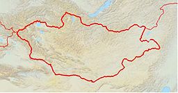
Choibalsan (Чойбалсан) Aimag capital Name origin: Named after Khorloogiin Choibalsan Country Mongolia Aimag Dornod Elevation 747 m (2,451 ft) Coordinates 48°04′42″N 114°32′06″E / 48.07833°N 114.535°E Population 38,150 (2008) Timezone UTC+8 Area code +976 (0)158 Website: [1] Choibalsan (Mongolian: Чойбалсан) is the fourth-largest city in Mongolia. The name of the city was Bayan Tu'men (Баян Түмэн) until 1941, when it was renamed after the communist leader Khorloogiin Choibalsan. It is the capital of the province of Dornod. The city administrative unit's official name is Kherlen sum, with area of 281 km2. It is situated at the Kherlen River, at an elevation of 747 m above sea.
Contents
History
The location has been a post on a trading route for centuries. In the 19th century it grew into a city, and became the economic hub of eastern Mongolia in the twentieth century. After democratization in 1992, when the Russian workers left, large parts of the economy collapsed. Since then, the city has suffered from one of the highest unemployment rates in Mongolia.
Due to the city's proximity to the site of the Battle of Khalkhin Gol, it contains a museum dedicated to Georgy Zhukov, hero of the battle.
Population
The city of Choibalsan has a population of 45,490 (1994), 41,714 (2000), 36,142 (2003), 39,500 (2006),[1] 39,500 (2007, 53.2% of the Dornod Aimag's total population),[2] 38,150 (2008 51.2% of the Aimag's population).[3]
Choibalsan is inhabited primarily by Halh Mongols, with smaller numbers of Buryats, Barga Mongols, and Üzemchin. There is also a minority of immigrants from Inner Mongolia in China.
Climate
Choibalsan experiences a cold semi-arid climate (Köppen BSk) with very cold, very dry winters and warm, wetter summers.
Climate data for Choibalsan Month Jan Feb Mar Apr May Jun Jul Aug Sep Oct Nov Dec Year Average high °C (°F) −14.4
(6.1)−10.7
(12.7)−0.5
(31.1)10.5
(50.9)19.0
(66.2)24.9
(76.8)26.6
(79.9)24.4
(75.9)18.0
(64.4)8.8
(47.8)−3.4
(25.9)−11.8
(10.8)7.62
(45.71)Daily mean °C (°F) −20.5
(−4.9)−17.7
(0.1)−7.8
(18.0)2.6
(36.7)11.3
(52.3)17.6
(63.7)19.8
(67.6)17.9
(64.2)10.6
(51.1)1.5
(34.7)−9.8
(14.4)−17.6
(0.3)0.66
(33.19)Average low °C (°F) −25.5
(−13.9)−23.9
(−11.0)−14.8
(5.4)−4.1
(24.6)3.8
(38.8)10.8
(51.4)14.4
(57.9)12.1
(53.8)4.9
(40.8)−4.2
(24.4)−15.2
(4.6)−22.7
(−8.9)−5.37
(22.34)Precipitation mm (inches) 1.6
(0.063)1.9
(0.075)2.9
(0.114)6.3
(0.248)14.4
(0.567)39.0
(1.535)57.4
(2.26)43.3
(1.705)27.2
(1.071)7.7
(0.303)3.3
(0.13)2.6
(0.102)207.6
(8.173)Avg. precipitation days (≥ 1.0 mm) 0.6 1.0 0.7 1.6 3.2 5.7 8.7 8.1 4.6 1.6 1.1 0.9 37.8 Sunshine hours 198.4 214.7 266.6 264.0 294.5 306.0 297.6 288.3 258.0 238.7 201.0 176.7 3,004.5 Source: Hong Kong Observatory [4] Transportation
The Choibalsan Airport (COQ/ZMCD) has one paved runway, and is served by regular flights to Ulan Bator.
References
- ^ Dornod Aimag: Статистикийн мэдээлэл 2006 (Statistical information), 2007-01-16
- ^ Dornod Aimag Statistics Office
- ^ Dornod Aimag Statistics Office.Dec. 2008 Report
- ^ "Climatological Normals of Choibalsan". Hong Kong SAR Government. http://www.hko.gov.hk/wxinfo/climat/world/eng/asia/china/choibalsan_e.htm. Retrieved 2011-01-05.
Bayan-Uul · Bayandun · Bayantu'men · Bulgan · Choibalsan (sum) · Chulunhoroot · Dashbalbar · Gurvanzagal · Halhgol · Herlen (Choibalsan city) ·
Ho'lonbuir · Matad · Sergelen · Tsagaan-Ovoo
Capital: Ulaanbaatar Choir, Govisümber · Mandalgovi, Dundgovi · Dalanzadgad, Ömnögovi · Baruun-Urt, Sükhbaatar · Sainshand, Dornogovi · Altai, Govi-Altai · Bulgan, Bulgan · Öndörkhaan, Khentii · Choibalsan, Dornod · Ulaangom, Uvs · Uliastai, Zavkhan · Erdenet, Orkhon · Bayankhongor, Bayankhongor · Zuunmod, Töv · Khovd, Khovd · Darkhan, Darkhan-Uul · Tsetserleg, Arkhangai · Ölgii, Bayan-Ölgii · Sükhbaatar, Selenge · Arvaikheer, Övörkhangai · Mörön, Khövsgöl

Coordinates: 48°04′42″N 114°32′06″E / 48.07833°N 114.535°E
Categories:- Aimag centers
- Populated places in Mongolia
Wikimedia Foundation. 2010.


