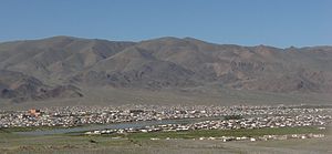
- Ölgii (city)
-
This article is about the city in Mongolia. For other uses, see Ölgii.
Ölgii
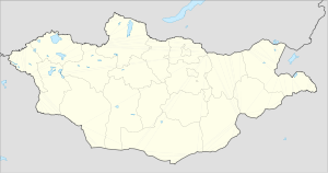
Өлгий— Sum — Ölgii city Location in Mongolia Coordinates: 48°58′06″N 89°58′07″E / 48.96833°N 89.96861°ECoordinates: 48°58′06″N 89°58′07″E / 48.96833°N 89.96861°E Country  Mongolia
Province Bayan-Ölgii Area – Total 5.8 sq mi (15 km2) Elevation 5,610 ft (1,710 m) Population (2008) – Total 28,496 – Density 3,885/sq mi (1,500/km2) Time zone UTC+7 Area code(s) +976 (0)142 License plate БӨ_ (_variable) Ölgii (Mongolian: Өлгий cradle) is the capital of the Bayan-Ölgii Aimag (province) of Mongolia, located in the extreme west of the country. It has an altitude of 1710 meters (5610 feet). City population is 28,496 (2008[1]).
Transportation
The Ölgii Airport (ULG/ZMUL) has one unpaved runway. It offers regular flights to Ulan Bator and regular flights to Almaty in Kazakhstan via Oskemen Airport.
Climate
Ölgii experiences a desert climate (Köppen BWk) with long, very dry, very cold winters and short, warm summers.
Climate data for Ölgii Month Jan Feb Mar Apr May Jun Jul Aug Sep Oct Nov Dec Year Average high °C (°F) −10.7
(12.7)−6.9
(19.6)1.2
(34.2)9.0
(48.2)16.1
(61.0)21.2
(70.2)22.6
(72.7)21.2
(70.2)15.5
(59.9)6.9
(44.4)−2.4
(27.7)−9.2
(15.4)7.04
(44.68)Daily mean °C (°F) −17.1
(1.2)−14.7
(5.5)−6.7
(19.9)1.7
(35.1)9.3
(48.7)14.6
(58.3)16.3
(61.3)14.5
(58.1)8.6
(47.5)0.1
(32.2)−8.5
(16.7)−15
(5.0)0.26
(32.47)Average low °C (°F) −22.6
(−8.7)−21.1
(−6.0)−13.6
(7.5)−5.1
(22.8)3.0
(37.4)8.3
(46.9)10.4
(50.7)8.6
(47.5)2.7
(36.9)−4.9
(23.2)−13.7
(7.3)−20.2
(−4.4)−5.68
(21.77)Precipitation mm (inches) 0.6
(0.024)0.5
(0.02)1.3
(0.051)4.5
(0.177)10.6
(0.417)25.0
(0.984)34.0
(1.339)20.0
(0.787)12.5
(0.492)3.0
(0.118)0.7
(0.028)1.0
(0.039)113.7
(4.476)Source: Hong Kong Observatory [2] Altai · Altantsögts · Bayannuur · Bugat · Bulgan · Buyant · Delüün · Nogoonnuur · Ölgii · Sagsai · Tolbo · Tsagaannuur · Tsengel · Ulaankhus
 Capital: Ulaanbaatar
Choir, Govisümber · Mandalgovi, Dundgovi · Dalanzadgad, Ömnögovi · Baruun-Urt, Sükhbaatar · Sainshand, Dornogovi · Altai, Govi-Altai · Bulgan, Bulgan · Öndörkhaan, Khentii · Choibalsan, Dornod · Ulaangom, Uvs · Uliastai, Zavkhan · Erdenet, Orkhon · Bayankhongor, Bayankhongor · Zuunmod, Töv · Khovd, Khovd · Darkhan, Darkhan-Uul · Tsetserleg, Arkhangai · Ölgii, Bayan-Ölgii · Sükhbaatar, Selenge · Arvaikheer, Övörkhangai · Mörön, Khövsgöl

References
- ^ Bayan-Ölgii Aimag Annual Statistical Report 2008[1]
- ^ "Climatological Normals of Ulgii". Hong Kong SAR Government. http://www.hko.gov.hk/wxinfo/climat/world/eng/asia/china/ulgii_e.htm. Retrieved 2011-01-05.
Categories:- Mongolia geography stubs
- Populated places in Mongolia
- Aimag centers
Wikimedia Foundation. 2010.


