- Bayan-Ölgii Province
Geobox|Province
country = Mongolia
name = Bayan-Ölgii aimag
other_name = _mn. Баян Өлгий аймаг
coordinates_type = adm1st
lat_d = 48 |lat_m = 18 |lat_NS = N
long_d = 89 |long_m = 30 |long_EW = E
symbol_type = Coat of arms
symbol = Bayan Olgiy.gif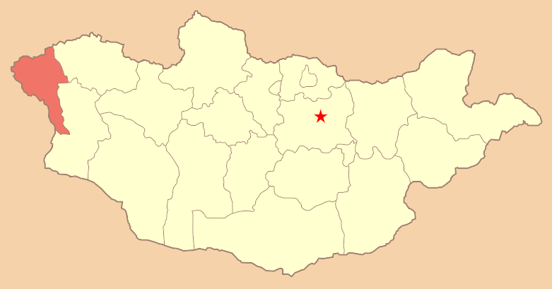
established = 1940
established_note = [ [http://gate1.pmis.gov.mn/bayan-ulgii/monsite/History1.htm Official website: Brief History] ]
capital = Ölgii
area = 45700
population = 95,758
population_as_of = 2005
population_density = 2.10
timezone = UTC+7
area_code = +976 (0)142
code1_type = License plate
code1 = БӨ_ (_variable)
code2_type =ISO 3166-2 code
code2 = MN-071
website = http://bayan-ulgii.pmis.gov.mnBayan-Ölgii ( _mn. Баян-Өлгий; _kz. Баян Өлгей) (Alternately spelled Olgiy, Ulgii, etc.) is the westernmost of the 21 aimags (provinces) of
Mongolia . The aimag was established in 1940. Its capital is Ölgii.Geography
The aimag is located in the extreme west of the country, and shares borders with both
Russia andChina . The border between the two neighbouring countries is very short here, though, and ends after about 40 km at the eastern end ofKazakhstan . Within Mongolia, the neighbouring aimags are Uvs in the north east and Khovd in the south east..Bayan-Ölgii is the highest Mongolian aimag. For the most part it is located in the Mongolian Altay, at the transition point to the Russian Altay. About 10% of the territory are covered by forests, consisting primarily of
Siberian Larch .The
Tavan Bogd Uul ("Five Saints Mountain") of the Tavan Bogd massif marks the corner between the three neighbouring countries. About 2.5 km further south on the Mongolian-Chinese border, theKhüiten Peak ("Cold Peak", also "Nairamdal", "Friendship Peak"; Chinese: "Youyi Feng") is the highest point of Mongolia with 4374 m. The massif includes several glaciers, such as the 19 km long "Potanii", and is only accessible to experienced climbers with local guidance.The River Khovd (the longest in the western Mongolian
Great Lakes Depression ) has its origin in this aimag. It is fed by the three lakes "Khoton", "Khurgan", and "Dayan", and in turn feeds the lakeKhar-Us Nuur in the Khovd Aimag. TheTolbo Nuur is a large saline lake about 50 km south of the aimag capital. It features clear and cold water on an elevation of 2080 m.Population
Most inhabitants of Bayan-Ölgii are
Kazakhs (88.7%). Smaller parts of the population are composed ofUriankhai (7.2%), Dörvöd (1.5%) [ [http://gate1.pmis.gov.mn/bayan-ulgii/ Official website: Main Page] ] ,Khalkha ,Tuva andKhoshuud . A significant portion of the population speaks Kazakh as their mother tongue and theMongolian language only as a second language, if at all.After democratization, many inhabitants moved to their historical homeland,
Kazakhstan , assuming they would find a better future there. The result was a noticeable loss of population in 1991-1993, when approx. 30,000 were repatriated to Kazakhstan. As it turned out though,Kazakhstan suffered much more from the consequences of former socialist rule thanMongolia did, so that most were disappointed in their hopes. A noticeable number of former immigrants have been returning, so that the population has risen again noticeably.Culture
The culture of the Kazakh majority is strongly influenced by Islamic traditions.The mosque of Ölgii also houses the Islamic Center of Mongolia. It is placed at an unusual angle within the fabric of the city, because the building was oriented exactly towards
Mecca . There's also a "Madrasah" (Islamic school) at the same place.The aimag is famous for the traditional hunting method using trained eagles. While the animals work in a similar way as hunting falcons do in other places, this is the only group in the world that has been able to train eagles to hunt.
Traffic
The
Ölgii Airport (ULG/ZMUL) has one unpaved runway. It offers regular flights toUlan Bator and irregular flights toAlmaty inKazakhstan .A road connecting to Russia starts in Tsagaannuur.
The border with China is open only for a short time in the summer.
National parks
The "Altai Tavan Bogd National Park" covers 6,362 km² and is located south of the highest mountain of Mongolia. It includes the lakes "Khoton", "Khurgan", and "Dayan". The protected area offers a home for many species of alpine animal, such as the
Argali sheep,Ibex ,Red deer ,Beech marten ,Moose ,Snow cock , andGolden eagle .The "Khökh Serkhiin Nuruu Protected Area" (659 km²) and the "Siilkhemiin Nuruu National Park" (1,428 km²) are of similar character.
The "Develiin Aral Natural Reserve" (103 km²) is established around "Develiin Island" at the confluence of the rivers "Lsan Khooloi" and "Khovd". Since 2000 it has provided protection for various birds and animals including
pheasant s,boar s, andbeaver s.The "Tsambagarav National Park" includes 1,115 km² of land around the glaciers near the Khovd aimag and protects the
snow leopard s living there, among others.Administrative subdivisions
* - Tsagaannuur including
References
External links
* [http://www.ulgii.wordpress.com Bayan-Ulgii blog]

Wikimedia Foundation. 2010.