- Clunie
-
Coordinates: 56°34′40″N 3°27′07″W / 56.577645°N 3.451953°W
Clunie Scottish Gaelic: Cluanaidh
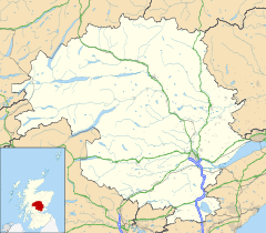
 Clunie shown within Perth and Kinross
OS grid reference NO109438 Council area Perth and Kinross Lieutenancy area Perth and Kinross Country Scotland Sovereign state United Kingdom Post town BLAIRGOWRIE Postcode district PH10 Dialling code 01250 Police Tayside Fire Tayside Ambulance Scottish EU Parliament Scotland UK Parliament Perth and North Perthshire Scottish Parliament Perth
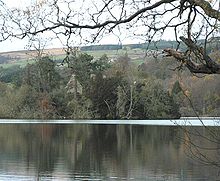
Mid Scotland and FifeList of places: UK • Scotland • Clunie is a small settlement in Perthshire, Scotland, 7 km west of Blairgowrie. It lies on the western shore of the Loch of Clunie. Near the village are the foundations of what is believed to have been be a castle used by Kenneth MacAlpin, the first king of Scotland, as a base for hunting in the nearby royal forest of Clunie.
On a small island (formerly a crannog) in the loch stand the remains of Clunie Castle, a tower house of the Bishops of Dunkeld. The last pre-Reformation bishop, Robert Crichton, passed the property to his near relative, Robert Crichton, Lord Advocate of Scotland. His son James, the notable Scottish polymath better known as the Admirable Crichton, spent his childhood there.
Within the grounds of the parish church, rebuilt in 1840, stands a mausoleum with a romanesque doorway thought to be from an earlier 12th or 13th century church which stood on the same site. The church is now linked with those at Kinclaven and Caputh.
Clunie Primary School is now closed but the local hall survives with regular functions taking place.
External links
- Clunie on the Gazetteer for Scotland
- Early morning at Loch Clunie
Categories:- Villages in Perth and Kinross
- Perth and Kinross geography stubs
Wikimedia Foundation. 2010.


