Massacre of Monzievaird — The Massacre of Monzievaird took place on 21 October 1490, the result of a violent blood feud between the Murray and Drummond families of Monzievaird in the Scottish Highlands.[1] Feuding, murdering kin, and marrying enemies were commonplace … Wikipedia
Monivaird and Strowan — MONIVAIRD and STROWAN, a parish, in the county of Perth, 3 miles (N. W.) from Crieff; containing 853 inhabitants. The word Monivaird is a corruption of the Gaelic term Moivard, or Monvard, signifying the hill of the bards. Strowan is corrupted … A Topographical dictionary of Scotland
Monzievaird — is situated two miles west of Crieff in Highland Perthshire, Scotland. It was originally named Muithauard c.1200, Moneward 1203. The name is derived from the Gaelic magh + bard; Plain of the bards. (Locals pronounce it as Mon ee vaird).… … Wikipedia
Kincardine In Monteith — KINCARDINE IN MONTEITH, a parish, in the county of Perth, 2 miles (S. by W.) from Doune; containing, with the villages of Kirklane and Woodlane, 2232 inhabitants. This parish, of which the name is of very uncertain etymology, is pleasantly… … A Topographical dictionary of Scotland
Perth, Scotland — Coordinates: 56°23′49″N 3°26′14″W / 56.396911°N 3.437262°W / 56.396911; 3.437262 … Wikipedia
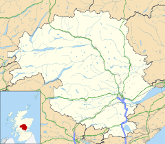
Perth and Kinross — This article is about the Scottish local government area. For the former UK Parliamentary constituency abolished in 1997, see Perth and Kinross (UK Parliament constituency). Perth and Kinross Pairth an Kinross Peairt agus Ceann Rois Location … Wikipedia
Crieff — Coordinates: 56°22′32″N 3°50′33″W / 56.37568°N 3.84262°W / 56.37568; 3.84262 … Wikipedia
Clan Keith — is a Scottish clan associated with Aberdeenshire and Caithness. Contents 1 History 1.1 Origins 1.2 Wars of Scottish Independence 1.3 … Wikipedia
Dunning — For other uses, see Dunning (disambiguation). St Serf s Church. Dunning is a small village in Perth and Kinross in Scotland with a population of about 1,000. The village is built around the 12th 13th century former parish church of St. Serf,… … Wikipedia
Milnathort — is a small village in the Perth Kinross region of central Scotland. The smaller neighbour of nearby Kinross, Milnathort has a small population of roughly 1000 people. It is situated amidst picturesque countryside at the foot of the Ochil Hills,… … Wikipedia
 Ochtertyre