Perth, Scotland — Coordinates: 56°23′49″N 3°26′14″W / 56.396911°N 3.437262°W / 56.396911; 3.437262 … Wikipedia
Perth and Kinross — This article is about the Scottish local government area. For the former UK Parliamentary constituency abolished in 1997, see Perth and Kinross (UK Parliament constituency). Perth and Kinross Pairth an Kinross Peairt agus Ceann Rois Location … Wikipedia
Crieff — Coordinates: 56°22′32″N 3°50′33″W / 56.37568°N 3.84262°W / 56.37568; 3.84262 … Wikipedia
Dunning — For other uses, see Dunning (disambiguation). St Serf s Church. Dunning is a small village in Perth and Kinross in Scotland with a population of about 1,000. The village is built around the 12th 13th century former parish church of St. Serf,… … Wikipedia
Milnathort — is a small village in the Perth Kinross region of central Scotland. The smaller neighbour of nearby Kinross, Milnathort has a small population of roughly 1000 people. It is situated amidst picturesque countryside at the foot of the Ochil Hills,… … Wikipedia
Coupar Angus — Coordinates: 56°32′47″N 3°16′01″W / 56.546425°N 3.266958°W / 56.546425; 3.266958 … Wikipedia
Dunkeld — This article is about the town in Scotland. For the town in Australia, see Dunkeld, Victoria. Coordinates: 56°33′52″N 3°35′06″W / 56.564341°N 3.584886°W … Wikipedia
Comrie — For other uses, see Comrie (disambiguation). Coordinates: 56°22′30″N 3°59′18″W / 56.374929°N 3.988251°W / 56.374929; 3.988251 … Wikipedia
List of Statutory Instruments of the United Kingdom, 1988 — NOTOC This is a complete list of all 1558 Statutory Instruments published in the United Kingdom in the year 1988.1 100* Origin of Goods (Petroleum Products) Regulations 1988 S.I. 1988/1 * Export of Sheep (Prohibition) (No.2) Amendment Order 1988… … Wikipedia
Methven, Perth and Kinross — Coordinates: 56°24′54″N 3°34′48″W / 56.415°N 3.580°W / 56.415; 3.580 … Wikipedia
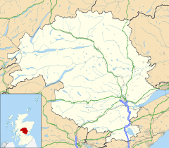
 Duncreavie shown within Perth and Kinross

