- Istria County
-
Istria County
Istarska županija (Croatian)
Regione istriana (Italian)[1]— County — 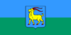
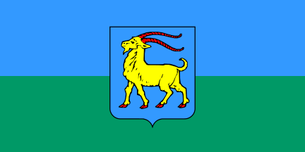
Flag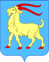
Coat of armsIstria County (light orange)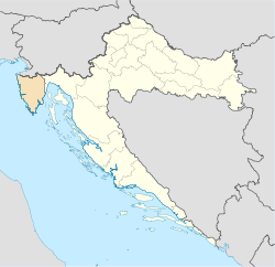
within Croatia (light yellow)County seat Pazin - Pisino Government – Župan Ivan Jakovčić (IDS) Area – Total 2,820 km2 (1,088.8 sq mi) Population (2001) – Total 206,344 – Density 73.2/km2 (189.5/sq mi) Area code 052 ISO 3166 code HR-18 Website http://www.istra-istria.hr/ Istria County (Croatian: Istarska županija; Italian: Regione istriana) is the westernmost county of Croatia which includes the biggest part of the Istrian peninsula (2,820 km2 (1,089 sq mi) out of 3,160 km2 (1,220 sq mi), 89%). The area of the county is called Istra in Croatian and Slovene. The county administrative center is Pazin[2] and the Croatian regional anthem is "Krasna zemljo".
Contents
History
The caves near Pula, Lim fjord, Šandalja and Roumald's cave, house stone age archaeological remains. Less ancient stone age sites, from the period between 6000-2000 BC, can also be found in the area. More than 400 locations are classified as Bronze Age, (1800 - 1000 BC), items. Numerous findings including weapons, tools, and jewelry), which are from the earlier iron era around the beginning of common era.
The Istrian peninsula was known to Romans as the terra magica. Its name is derived from the Histri, an Illyrian tribe who, as accounted by the geographer Strabo, lived in the region. Romans described them as pirates who were hard to conquer due to the difficulty of navigating their territory. After two military campaigns, Roman legions finally subdued them in 177 BC.
With the fall of the Western Roman Empire in 476, Istria was conquered by the Goths, the Byzantines. During Byzantine rule, it was shortly ruled by Avars. Istria was annexed by the Lombards in 751, by the Avars in 774 and then by the Franks during the reign of (Charlemagne) in 789, then successively controlled by various dukes, (Carinthia, Meran, Bavaria), and the patriarchs of Aquileia.
In 1267 the Republic of Venice annexed the Istrian peninsula because of the strong presence of the autochthonous Italian community; it is in this period that the region prospered. The major Istrian cities were reborn under Italian government, and it was in this half millennium that they developed their typical beauty and atmosphere.
In 1797, with the Treaty of Campo Formio written by Napoleon, the peninsula, with the whole Republic of Venice, passed to the Habsburgs of Austria. Starting in 1861, the capital of Istria and the seat to a Regional Parliament in Austro-Hungarian Empire was in Parenzo (today: Porec).
After World War I, according to the peace treaty of Rapallo, in 1920 Istria became part of Italy. Fascism and, later, Nazi occupation spoiled otherwise tolerant ethnic relations. After the World War II, Istria was assigned to Yugoslavia and many ethnic Italians left in the Istrian exodus.
Famous individuals like Robert Koch and writer James Joyce lived and worked in Istria. Writer Jules Verne was inspired to write his novel Mathias Sandorf after hearing of quarry and cave in Pazin and the poet Dante Alighieri visited and wrote a few lines about Istria.
Geography
Its coastline is 445 km (277 mi) long with islands making up 539.9 km (335 mi). A smaller part of Istria also belongs to the Primorje-Gorski Kotar County of Croatia. Mirroring the bay of Venice across the Adriatic and the Gulf of Kvarner, the region is not far from the Julian Alps. The western most point is at Savudrija while the southern most is near Premantura, on the local promontory Kamenjak.
The terrain consists of a limestone plateau, much of which lacks water owing to its karst topography. The northeastern section is an extension of the Dinaric Alps. The highest point is Vojak on Učka mountain 1,401 m (4,596.46 ft) above sea level while another range of mountains is Ćićarija.
There are so called "bijela", "siva", "crvena" Istra, (white, grey and red Istria). White Istria is around the mountain peaks, Grey Istria is the fertile inner lands while Red Istria is the blood-red painted lands of terra rossa or "crljenica" near the coastline.
Sites such as the Grotto of Baredine near Poreč, the underground river Pazinčica and the karst Pazin pit (Pazinska jama) near Pazin are popular geologic attractions. The Limski Kanal is the only fjord resembling structure in continental Europe outside of Scandinavia (actually it's not a fjord, but a ria). The quarry near Rovinj is specifically designed for studying geology. The longest river, the Mirna, is only 32 km (20 mi) long with its mouth near Novigrad. Other rivers that pass through Istria include the Dragonja River and Raša River.
The continental plains and valleys, are primarily utilized for agriculture, such as growing cereals and vegetables. Closer to the sea, red lands are used for cultivation of grapes, vine, olives and figs. Agriculture and the production of ecological food, the olive gardens, and the production of quality wines, is the focus of Istria's agriculture sector. The coastline and nearby islands are rich in the maquis shrubland (mostly holm oak and strawberry tree). Woods, mostly oak and pine trees, cover a third of the territory.
The well-known natural reservations national park Brijuni and nature park Učka are legally protected landscapes. Other interesting localities are Lim Kanal, wood near Motovun, park woods Zlatni Rt and Šijana near Pula, protected landscape Kamenjak in the extreme south of Istria, the reservation Palud, (ornithology), near Rovinj. Brijuni archipelago is interesting as the habitat of about 680 plant species, also decorated by the most diverse vegetation and olive groves.
Climate
Protected from the north by the mountain chain of Alps as well the inner highland, the climate is Mediterranean, very pleasant, with the highest air temperature averaging 24 °C during August and lowest averaging 5 °C, in January. Summers are usually warm during the day and cooler near the evening, although strange heat wave patterns are common. The weather also ranges from humid to dry with over 10 hours of sunshine daily. Primarily, there is a lot of moisture in the air, especially in the costal towns of Istra such as Porec, Vrsar, Rovinj, Pula and others. Temperatures above 10 °C last for more than 240 days a year. Excessive heat (above 30 °C) lasts for three weeks at most. Despite air temperatures being lower than those of in Dalmatia, the Adriatic sea is warmer, reaching up to 26 °C in August, coldest in March, (9-11 °C), while the freezing even in small, shallow bays is very rare. Two kinds of winds are here - the bora is bringing cold and clear weather from the north in winters, and the southern jugo (jug=south) bringing rain in summer. Mistral is the summer breeze blowing from the inland to the sea. The salinity of the sea water is 0.37%.
Demographics
Over 205,000 people or 4.65% of the nation's population live here. Population density is 73 inhabitants per km² with an average age of 40.2 years for the entire population.
In addition to Pula, the biggest urban area with 82.000 inhabitants, the cities are Poreč, Rovinj, Pazin, Labin, Novigrad, Umag, Buzet, Buje, Vodnjan. About 70.7% of the population lives in the urban areas.
Municipalities are: Bale, Barban, Brtonigla, Cerovlje, Fažana, Gračišće, Grožnjan, Kanfanar, Karojba, Kaštelir-Labinci, Kršan, Lanišće, Ližnjan, Lupoglav, Marčana, Medulin, Motovun, Oprtalj, Pićan, Raša, Sveti Lovreč, Sveta Nedelja, Sveti Petar u Šumi, Svetvinčenat, Tinjan, Višnjan, Vižinada, Vrsar, Žminj. Numerous are small municipalities and hamlets. In whole Istria there are actually more than 600 of them. So called smallest town in the world - Hum, ("mound") is populated by just three families (22 people).
Besides official Croatian, the Chakavian dialect of the Croatian language is often in use, as in most coastal counties. Italian is also recognized in the county as an official minority language.
As for 2001 the population was 206,344 and the population structure was:
- Croats 148,328
- Italians 14,284
- Istrians 8,865
- Serbs 6,614
- Bosniaks 3,077
- Albanians 2,032
- Slovenes 2,020
- Others and Unknown 4,014
- Haven't declared 13,110
Before World War I and until World War II, Istria contained a large autochthonous Romance language speaking community consisting of Venetian dialects, Istriot and Istro-Romanian along with Italian, plus various local Slavic dialects, some of which were likewise unique to Istria. Today, apart from the local dialects and the official Croatian language, one still finds in this region a small community of people, the Istro-Romanians, who speak the ancient Istro-Romanian language, an ancient dialect of Romanian, other districts where Venetian dialects and Istriot are still spoken.
Due to its traditional bond with Europe and its level of international integration, in 1994 Istria was the first region from the former Yugoslavia to be officially designated as a Region of Europe.[citation needed]
Communication
Istra is well connected with the rest of Croatia and Europe. Due to its connection with a wider European area, road development suitably covers all needs and contributes to a balanced development of the coastal area and the Istrian interior.
Initially, the need for railroads in Istria was based upon fast development of industrial activities; shipbuilding, construction material, machine and electric industries, as well as Austrian military interests. After Vienna and Trieste were connected in 1876, the railway between Divača, (in today's Slovenia) and Pula, (122 km (76 mi) long with 21 km (13 mi) long branch Kanfanar - Rovinj), was opened. Despite numerous initiatives, the western part of Istria have been connected with the railroad only in 1902, with construction of the narrow-gauge track Poreč - Trieste. The famous 123.1 km (76 mi) long "Parenzana", or Parenzaner Bahn, was cancelled in 1935. The nearest commercial airport is in Pula.
Economy
Well-developed are processing industry, with traditional agriculture, sea fishing and growing, construction and production of construction materials (lime, cement, brick, stone), trade and transport. Most developed branches of industry are shipbuilding (In the early 1970s its shipyard Uljanik was building the biggest ships in the world as Berge Adria and others), metal processing, wood industry, furniture industry, automotive components industry, electric machines and appliances industry, glass, plastic, textile, tobacco industry. According to economic indicators, the leading activities are processing industry, tourism, and trade.
Great attention is being given to agriculture and the production of ecologic food, the wine and olive growing. Historically cultivated local wine varietals include Malvasia (white) and Teran (red).
Tourism
Organized tourism in Istria goes back to the Romans, when emperor Vespasian, for the entertainment of that time, built the amphitheater (Arena) in Pula. During the reign of Austro-Hungarian Empire in (1866), Austrian and Hungarian royalty and aristocracy started visiting local resorts and discovered Poreč.
Significant efforts were made after World War II to develop the tourist infrastructure and to accentuate its importance. In combination with the natural beauties, rich history and cultural heritage, investments paid off and resulted in highly developed, competitive service all along the western coast in Poreč, Pula, Rovinj, Umag, Novigrad, and Vrsar.
In the eastern part, as part of another county, there are resorts like Rabac, Opatija. Istria was and still is the most important tourist destination in Croatia, hosting the western and central European visitors. Area is the most visited tourist region with 27% of all visitors and 35% of time spent in all of Croatia.
County government
Current Župan (prefect): Ivan Jakovčić (IDS)
The county assembly is composed of 41 representatives, organized as follows:
- Istrian Democratic Assembly (IDS) 20
- Social Democratic Party of Croatia (SDP) 5
- Croatian Democratic Union (HDZ) 5
- Istrian Democratic Forum (IDF) 4*
- Croatian Party of Pensioners(HSU) 4
- HNS, HSLS, ZELENI 3
See also
References
- Notes
- ^ [1] Statute of the Istrian Region, Article 3
- ^ Istarska Županija: Ustrojstvo
External links
- Portal of Istria and it's capital city
- Istria on the Internet
- Istra 3D
- Istra Global
- Istrian county
- Istria
- Destinations
Subdivisions of Istria County Cities and towns 
Municipalities Bale · Barban · Brtonigla · Cerovlje · Fažana · Funtana · Gračišće · Grožnjan · Kanfanar · Karojba · Kaštelir-Labinci · Kršan · Lanišće · Ližnjan · Lupoglav · Marčana · Medulin · Motovun · Oprtalj · Pićan · Raša · Sveti Lovreč · Sveta Nedelja · Sveti Petar u Šumi · Svetvinčenat · Tar-Vabriga · Tinjan · Višnjan · Vižinada · Vrsar · ŽminjCoordinates: 45°14′21″N 13°56′19″E / 45.23917°N 13.93861°E
Categories:- Istria
- Istria County
- Counties of Croatia
- Regions of Europe with multiple official languages


Wikimedia Foundation. 2010.