- Cerovlje
-
Cerovlje — Municipality — Cerovlje Municipality
Općina Cerovlje
Coat of armsLocation of Cerovlje in Croatia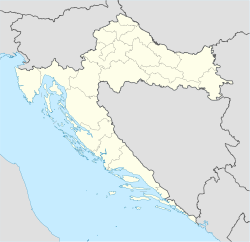
 Cerovlje
Coordinates: 45°27′N 14°01′E / 45.45°N 14.017°E Country Croatia County Istria Government – Municipal mayor Mirko Opašić Area – Total 106 km2 (40.9 sq mi) Population (2001) – Total 1,745 – Density 16.5/km2 (42.6/sq mi) Time zone CET (UTC+1) – Summer (DST) CEST (UTC+2) Postal code 52402 Area code(s) 52 Cerovlje (Italian: Cerreto) is a village and municipality at the very centre of the Istrian peninsula in Croatia. Many ancient settlements, old towns and once solid castles can be found on that territory. Almost every town or castle in Cerovlje is situated on top of a hill from where the view extends into a unique panorama over the past unsettled centuries such position of the town and castles provided security to their inhabitants to a certain degree.
An extraordinary work of nature and human hand can be found on the territory of Cerovlje. During the Middle Ages under the reign of the Holy Roman Empire of the German Nation the industrious and pious people living in these parts built many beautiful churches. The churches of this territory, which some are considered as very important works of art, raise themselves over this hilly landscape as a lighthouse.
External links
Subdivisions of Istria County Cities and towns 
Municipalities Bale · Barban · Brtonigla · Cerovlje · Fažana · Funtana · Gračišće · Grožnjan · Kanfanar · Karojba · Kaštelir-Labinci · Kršan · Lanišće · Ližnjan · Lupoglav · Marčana · Medulin · Motovun · Oprtalj · Pićan · Raša · Sveti Lovreč · Sveta Nedelja · Sveti Petar u Šumi · Svetvinčenat · Tar-Vabriga · Tinjan · Višnjan · Vižinada · Vrsar · ŽminjCoordinates: 45°17′N 14°01′E / 45.283°N 14.017°E
Categories:- Populated places in Istria County
- Istria County geography stubs
- Municipalities of Croatia


Wikimedia Foundation. 2010.