- Peacehaven
-
Coordinates: 50°48′N 0°00′E / 50.80°N -0.00°E
Peacehaven 
The Meridian Monument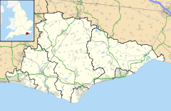
 Peacehaven
Peacehaven shown within East SussexArea 5.2 km2 (2.0 sq mi) [1] Population 13,268 (Parish-2007)[1] - Density 6,621 /sq mi (2,556 /km2) OS grid reference TQ407013 - London 49 miles (79 km) N District Lewes Shire county East Sussex Region South East Country England Sovereign state United Kingdom Post town PEACEHAVEN Postcode district BN10 Dialling code 01273 Police Sussex Fire East Sussex Ambulance South East Coast EU Parliament South East England UK Parliament Brighton Kemptown Website Town Council website List of places: UK • England • East Sussex Peacehaven (formerly known as New Anzac-on-Sea) is a town and civil parish in the Lewes district of East Sussex, England. It is located above the chalk cliffs of the South Downs approximately six miles (9.7 km) east of Brighton city centre, on the A259 road. Its site coincides with the point where the Greenwich meridian crosses the English south coast.
Contents
History
There is a Bronze Age barrow (burial mound), currently under investigation by local societies very close to the cliff top.[2] The barrow represents evidence of the occupation of Peacehaven at least 3,500 years ago.
A 2007 excavation of the new Bovis Homes site to the west of Peacehaven Community School's playing fields unearthed an astonishing range of evidence for a prehistoric settlement throughout the Bronze and Iron Ages.
Peacehaven has only existed as a settlement since 1916, after its founder, Charles Neville had purchased land in the parish of Piddinghoe; he then set up a company to develop the site. He advertised it by setting up a competition to name the development, although the newspaper concerned — the Daily Express— sued Neville over the competition, holding that it was a scam, since he was offering "free" plots of land in the town as runner-up prizes, but issuing them only on the payment of a conveyancing fee. The exact name of the winner is unknown only it is believed to be a member of the Fearby family. The newspaper won the case, but the publicity brought the scheme to a large audience. The name chosen — New Anzac-on-Sea — lasted less than a year: the fateful Gallipoli campaign led Neville to rename his development Peacehaven. By 1924 there were 3,000 people living in Peacehaven.
The town, apart from the newer development to the west named Telscombe Cliffs & above Firle Road, still retains its original "grid" layout: rectangular plots of land on both sides of the main road. There are no "Streets" in Peacehaven, originally there were only "Roads" and "Avenues". With very few exceptions, "Roads" run east to west, and "Avenues" north to south — most forming crossroads where they intersected the South Coast Road (A259). Apart from this road, Roderick Avenue, running roughly up the centre, was the only surfaced road (except for the area of Local Authority housing around Friars Avenue (north)) in Peacehaven until the late 1950s, when the process of "making-up" the roads began. This started in Telscombe Cliffs and worked eastwards. As part of this, many of the Avenues had their junction with the main road blocked off, to reduce the number of junctions, and mainly eliminate crossroads.
Original houses were often very temporary affairs (some were old railway carriages). Others were constructed from former army huts, brought from North Camp near Seaford, a few of these still survive, having been given an outer concrete block wall (they can be identified by their oblong shape that tends to be end on to the road). Peacehaven eventually grew to be larger in area than Lewes, the county town and administrative headquarters of the region.
Geography
The pebbly beach below the cliffs can be reached by means of a pathway. There is an area of common land in the town now called The Dell, which sits between the A259 and the cliffs. A cinema formerly stood on this site. The Dell holds many events during the year from car boot sales and entertainments such as fireworks to fairgrounds, motorhome exhibitions, the Donkey Derby and an annual carnival, though in 2005 the carnival was held on the Joff field located behind the Meridian shopping centre. In the 1950s, the carnival stalls were located on the then vacant land on the NW corner of the South Coast Road (A259) and Dorothy Avenue. Also Peacehaven & Telscombe F.C. hosts a variety of football tournaments that range from age U10–U16 these can be seen every summer. The football club is located in the mid east of the town marked by the world famous floodlights.[citation needed]
Landmarks
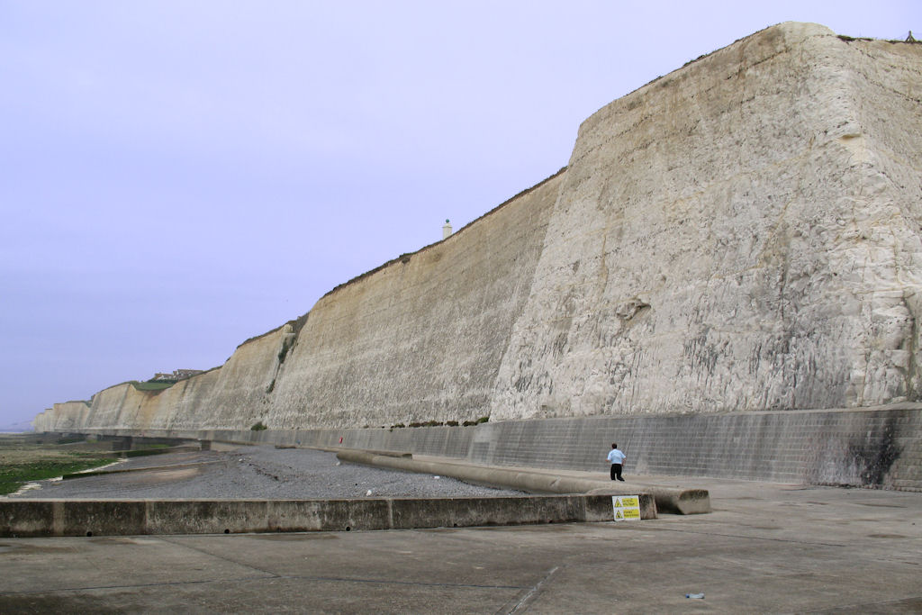
 The chalk cliffs at Peacehaven
The parish includes part of the Brighton to Newhaven Cliffs Site of Special Scientific Interest. The cliffs are mainly of geological interest, containing many Santonian and Campanian fossils. The SSSI listing includes flora and fauna biological interest too.[3]
The Greenwich meridian is marked by a 3.5 m (11 ft) tall obelisk, commissioned by Charles Neville. It was unveiled on 10 August 1935 and has been relocated twice due to erosion of the cliffs.[4]
Religious buildings
See also: List of places of worship in Lewes (district)There are four churches in Peacehaven and one in Telscombe Cliffs. L. Keir Hett designed and built the Church of the Ascension, Peacehaven's Anglican church, to replace a temporary building which had been erected in 1922. The Roman Catholic church, dedicated to the Immaculate Conception, was also founded in a temporary building in the 1920s; this survives as the church hall of the present brick structure. A Jehovah's Witnesses Kingdom Hall and an Evangelical church are also in use.[5][6][7][8] Telscombe Cliffs United Reformed Church serves the population of both communities.[7]
Governance
Peacehaven's lowest tier of government is the Peacehaven Town Council who are responsible for local planning, highways and other amenities. The council consists of 17 elected councillors from three wards, North, West and East Peacehaven.[9] The May 2007 election returned 17 Conservative Party councillors.[10]
The next level of government is Lewes District Council with responsibilities for the wider ranging areas such as council tax collection, environmental health and democratic services. Peacehaven provides six councillors to the district council, representing the same three wards as the parish council. Election are held every four years, the May 2007 election returned six Conservative Party councillors.[11]
The county council for East Sussex has responsibility for Education, Libraries, Social Services, Civil Registration, Trading Standards and Transport. Elections for the County Council are held every four years. Peacehaven parish is combined with the neighbouring Telscombe parish forming the Peacehaven & Telscombe Towns electoral division which elects two councillors to the council. The May 2005 election returned two Conservative councillors with a 61% turnout.[12]
Peacehaven is in the Brighton Kemptown constituency for the UK parliamentary elections.
At European level, Peacehaven is represented by the South-East region, which holds ten seats in the European Parliament. The June 2004 election returned four Conservatives, two Liberal Democrats, two UK Independence, one Labour and one Green, none of whom live in East Sussex.[13]
Economy
 The A259 running through the town
Although an independent town, Peacehaven relies heavily on the bordering city of Brighton and Hove. Many local residents commute into work via a regular bus link supplied by Brighton & Hove Bus and Coach Company, and most travel into the city for shopping and other leisure activities. Being in such close proximity to Brighton and the reliance upon the city for local amenities has led to a considerable "Brighton feel" to the town, in which many of the residents consider themselves "from Brighton". Peacehaven is twinned with the French town of Épinay-sous-Sénart and the German town of Isernhagen.
There is a leisure centre and the Co-operative Meridian Shopping Centre; there are also four schools in Peacehaven: Hoddern Junior school; Peacehaven Infants School; Meridian School and Peacehaven Community School; a police station, a dentist, several doctors’ surgeries and a plentiful supply of pubs and restaurants located throughout the town. These include the independent fast food outlet "Big Mouths" on the corner of the South Coast Road and Horsham Avenue, which leads the town's al fresco dining, and the eye-catchingly named "Grindlestonkers" towards the east. There are four churches; the parish church is the Church of the Ascension, and serves both Peacehaven and Telscombe Cliffs. There are dance schools, such as Harlequin and Studio 54, as well as numerous football and martial arts clubs.
In late 2006 a number of meetings between the then Mayor, Cllr Elayne Merry, and local businesses lead to the formation of the Peacehaven & District Chamber of Commerce in February 2007. The Chamber organises regular networking and support meetings for the benefit of its members plus an annual Trade Show to promote local services. 2009 saw the first Business Awards ceremony in which the winners in each category received a "Monument" to mark their achievement.
Media
The town plays a part in Graham Greene's 1938 novel Brighton Rock when anti-hero Pinkie Brown intends to throw his girlfriend Rose from the high cliffs which are part of the town. More recently Peacehaven was selected for the site at which Tiffany's ashes were portrayed to be cast over the cliffs, in the BBC soap EastEnders in 1998, with viewers told she had spent happy childhood holidays there.[14] Filming however, took part in the adjacent town of Seaford. Also, a Mr. Bean episode was shot at the cliff tops of Peacehaven and down to the beach.
The film Quadrophenia starring Phil Daniels in the leading role as a Mod named Jimmy also ended up in Peacehaven. At the end of the film he finds out his idol, the suave Mod "poster boy" Ace Face (played by Sting), is in reality a bellboy. He steals Ace's scooter and heads out to Peacehaven Cliffs and an uncertain fate.
In 1978, the Oi!/punk band Peter and the Test Tube Babies were formed in Peacehaven by Peter Bywaters and Del Strangefish. They are still performing today. They immortalised Peacehaven with the track "Peacehaven Wild Kids", released on the b-side of their 1980 single "Banned From The Pubs" (No Future Oi4).
International relations
Twin towns - Sister cities
References
- ^ a b "East Sussex in Figures". East Sussex County Council. http://www.eastsussexinfigures.org.uk/webview/. Retrieved 26 April 2008.
- ^ Peacehaven's Ancient Mound reveals hidden secrets of prehistoric past, Events Diary, Government Office for the South East, 12 May 2008, retrieved 16 October 2009
- ^ "Natural England – SSSI". English Nature. http://www.english-nature.org.uk/special/sssi/sssi_details.cfm?sssi_id=1003033. Retrieved 19 June 2008.
- ^ Bridgewater, Peter (2007). An Eccentric Tour of Sussex. Sussex: Snake River Press. pp. 78–81. ISBN 9781906022037.
- ^ Salzman, L. F. (ed) (1940). "A History of the County of Sussex: Volume 7. Parishes: Piddinghoe". Victoria County History of Sussex. British History Online. pp. 66–69. https://www.british-history.ac.uk/report.aspx?compid=56918. Retrieved 7 April 2010.
- ^ Elleray, D. Robert (2004). Sussex Places of Worship. Worthing: Optimus Books. p. 44. ISBN 0-95-331-3271.
- ^ a b "Schools & Churches". Peacehaven Town Council. 2009. http://www.peacehavencouncil.co.uk/index.php/useful-numbers-a-contacts. Retrieved 7 April 2010.
- ^ Harris, Roland B. (November 2004). "Peacehaven Historic Character Assessment" (PDF). Sussex Extensive Urban Survey (EUS). East Sussex County Council, West Sussex County Council, Brighton and Hove City Council and English Heritage. http://www.lewes.gov.uk/Files/plan_Peacehaven_EUS_reportpages13to23.pdf. Retrieved 7 April 2010.
- ^ Crawford, John (2007-03-19). "Notice of Election" (pdf). Lewes District Council. http://www.lewes.gov.uk/Files/Elections_Notice_TownPar07.pdf. Retrieved 19 June 2008.[dead link]
- ^ "Results – Town and Parish Council Elections" (pdf). Lewes District Council. 2007-05-03. pp. 5–6. http://www.lewes.gov.uk/Files/Elections_Results_TownParish.pdf. Retrieved 19 June 2008.
- ^ "Results – District Council Elections" (pdf). Lewes District Council. 3 May 2007. pp. 10–11. http://www.lewes.gov.uk/Files/Elections_Results_District.pdf. Retrieved 3 July 2008.
- ^ "County Council Election". East Sussex County Council. 5 May 2005. http://www.eastsussex.gov.uk/yourcouncil/localelections/electionmap/default.aspx. Retrieved 3 July 2008.
- ^ "UK MEP's". UK Office of the European Parliament. Archived from the original on 24 January 2007. http://web.archive.org/web/20070124233126/http://www.europarl.org.uk/uk_meps/MembersMain.htm. Retrieved 25 January 2007.
- ^ "Now for the Tiffany tour". The Argus (Newsquest Media Group). 1999-02-06. http://archive.theargus.co.uk/1999/2/6/198859.html. Retrieved 2008-06-18.
External links
- Local chat forum
- History of Peacehaven
- Peacehaven Town Council
- Peacehaven Chamber of Commerce
- Photographs of Peacehaven
- www.peacehaven.co.uk
Towns Villages / hamlets - Barcombe
- Barcombe Cross
- Barcombe Mills
- Beddingham
- Bishopstone
- Chailey
- Denton
- Ditchling
- East Blatchington
- East Chiltington
- Falmer
- Firle
- Glynde
- Hamsey
- Iford
- Kingston near Lewes
- Newick
- North Chailey
- Piddinghoe
- Plumpton
- Plumpton Green
- Ringmer
- Rodmell
- Spithurst
- South Heighton
- Southease
- St Ann Without
- St John Without
- South Chailey
- South Street
- Streat
- Tarring Neville
- Telscombe Cliffs
- Town Littleworth
- Westmeston
- Wivelsfield
- Wivelsfield Green
Other areas - The East Saltdean district of Saltdean
- Parts of the World's End district of Burgess Hill
Ceremonial county of East Sussex Unitary authorities Boroughs or districts Major settlements Rivers Topics - History
- Geography
- Museums
- Parliamentary constituencies
- Places
- Transport
- South Downs
- North Downs
- Beachy Head
- High Weald
- Long Man of Wilmington
Categories:- Lewes
- Populated places established in 1916
- Towns in East Sussex
- Local government in East Sussex
- Populated coastal places in East Sussex


Wikimedia Foundation. 2010.