- Barcombe
-
Coordinates: 50°55′N 0°01′E / 50.91°N 0.01°E
Barcombe 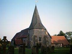
Barcombe Anglican parish church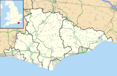
 Barcombe
Barcombe shown within East SussexArea 17.8 km2 (6.9 sq mi) [1] Population 1,447 (Parish-2007) [1] - Density 211 /sq mi (81 /km2) OS grid reference TQ417144 - London 41 miles (66 km) N District Lewes Shire county East Sussex Region South East Country England Sovereign state United Kingdom Post town LEWES Postcode district BN8 Dialling code 01273 Police Sussex Fire East Sussex Ambulance South East Coast EU Parliament South East England UK Parliament Lewes Website http://www.barcombe.net/ List of places: UK • England • East Sussex Barcombe is an East Sussex village lying some 4–5 miles (6.4 km) north of Lewes. It is also the name of one of the civil parishes in the Lewes District of East Sussex. Within the parish are Barcombe itself (the older of the settlements); Barcombe Cross the larger of the two villages and now the main centre of the parish with the amenities and services, where the villagers of the original Barcombe evacuated during the Medieval plague; and the area around Barcombe Mills on the River Ouse. The parish also includes the settlements of Spithurst to the north east and Town Littleworth to the north west.
Curiously the village of Barcombe Cross is known as Barcombe in the local area and also to the Royal Mail and is signed as such. Only on maps is it shown in its full name.
Barcombe is probably best known to Sussex residents and tourists for its 'Mills', a reference to an old water-mill complex on the River Ouse at the base of the hill upon which Barcombe Cross is situated. The Mills were a favourite Sunday outing for townsfolk from Lewes and Brighton before World War II, when the mills were burnt down.
Barcombe was recorded in the Domesday Book as "Berchamp", a reference to fields of barley. Remains have been also found of a Roman villa and an earlier Iron Age roundhouse on the same site, just to the south of the village.
Barcombe parish church is dedicated to St Mary, and is in the older village.
Contents
Bonfire
Barcombe Bonfire is held annually, two weeks after the Lewes celebration. Barcombe’s celebrations are hailed as close to Lewes as it gets and have been said to be the best village celebrations. The society is largely family-orientated and everyone helps out with torch dipping, bonfire building etc. The Grand Firework Display is ‘grand’ as well as the four processions (including the dedicated Children's Procession.) They always have many societies visiting and have a fancy dress competition: always well attended.
Transport
- Road
The A26 between Lewes and Uckfield runs south-east of the villages. It can be accessed 2 miles (3.2 km) from the centre of the village via Barcombe Mills Road. The A275 runs north of the villages. This links Lewes and Haywards Heath
- Rail
Two railway lines ran through the villages: the line between Lewes and Uckfield opened in October 1868; and the line from East Grinstead, part of which is now the Bluebell Railway. There were stations on each of the two lines: Barcombe on the East Grinstead line, and Barcombe Mills on the Uckfield line, with a junction south of the latter before the line continued to Lewes. Barcombe closed on 17 March 1958, whilst Barcombe Mills closed on 4 May 1969. Part of the line is now a cycle track.
The nearest railway station is now Cooksbridge, about 2½ miles away.
- Public Rights of Way
There are many bridleways and footpaths in and around the villages, linking to Lewes, Isfield, Newick and many other places. The Sussex Ouse Valley Way runs through Barcombe Mills to the south.
- Bus
A bus service is provided to the bus stop at the north of Barcombe Cross and outside the junction with the old road at Barcombe Mills. Services are provided by Countryliner: the number is 122. The 121 will diverge from its main route and operate via Barcombe Cross on request; resulting in it visiting Chailey 15 minutes later than usual. The buses connect with the trains at Cooksbridge. There are no buses on Sundays to Barcombe Cross and no buses at all on weekends to Barcombe Mills.
- Air
The nearest big airport is London Gatwick, 45 minutes' drive to the north; this offers domestic, European and international flights.
Shoreham Airport is about half an hour's drive to the west. This small Art Deco airport offers flights to France and the Channel Islands. It is mainly used for private planes though.
Fishing lakes
There is now only one fishable lake in the parish, Cornwell's Reservoir which is controlled by Lewes Angling Club. The main Barcombe Reservoir has been closed to anglers for some years.
References
- ^ a b "East Sussex in Figures". East Sussex County Council. http://www.eastsussexinfigures.org.uk/webview/. Retrieved 2008-04-26.
External links
- Barcombe at the Open Directory Project
- History of Barcombe Mill (inter alia)
- Barcombe Parish Council
- There is also a village called Balcombe, north of Haywards Heath.
- There is a small settlement named Barcombe on Exmoor in Somerset.
Towns Villages / hamlets - Barcombe
- Barcombe Cross
- Barcombe Mills
- Beddingham
- Bishopstone
- Chailey
- Denton
- Ditchling
- East Blatchington
- East Chiltington
- Falmer
- Firle
- Glynde
- Hamsey
- Iford
- Kingston near Lewes
- Newick
- North Chailey
- Piddinghoe
- Plumpton
- Plumpton Green
- Ringmer
- Rodmell
- Spithurst
- South Heighton
- Southease
- St Ann Without
- St John Without
- South Chailey
- South Street
- Streat
- Tarring Neville
- Telscombe Cliffs
- Town Littleworth
- Westmeston
- Wivelsfield
- Wivelsfield Green
Other areas - The East Saltdean district of Saltdean
- Parts of the World's End district of Burgess Hill
Categories:- Villages in East Sussex
- Lewes
- Local government in East Sussex


Wikimedia Foundation. 2010.