- Chhatrapur
-
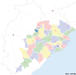
Chhatrapur — town — Coordinates 19°21′N 84°59′E / 19.35°N 84.98°ECoordinates: 19°21′N 84°59′E / 19.35°N 84.98°E Country India State Orissa District(s) Ganjam Population 20,288 (2001[update]) Time zone IST (UTC+05:30) Area
• 17 metres (56 ft)
Chhatrapur (Oriya: ଛତ୍ରପୁର) (also spelt as Chatrapur) is a town and a notified area committee in Ganjam District in the state of Orissa, India. It is the headquarter town of Ganjam District. There are two railway stations in Chhatrapur. They are Chhatrapur station and Chhatrapur court station.
Contents
Geography
Chhatrapur is located at 19°21′N 84°59′E / 19.35°N 84.98°E.[1] It has an average elevation of 17 m (56 ft).
Demographics
As of 2001[update] India census,[2] Chhatrapur had a population of 20,288 (fourth biggest city in the district of Ganjam after Brahmapur,Hinjilicut and Aska). Males constitute 51% of the population and females 49%. Chhatrapur has an average literacy rate of 79%, higher than the national average of 59.5%; with male literacy of 85% and female literacy of 73%. 10% of the population is under 6 years of age.
Industries
IRE(OSCOM) which is a public sector undertaking under the Dept. of Atomic Energy is situated near Chatrapur which benficiates different minerals from the beachsands of the Bay of Bengal. Different products such as zircon, ilmenite, sillimanite, Rutile are extracted. It also houses a thorium extraction plant. There is a huge chain of cashewnut factories situated in or near Chatrapur. A Joint Venture between Saraf Agencies of Kolkalta and The Russian Federation has been signed to start a Titanium slag and pig iron manufacturing plant. However, Chatrapur, despite being on NH-5, the Chennai-Howrah Main railway line and with ample land and water has not been able to attract any largescale Industry which could potentially change the geo-economic scenario of the region.
Festivals
Chatrapur celebrates almost all festivals. Thakurani Yatra, Dola Purnima, Durga Puja, Ganesh Puja and many other occasions are celebrated with pomp and joy. Thakurani Yatra is one of the most awaited festivals in the city which is celebrated once in every two years.diwali is another festival which is celibrated with full pump. Durga Puja, Diwali, Ganesh Puja etc.
Education
Chatrapur hosts a Government Science College and some other private ones. It hosts many English medium schools which include
- 1] Atomic Energy Central School[AECS]CBSE pattern at OSCOM/ IRE [orissa sand complex]/ [Indian rare earth] at Matikhalo, also known as Kaliaballi[dark sand]. It locates just a 6km distance from the main city centre Chatrapur.
- 2] Carmel Convent School, ICSE pattern (classes from Nursery to std-10th)(OR079)Chatrapur,Ganjam-761020 [O]06811-263038,[F]06811-263038 [E-mail]carmel3carmel@gmail.com, Co-ed., Day School,ICSE.
- 3] Public school( CBSE pattern) Classes from Nursery to Std 10th. Locates near chatrapur stadium n in front of District collector's Official residence.
- 4) Women's college, in front of District collector's Official residence.
- 5)PNUA (Pandit neelakantha utkal academy) at chandi mandir Square, It ruining On the students hostel of Onslow Institution.
Politics
Current MLA from Chatrapur Assembly Constituency is Adikanda Sethi of CPI, who won the seat in State elections of 2009. Previous MLAs from this seat include Rama Chandra Panda of BJP who won this seat in 2000, Daitari Behera of INC in 1995, Parsuram Panda of CPI in 1990, Ashok Kumar Choudhury of INC in 1985, and Biswanath Sahu of CPI in 1980 and in 1977.[3]
Chatrapur is part of Berhampur (Lok Sabha constituency).[4]
Notable people
Alan Turing, the father of modern computer science was conceived in Chhatrapur in 1912.
References
- ^ Falling Rain Genomics, Inc - Chhatrapur
- ^ "Census of India 2001: Data from the 2001 Census, including cities, villages and towns (Provisional)". Census Commission of India. Archived from the original on 2004-06-16. http://web.archive.org/web/20040616075334/http://www.censusindia.net/results/town.php?stad=A&state5=999. Retrieved 2008-11-01.
- ^ "State Elections 2004 - Partywise Comparison for 72-Chatrapur Constituency of ORISSA". Election Commission of India. http://archive.eci.gov.in/March2004/pollupd/ac/states/s18/Partycomp72.htm. Retrieved 2008-09-25.
- ^ "Assembly Constituencies - Corresponding Districts and Parliamentary Constituencies of Orissa". Election Commission of India. http://archive.eci.gov.in/se2000/background/S18/Orissa_AC_Dist_PC.pdf. Retrieved 2008-09-25.
Cities and towns in Ganjam district Ganjam Asika · Bellaguntha · Bhanjanagar · Berhampur · Buguda · Chhatrapur · Chikiti · Digapahandi · Dharakote · Ganjam · Gopalpur · Gandola · Hinjilicut · Kavisuryanagar · Khalikote · Kodala · Makundapur · Patrapur · Polasara · Purusottampur · Rambha · Surada
Cities and towns
in other districtsAngul · Balangir · Balasore · Bargarh · Bhadrak · Boudh · Cuttack · Debagarh · Dhenkanal · Gajapati · Jagatsinghpur · Jajpur · Jharsuguda · Kalahandi · Kandhamal · Kendrapara · Kendujhar · Khordha · Koraput · Malkangiri · Mayurbhanj · Nabarangpur · Nayagarh · Nuapada · Puri · Rayagada · Sambalpur · Subarnapur · Sundergarh
Categories:- Cities and towns in Ganjam district
- Railway stations in Ganjam district
- Ganjam district
Wikimedia Foundation. 2010.


