- Digapahandi
-
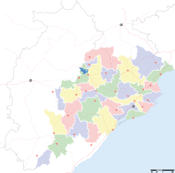
Digapahandi — city — Coordinates 19°22′N 84°35′E / 19.37°N 84.58°ECoordinates: 19°22′N 84°35′E / 19.37°N 84.58°E Country India State Orissa District(s) Ganjam Population 10,888 (2001[update]) Time zone IST (UTC+05:30) Area
• 53 metres (174 ft)
Digapahandi (Oriya: ଦିଗପହଂଡି) is a town and a notified area committee in Ganjam district in the state of Orissa, India.
Contents
Geography
Digapahandi is located at 19°22′N 84°35′E / 19.37°N 84.58°E.[1] It has an average elevation of 53 metres (173 feet).
Demographics
As of 2001[update] India census,[2] Digapahandi had a population of 10,888. Males constitute 51% of the population and females 49%. Digapahandi has an average literacy rate of 59%, lower than the national average of 59.5%: male literacy is 68% and, female literacy is 50%. In Digapahandi, 12% of the population is under 6 years of age.
Economy
Most families of this small town are cultivators, farmers, there is no industries in this area. Being this is a junction of state Highway some peoples depends on small business.
Transport
There are 12 streets namely bazar street, Sunari street, New street, Phulasundari Street, Bada Brahmin street, Sana Brahmin street,Sasan street, Chikitia street,Rani street,Annapurna street,Anchala street,etc.
Education
The town has two government high schools namely BadaKhemundi High School and Govt. Girls High School. There are two colleges here.Khemundi college and BijuPatnaik Women's College.Besides there is a Central School at Digapahandi . There are about 20 numbers of primary / M.E schools .
Places of interest
Moulabhanja is the self sufficient old village system still surviving. It has a very old Sri Radha Krishna Temple, with two streets one for Brahmins & the other of non-brahmins. It is by side of river Ghodahada (tributary to rusikulya River).
Across this river existed the oldest high level bridge of Orissa built by Bird & Co in the year 1918, of Bow string Girder Design an aesthetically pleasing & beautiful structure standing high above ground, which was washed away in the floods of 1991, where now stands a pre stressed bridge, constructed by U P Bridge Construction Corporation.Sree Lokanatheswar siva Temple at madhuban Sasan have great significance to this area
References
- ^ Falling Rain Genomics, Inc - Digapahandi
- ^ "Census of India 2001: Data from the 2001 Census, including cities, villages and towns (Provisional)". Census Commission of India. Archived from the original on 2004-06-16. http://web.archive.org/web/20040616075334/http://www.censusindia.net/results/town.php?stad=A&state5=999. Retrieved 2008-11-01.
Cities and towns in Ganjam district Ganjam Asika · Bellaguntha · Bhanjanagar · Berhampur · Buguda · Chhatrapur · Chikiti · Digapahandi · Dharakote · Ganjam · Gopalpur · Gandola · Hinjilicut · Kavisuryanagar · Khalikote · Kodala · Makundapur · Patrapur · Polasara · Purusottampur · Rambha · Surada
Cities and towns
in other districtsAngul · Balangir · Balasore · Bargarh · Bhadrak · Boudh · Cuttack · Debagarh · Dhenkanal · Gajapati · Jagatsinghpur · Jajpur · Jharsuguda · Kalahandi · Kandhamal · Kendrapara · Kendujhar · Khordha · Koraput · Malkangiri · Mayurbhanj · Nabarangpur · Nayagarh · Nuapada · Puri · Rayagada · Sambalpur · Subarnapur · Sundergarh
Categories:- Cities and towns in Ganjam district
Wikimedia Foundation. 2010.


