- Clifton Without
-
Coordinates: 53°58′33″N 1°06′11″W / 53.975781°N 1.103031°W
Clifton (Without) 
 Clifton (Without)
Clifton (Without) shown within North YorkshirePopulation 5,113 OS grid reference SE585543 Parish Clifton Without Unitary authority City of York Ceremonial county North Yorkshire Region Yorkshire and the Humber Country England Sovereign state United Kingdom Post town YORK Postcode district YO30 Dialling code 01904 Police North Yorkshire Fire North Yorkshire Ambulance Yorkshire EU Parliament Yorkshire and the Humber UK Parliament York Outer List of places: UK • England • Yorkshire Clifton Without is a suburb and civil parish in the unitary authority of the City of York, North Yorkshire, England. It consists of those parts of Clifton that lie outside, i.e. Without, the (pre-1996) city boundaries and Clifton Moor. It lies on the A19 about two miles north-west of central York.
According to the 2001 census it had a population of 5,113. Before 1996 it formed part of the Ryedale district. The Parish is bounded by the River Ouse to the west and the B1363 and River Foss in the east, and from the Clifton Moor retail park in the north to near Clifton Green in the south. The parish contains a diverse mix of industrial and retail areas, to residential areas in the rest of the parish. The area also includes the natural areas of Clifton Ings and Clifton Backies and Rawcliffe Lake.
Contents
History
On 27 May 1933 an air circus visited York and flew from Rawcliffe meadow, now the site of Clifton Moor Retail Park. It demonstrated the viability of the area for a commercial airfield for York. In 1934 York Corporation compulsory purchased parts of Clifton (Without) and Rawcilffe and on, 4 July 1936 York Municipal Aerodrome opened. Before the outbreak of the Second World War, the airfield was managed by Yorkshire Air Services and Country Club Ltd, who ran a flying club and an air taxi service, but no scheduled flights. On 1 September 1939 the airfield was requisitioned by the government for military use and was renamed RAF Clifton. It host to a flight of Whitley Bombers.[1]
Following an upgrade in status, the airfield became host to reconnaissance aircraft such as the Westland Lysander and the North American Mustang. The airfield also contained a large civilian staffed repair facility for the Halifax bomber. The repair centre was closed in 1948, after which the airfield returned to its former role as a flying club. Due to the high rents charged by the Air Ministry, which had not de-commissioned the site, the club closed in the 1950s and fell into disuse. Parts of the airfield can still be seen around the area, including a small portion of the runway to the north of the York Outer Ring Road. The airfield is now covered by the Clifton Moor Retail Park.[1]
Governance
Clifton Without is part of the Unitary Authority of the City of York Council. As of 2010 the Ward of Skelton, Rawcliffe and Clifton Without is represented by Councillors Richard Moore and Irene Waudby of the local Liberal Democrat Party and by Joe Watt of the local Conservative party.[2] It is also has its own parish council consisting of 10 councillors.[3]
Geography
The parish is bounded to the west by the River Ouse and the B1363 and River Foss to the east. To the north the parish meets the parish of Rawcliffe. To the south the boundary runs past Homestead Park from the Ouse then northward along the A19 to turn east along Brompton Road, then it turns north up Water Lane before going east again along Lilbourne Drive and then following the waterway known as Bur Dyke. Where Bur Dyke reaches Bootham Stray it extends an arm towards the Nestle Factory they and ends at the River Foss.
The parish contains Clifton Backies Nature Reserve which, in May 2002, was designated as a Local Nature Reserve. The diverse habitats support many different species of mammal, bird, insect and plant life. It was part of the former Clifton Airfield but after its last use in the Berlin Airlift in the late 1940s, it was allowed to return to nature. The land originally belonged to St Mary's Abbey, but after the dissolution of the monasteries the land was part of a furlong or field known as 'Moor Broats' and cultivated under the strip farming system in medieval times. The current ridge and furrow appearance of the fields shows its previous history.
The meadows are home to Short-Tailed Vole, with the Bur Dyke home for Water Voles, Rabbits, Fox, Weasel, Common Shrew, Hedgehog, Bank Vole, Wood Mouse and Roe Deer have been seen on the site. Bats can also be seen over the meadows. Suitable breeding habitats for the Common Frog and Smooth Newt are provided by seasonal ponds. The Bur Dyke supports a population of Three-spined Stickleback. Birds that frequent the area include Blackbird, Blue Tit, Great Tit, Wren, Dunnock, Robin, Chaffinch, Bullfinch, Blackcap, Whitethroat, Willow Warbler, Fieldfare, Redwing, Heron, Kingfisher and Chiffchaff. A recent survey identified 22 species of butterfly on the site, including Speckled Wood, Holly Blue, Small copper, Brown Argus and Marbled White.
Amongst the flora in the area are many species of wildflowers and grasses, including Dog's Tail, Knapweed, Red Clover, Great Burnet, Pignut, with such waterside plants as Watercress and Water forget-me-not.[4][5]
Economy
The parish includes the Clifton Moor Retail and Industrial Park where there are many nationwide and local stores, small and medium sized enterprises, as well as entertainment venues.
Transport
Due to the A19 and Clifton Retail Park being within the Parish boundary, Clifton Without is served by many bus routes.[6] As of 2010 they are:
- Rawcliffe Bar Park & Ride to the City Centre run by First Transport Group
- Clifton Moor to Tang Hall run by First Transport Group
- York to Easingwold run by Hodgson & Son Coach Services
- York to Easingwold via Linton-On-Ouse run by Hodgson & Son Coach Services
- York to Northallerton via Thirsk run by John Smith & Sons Ltd
- York to Easingwold via Linton-On-Ouse run by Stephensons of Easingwold Ltd
- York to Easingwold via Alne and Tollerton run by Stephensons of Easingwold Ltd
- York to Kirbymoorside via Easingwold and Helmsley run by Stephensons of Easingwold Ltd
- York to Helmsley run by Stephensons of Easingwold Ltd
- City Centre to Clifton via Green Lane, Burton Stone Lane and Bur Dyke Avenue run by TransDev York
- Askham Bar to Monks Cross via Acomb, Poppleton, Clifton Moor, Wigginton, Haxby, New Earswick and Huntington run by TransDev York
- City Centre to Skelton run by York Pullman
- York to Thirsk run by Reliance Motor Services
Education
Primary education is catered for by the Clifton with Rawcliffe Federation. This is a partnership of the Rawcliffe Infant and Nursery School on Eastholme Drive in nearby Rawcliffe, where pupils up to Year 2 are taught prior to going to Clifton with Rawcliffe Junior School on Rawcliffe Lane.[7][8][9][10] Secondary Education is provided at Canon Lee School, located on the same site as Clifton with Rawcliffe Junior School on Rawcliffe Lane.[11] This school has been designated a specialist arts college. The school was opened in April 1941 and is an 11-16 comprehensive with catchment from the city centre to the village of Skelton.
Religious sites
Clifton Moor Church opened in September 1998, and is a partnership of two churches. It has links to both the Church of England and the Methodist Church. York Council gave the land, and the local Church raised the money to pay for the building.[12]
Sports
York Sports Club is located in the south of the parish on the A19 near Clifton Ings. It provides facilities for four sports club; York Cricket Club; York Rugby Union Football Club; York Squash Club and York Tennis Club.
York Cricket Club has been in existence for over 200 years. It first played matches on the Knavesmire in 1790 before moving to the site of the York District Hospital on Wigginton Road. It moved to its present site upon purchase of land from the Clifton Hospital in 1967. York Cricket Club was a founding member of the Yorkshire Cricket League in 1935, which it has won on 10 occasions. It also won the National Knockout Cup in 1975. As of 2010 it has five senior men’s teams, nine junior teams, ranging from U9s to U17s, and one ladies’ team.[13]
York RUFC moved to its present location a t the same time as the Cricket Club. It fields four senior sides as well as juniors, seniors and veterans. They have won the Yorkshire Shield three times. The 1st XV play in the Yorkshire 1 league, the 2nd XV play in the Yorkshire 2nd XV Merit League Division 1 and the 3rd XV play in the North Yorkshire Merit Table. The 4th XV are a social side and play friendlies.[14]
York Squash Club has eight mens teams and two ladies teams in the York and District League. As of 2010 York Men's 1st, 2nd and 3rd all play in Division 1. York Mens 4th and 5th play in Division 3, York Mens 6th in Division 4 and the Mens 7th and 8th in Division 5.[15][16]
York Tennis Club was formed in 1966 following the merger of Clifton and Tanh Hall clubs, who were both facing eviction from their grounds. The club run 16 teams in both local and county leagues. Facilities include six carpet based courts with some floodlit courts and shale courts. The club have one Ladies and one Mens team in the Yorkshire League Doubles competition. One mens team plays in both singles and doubles competitions in the National League. They have six mixed doubles teams in the York & District Mixed Doubles League and four teams in the Mens Local Doubles League with 2 Ladies teams in the Ladies Local Doubles League.[17]
Gallery
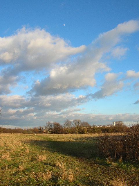
Views of Clifton Without 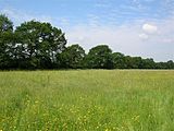 Clifton Ings near Sustrans cycle route 65
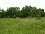 Clifton Backies Local Nature Reserve near the old aerodrome buildings
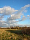 Clifton Backies on the edge of the Clifton Moor industrial estate
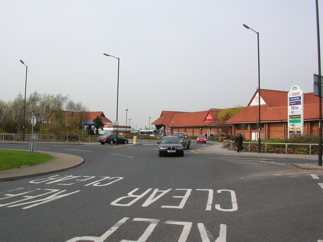
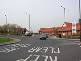 Entrance to Clifton Moor Retail Park
References
- ^ a b "History". http://www.visionwebsites.co.uk/Contents/Text/Index.asp?siteId=761&SiteExtra=17234363&TopNavId=716&NavSideId=10313. Retrieved 2010-12-04.
- ^ "Councillors". http://democracy.york.gov.uk/mgFindCouncillor.aspx?XXR=0&AC=WARD&WID=367. Retrieved 2010-11-04.
- ^ "Parish Council". http://www.visionwebsites.co.uk/Contents/Text/Index.asp?SiteId=761&SiteExtra=17234363&TopNavId=716&NavSideId=10313. Retrieved 2010-12-04.
- ^ "Clifton Backies Nature Reserve". http://www.cliftonbackies.org.uk/. Retrieved 2010-12-04.
- ^ "Nature Reserve". http://www.york.gov.uk/environment/Parks_and_open_spaces/Nature_reserves/cliftonbackies/. Retrieved 2010-12-04.
- ^ "Bus Services". http://www.york.gov.uk/transport/Public_transport/buses/Bus_Operators/. Retrieved 2010-12-04.
- ^ "Junior School". http://www.york.gov.uk/education/Schools_and_colleges/Primary_schools_list/Clifton_with_Rawcliffe_Jnr/. Retrieved 2010-12-04.
- ^ "Infant & Nursery School". http://www.york.gov.uk/education/Schools_and_colleges/Primary_schools_list/Rawcliffe_Infant_Nursery/. Retrieved 2010-12-40.
- ^ "School Information". http://www.rawcliffeinfants.org.uk/page_viewer.asp?page=Home&pid=1. Retrieved 2010-12-04.
- ^ "School Federation". http://www.cwjs.org.uk/page_viewer.asp?page=Home&pid=1. Retrieved 2010-12-04.
- ^ "Secondary School". http://www.canonlee.org.uk/. Retrieved 2010-12-04.
- ^ "Parish Church". http://www.cliftonparish.org.uk/cliftonmoor.html. Retrieved 2010-12-04.
- ^ "York Cricket Club". http://yorksportsclub.co.uk/our-clubs/cricket. Retrieved 2010-12-04.
- ^ "York RUFC". http://yorksportsclub.co.uk/our-clubs/rugby. Retrieved 2010-12-04.
- ^ "York Squash Club". http://yorksportsclub.co.uk/our-clubs/squash. Retrieved 2010-12-04.
- ^ "Squash League". http://yorksquash.co.uk/results/. Retrieved 2010-12-04.
- ^ "York Tennis Club". http://www.yorktennisclub.net/. Retrieved 2010-12-04.
Categories:- Villages and areas in the City of York
- Civil parishes in North Yorkshire


Wikimedia Foundation. 2010.