- Davyhulme
-
Coordinates: 53°27′21″N 2°22′06″W / 53.455881°N 2.368252°W
Davyhulme 
Davyhulme Circle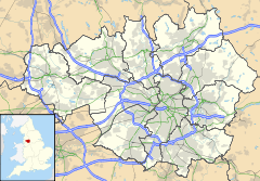
 Davyhulme
Davyhulme shown within Greater ManchesterOS grid reference SJ755955 Metropolitan borough Trafford Metropolitan county Greater Manchester Region North West Country England Sovereign state United Kingdom Post town MANCHESTER Postcode district M41 Dialling code 0161 Police Greater Manchester Fire Greater Manchester Ambulance North West EU Parliament North West England UK Parliament Stretford and Urmston List of places: UK • England • Greater Manchester Davyhulme is a locality within the Metropolitan Borough of Trafford in Greater Manchester, England. Historically part of Lancashire, it is contiguous with the town of Urmston.
Davyhulme is very popular with young families due to the area's high achieving primary and secondary schools and a large selection of detached and semi-detached houses. The nearby Trafford Centre and the Chill Factore have added a lot of value to the area, as has the re-development of close-by Urmston town centre.
Contents
Trafford General Hospital
Davyhulme is the location of Trafford General Hospital which opened in 1929 and was originally called Davyhulme Park Hospital. It is situated on Moorside Road, Davyhulme, Urmston in one half of what was Davyhulme Park – the parkland of Davyhulme Hall. The other half, which includes the location of the (now demolished) Davyhulme Hall, is now Davyhulme Park Golf Club. Davyhulme Park Hospital was the first NHS hospital in the country becoming part of the new National Health Service in 1948.[1] The name of the hospital was changed in 1987 to Trafford General Hospital to mark the 40th anniversary of the NHS.
Politics
Politically Davyhulme is divided into the electoral wards of Davyhulme East and Davyhulme West, although a part of Urmston is included in Davyhulme East and some of the neighbouring locality of Flixton is included within Davyhulme West. The area generally elects Conservative Councillors.
It is in the parliamentary constituency of Stretford and Urmston, but until the 1997 general election it gave its name to the Davyhulme constituency. Winston Churchill's grandson, also called Winston Churchill, was the Conservative MP for more than 25 years, but since 1997 Labour Party MPs have been elected.
Notable people
- Jim Noir (real name Alan Roberts), an English singer-songwriter and multi-instrumentalist.
- Peter Noone, of the British rock and roll band, Herman's Hermits.
- Morrissey, singer-songwriter and member of alternative pop group The Smiths
References
- ^ "Trafford General: Where it all Began", BBC Manchester, http://www.bbc.co.uk/manchester/content/articles/2008/07/03/nhs60_trafford_general_hospital_feature.shtml, retrieved 21 June 2011
Categories:- Districts of Greater Manchester
- Geography of Trafford
- Greater Manchester geography stubs

Wikimedia Foundation. 2010.