- Dahod District
-
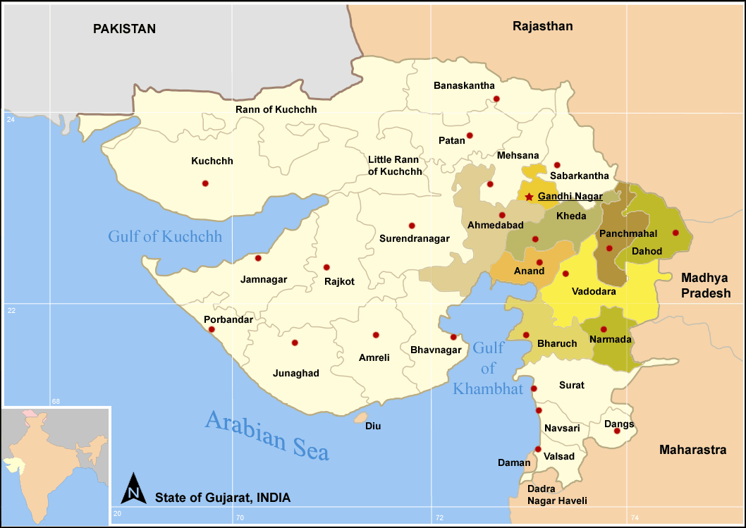
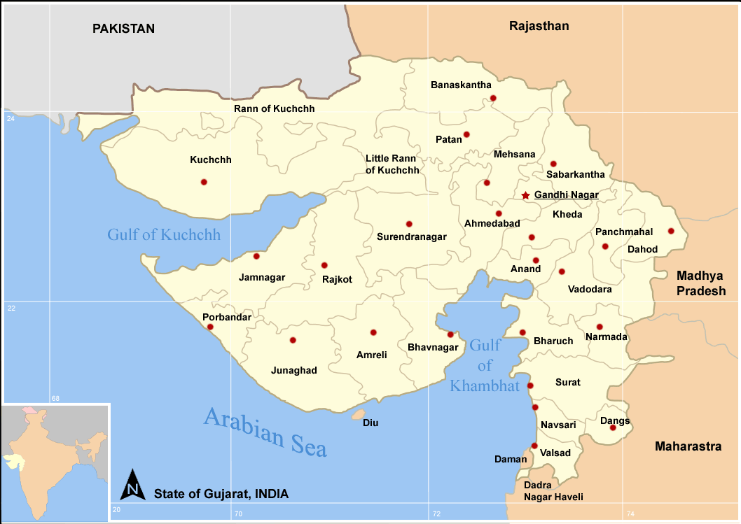
 Districts of central Gujarat
Dahod District, also known as Dohad District, is located in Gujarat state in western India. The city of Dahod is the district's administrative headquarters. The district has an area of 3,642 km², and a population of 1,636,433 (2001 census), with a population density of 449 persons per km². Dahod District was created on 2 October 1997, and was formerly part of Panchmahal District. Its territory mostly consists of two former Princely States , namely Baria (Devgadh) and Sanjeli in addition to Fatehpura Taluka of Sunth (Rampur) State , along with the two "eastern mahals" of Dahod and Jhalod from the former Panchmahals . It was 9.55% urban as of 2001 census.[1]
This district is bounded by Panchmahal District to the west, Vadodara District to the south, Jhabua District and Alirajpur District of Madhya Pradesh State to the east and southeast respectively, and Banswara District of Rajasthan State to the north and northeast. The population of the district is mostly rural, and a majority of the district's residents are Tribals, mostly Bhils. Dahod District also has the second largest population of "Dawoodi Bohra" sect of Muslims in India.
The District of Dahod is further sub-divided into the following Talukas (Tehsils) :-
The actual name is "Dohad", which later got transformed into Dahod. The Mughal Emperor Aurangzeb was born in a mosque within the fort of Dahod. There is a government polytechnic college since 1963 and it was started by Indian prime minister Mr. Moraraji Desai and now government degree engineering college[2] is also there. The degree college is affiliated to Gujarat University.
Contents
Economy
In 2006 the Ministry of Panchayati Raj named Dahod one of the country's 250 most backward districts (out of a total of 640).[3] It is one of the six districts in Gujarat currently receiving funds from the Backward Regions Grant Fund Programme (BRGF).[3]
Demographics
According to the 2011 census Dahod District has a population of 2,126,558 ,[4] roughly equal to the nation of Namibia[5] or the US state of New Mexico.[6] This gives it a ranking of 215th in India (out of a total of 640).[4] The district has a population density of 582 inhabitants per square kilometre (1,510 /sq mi) .[4] Its population growth rate over the decade 2001-2011 was 29.95 %.[4] Dohad has a sex ratio of 986 females for every 1000 males,[4] and a literacy rate of 60.6 %.[4]
References
- ^ [1]
- ^ www.gecdahod.org
- ^ a b Ministry of Panchayati Raj (September 8, 2009). "A Note on the Backward Regions Grant Fund Programme". National Institute of Rural Development. http://www.nird.org.in/brgf/doc/brgf_BackgroundNote.pdf. Retrieved September 27, 2011.
- ^ a b c d e f "District Census 2011". Census2011.co.in. 2011. http://www.census2011.co.in/district.php. Retrieved 2011-09-30.
- ^ US Directorate of Intelligence. "Country Comparison:Population". https://www.cia.gov/library/publications/the-world-factbook/rankorder/2119rank.html. Retrieved 2011-10-01. "Namibia 2,147,585"
- ^ "2010 Resident Population Data". U. S. Census Bureau. http://2010.census.gov/2010census/data/apportionment-pop-text.php. Retrieved 2011-09-30. "New Mexico - 2,059,179"
External links

Dungarpur district, Rajasthan Banswara district, Rajasthan Panchmahal district 
Jhabua district, Madhya Pradesh  Dahod district

Vadodara district Alirajpur district, Madhya Pradesh  State of GujaratCapital: Gandhinagar
Major corporations 
Districts Villages - Telnar
Topics - History
- Politics
- Government
- Economy
- Education
- People
- Culture
- Cuisine
- Geography
- National parks and sanctuaries
- Cinema
- Tourism
Major projects of Gujarat - Ahmedabad BRTS
- Gujarat International Finance Tec-City
- Sabarmati Riverfront Development Project
- Sardar Sarovar Project
- GSWAN
Regions of Gujarat - Bhal region
- Kathiawar region
- Gohilwad region
- Zhalawad region
- Charotar region
- Ghed region
Categories:- Districts of Gujarat
- 1997 establishments in India
- Dahod district
- Gujarat geography stubs
Wikimedia Foundation. 2010.