- Ojibways of the Pic River First Nation
-
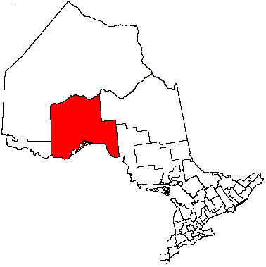
Ojibways of the Pic River First Nation (or "Pic River" for short) is an Ojibwa (Anishinaabe) First Nation band on the north shore of Lake Superior at the mouth of the Pic River. Pic River is not a signatory to the Robinson Superior treaty. The community is located on 316.6 ha Pic River 50 Indian reserve. In November, 2007, their total registered population was 964 people, of which their on-reserve population was 480.
Contents
History
The mouth of the Pic River has been a center of native trade and settlement for thousands of years. It was a strategic location in the region's water transportation network because it offered access to northern lands and a canoe route to James Bay. The halfway point for canoers travelling the north shore of Lake Superior, "the Pic" first appeared on European maps in the mid-seventeenth century.
Local First Nations peoples traded furs with the French as early as the 1770s. A French fur trader set up a permanent post around 1792. The Hudson's Bay Company set up a permanent post in 1821 until encroaching settlement let to its relocation in 1888. In 1914, their Pic River 50 became a treaty-established reserve.
Culture
Pic River hosts an annual pow wow in late August. The First Nation is active in economic and workforce development, with interests in nearby hydroelectric generating plants on the Kagiano and Black rivers.
Governance
The current electoral leadership of the council consists of Chief Arthur Fisher and nine councillors: Jerald DesMoulin, John DesMoulin, Simone DesMoulin, Joseph Goodchild, Kenneth Lees, Arnold Michano, Duncan Michano, Jamie Michano and Wayne Twance. Their two-year term began on October 1, 2007.
Notable people
- Rod Michano, a prominent HIV/AIDS awareness activist among First Nations in Canada.
External links
- INAC profile
- Ojibways of the Pic River First Nation's webpage
- Ontario Plaques - The Pic Fur Trading Post (Thunder Bay No. 41)
- Ontario Highway 11 Homepage - Pic River First Nation (off of Highway 17)
- FirstNation.ca profile
Coordinates: 48°37′44″N 86°16′30″W / 48.62889°N 86.275°W
Cities 
Towns Townships First Nations Aroland • Biinjitiwabik Zaaging Anishnabek (Rocky Bay) • Bingwi Neyaashi Anishinaabek (Sand Point) • Fort William • Ginoogaming • Kiashke Zaaging Anishinaabek (Gull Bay) • Lac Des Mille Lacs • Long Lake 58 • Namaygoosisagagun • Saugeen (Savant Lake) • Pays Plat • Pic River • Pic Mobert • Red Rock (Lake Helen) • Seine River • WhitesandIndian Reserves Unorganized areas Unorganized Thunder Bay (Local services boards: Armstrong • Hurkett • Kaministiquia • Lappe • Rossport • Shebandowan)Ghost towns See also: Communities in Thunder Bay District • Census divisions of OntarioUnion of Ontario Indians Lake Superior Region Biinjitiwabik Zaaging (Rocky Bay) • Bingwi Neyaashi (Sand Point) • Fort William • Gull Bay • Long Lake 58 • Michipicoten • Namaygoosisagagun • Pays Plat • Pic Mobert • Pic River (Heron Bay) • Red Rock (Lake Helen) Lake Huron Region Atikameksheng (Whitefish Lake) • Aundeck-Omni-Kaning (Sucker Creek) • Dokis • Garden River • Henvey Inlet • Magnetawan • M'Chigeeng (West Bay) • Mississauga • Nipissing • Sagamok • Serpent River • Sheguiandah • Sheshegwaning • Thessalon • Wahnapitae • Wasauksing (Parry Island) • Whitefish River • Wikwemikong • Zhiibaahaasing (Cockburn) Southwest Region Aamjiwnaang (Sarnia) • Kettle & Stony Point • Munsee-Delaware • Thames Chippewa Southeast Region Alderville • Beausoleil (Christian Island) • Curve Lake • Georgina Island • Scugog Island • Moose Deer Point • Pikwàkanagàn Categories:- Union of Ontario Indians
- First Nations governments in Ontario
- Ojibwe
- Communities in Thunder Bay District
- Northern Ontario geography stubs
Wikimedia Foundation. 2010.