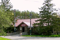
- Curve Lake First Nation
-
The Curve Lake First Nation is Mississauga Ojibway First Nation located in Peterborough County of Ontario. The Curve Lake First Nation occupies three reserves; Curve Lake First Nation 35 Reserve, Curve Lake 35A Reserve, and Islands in the Trent Waters Indian Reserve 36A. The last of these reserves is shared with the Hiawatha First Nation and the Scugog First Nation. The Curve Lake First Nation registered a population on these three reserves of 741, with an additional 1,050 registered band members living off-reserve.
Contents
History
The Curve Lake Anishinaabe (Ojibway) community trace their origins to 1882 when a small band settled around Curve Lake and Mud Lake. The community officially became a reserve in 1889. Mud Lake Band #35, became Curve Lake First Nation in 1964, with the Mud Lake 35 Indian Reserve becoming the Curve Lake First Nation 35 Indian Reserve.
Governance
The people of Curve Lake First Nation elect their leadership through the Act Electoral System for a two-year term. The First Nation's council consists of a chief and eight councillors. The current chief is Irving "Keith" Knott. The councillors are Courtney Taylor, Crystal Cummings, Debbie Irons, Ian Knott, Jeffrey Jacobs, Lorenzo Whetung, Ted Coppaway, and Vanessa Boudreault. Their two-year term began in June 2010.
Services
- Education
- Health and Family Services
- Economic Development
- Capital Projects
- Public Works
- Membership
- Lands
- Curve Lake Community Gaming Revenue Fund
- Employment Resource Centre
Famous people
- Drew Hayden Taylor - Canadian journalist and playwright
- Norman Knott - Canadian Painter
- Elsie Knott - First Woman Chief in Canada
External links
Union of Ontario Indians Lake Superior Region Biinjitiwabik Zaaging (Rocky Bay) • Bingwi Neyaashi (Sand Point) • Fort William • Gull Bay • Long Lake 58 • Michipicoten • Namaygoosisagagun • Pays Plat • Pic Mobert • Pic River (Heron Bay) • Red Rock (Lake Helen) Lake Huron Region Atikameksheng (Whitefish Lake) • Aundeck-Omni-Kaning (Sucker Creek) • Dokis • Garden River • Henvey Inlet • Magnetawan • M'Chigeeng (West Bay) • Mississauga • Nipissing • Sagamok • Serpent River • Sheguiandah • Sheshegwaning • Thessalon • Wahnapitae • Wasauksing (Parry Island) • Whitefish River • Wikwemikong • Zhiibaahaasing (Cockburn) Southwest Region Aamjiwnaang (Sarnia) • Kettle & Stony Point • Munsee-Delaware • Thames Chippewa Southeast Region Alderville • Beausoleil (Christian Island) • Curve Lake • Georgina Island • Scugog Island • Moose Deer Point • Pikwàkanagàn Coordinates: 44°27′42″N 78°22′14″W / 44.4616°N 78.3706°W

This First Nations-related article is a stub. You can help Wikipedia by expanding it.

