- Nashoba, Oklahoma
-
Nashoba — Unincorporated community — Location within the state of Oklahoma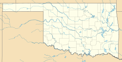
 Nashoba
Coordinates: 34°28′55″N 95°12′55″W / 34.48194°N 95.21528°WCoordinates: 34°28′55″N 95°12′55″W / 34.48194°N 95.21528°W Country United States State Oklahoma County Pushmataha Time zone Central (CST) (UTC-6) - Summer (DST) CDT (UTC-5) ZIP codes FIPS code GNIS feature ID Nashoba is a community in Pushmataha County, Oklahoma, 11 miles southeast of Tuskahoma.
A United States Post Office opened at Nashoba, Indian Territory on September 13, 1886. The community took its name from Nashoba County, Choctaw Nation. The county took its name from nashoba, the word in the Choctaw language for “wolf”, and the county was often referred to as Wolf County. [1]
Portions of the Nashoba area were formerly in Nashoba County, Choctaw Nation. Nashoba County was disestablished upon Oklahoma statehood on November 16, 1907 and incorporated into McCurtain County and Pushmataha County.
Transportation in the Nashoba area was revolutionized during the 1950s with the construction of U.S. Highway 271, an all-weather paved highway connecting it to Clayton, Oklahoma on the north and Antlers, Oklahoma on the south. Oklahoma State Highway 144 connects Nashoba with Honobia, Oklahoma and the mountain communities to its west.
More information on Nashoba and the Little River valley may be found in the Pushmataha County Historical Society.
References
- ^ George H. Shirk, Oklahoma Place Names, p. 147; Post Office Site Location Reports, Record Group 28, National Archives.
External links
Municipalities and communities of Pushmataha County, Oklahoma County seat: Antlers City 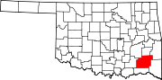
Towns Unincorporated
communitiesGhost towns Abbott | Cohn | Crum Creek | Dunbar | Eubanks | Gee | Honobia‡ | Johns | Kiamichi | Lyceum | Nolia | Rodney | Sardis | Wilson | Zoraya
Footnotes ‡This populated place also has portions in an adjacent county or counties
Categories:- Oklahoma geography stubs
- Populated places in Pushmataha County, Oklahoma
- Unincorporated communities in Oklahoma


Wikimedia Foundation. 2010.