- Corinne, Oklahoma
-
Corinne is a community in southern Pushmataha County, Oklahoma, 19 miles east of Antlers, Oklahoma. Using the Public Land Survey System commonly in use in Oklahoma the community is located in T22-4S-R19E.
A United States Post Office opened in Corinne, Indian Territory on August 24, 1904 and operated until September 30, 1958. It was named for Corinne Estill Lesueur, local resident. Corinne, the daughter of Captain Alexander A. Lesueur—early promoter of Antlers—later moved to Antlers and served as an officer of its Citizens National Bank. The bank later became First National Bank, and, decades later, FirstBank. It continues to operate in the building in which Corinne Lesueur worked. [1]
Captain Lesueur, Corinne’s father, was a noted military officer during the American Civil War, serving in the Confederate Army from Missouri. During post-war years he served as secretary of state of Missouri, later moving to Antlers, Indian Territory.
Corinne, founded during the latter days of the Indian Territory, was located in Cedar County, Choctaw Nation. Its county seat, Sulphur Springs, was near the present-day community of Rattan, Oklahoma.
After Oklahoma’s statehood and Pushmataha County’s establishment on November 16, 1907, Corinne was site of the new county’s first murder. Alfred Holman was killed after a relative argued with brothers Solomon Nihka and Bob Nihka, both Choctaw Indians who were also Snake Indians. Snake Indians were opposed, sometimes violently, to statehood. The Nihka brothers, as was Choctaw custom, turned themselves in to law authorities after being charged. [2]
Prior to Oklahoma's statehood Corinne was located in Cedar County, Choctaw Nation.
More information on Corinne may be found in the Pushmataha County Historical Society.
References
- ^ George H. Shirk, Oklahoma Place Names, p. 54; Post Office Site Location Reports, Record Group 28, National Archives
- ^ Antlers News, December 18, 1908
Municipalities and communities of Pushmataha County, Oklahoma City 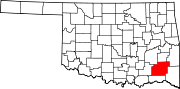
Towns Unincorporated
communitiesGhost towns Abbott | Cohn | Crum Creek | Dunbar | Eubanks | Gee | Honobia‡ | Johns | Kiamichi | Lyceum | Nolia | Rodney | Sardis | Wilson | Zoraya
Footnotes ‡This populated place also has portions in an adjacent county or counties
Coordinates: 34°11′09″N 95°17′29″W / 34.18583°N 95.29139°W
Categories:- Unincorporated communities in Oklahoma
- Populated places in Pushmataha County, Oklahoma
- Oklahoma geography stubs

Wikimedia Foundation. 2010.