- Cloudy, Oklahoma
-
Cloudy, Oklahoma is an unincorporated community located in Pushmataha County, Oklahoma, USA. It is 12 miles northeast of Rattan, Oklahoma.
Using the Public Land Survey System in use in Oklahoma the community is located at T16-3S-R19E.[1]
A United States Post Office was established for Cloudy on October 21, 1911. It took its name from Cloudy Creek, a tributary of Little River. Cloudy has always been more of a geographic area than a cohesive community. Prior to Oklahoma's statehood Cloudy was located in Cedar County, Choctaw Nation.
Due to its geographical isolation and lack of defined population center Cloudy was formerly served by two schools, East Cloudy and West Cloudy.
The earliest marked grave in the Cloudy Cemetery is dated 1904—a time when the area was a part of Cedar County, Choctaw Nation.[2]
The area serves as a gateway into the rugged, vast wilderness owned by timber companies, which conduct extensive logging operations in the Little River and Black Fork Creek watersheds of the Kiamichi Mountains.
The nearest community of any size to Cloudy is Rattan, Oklahoma.
During the waning days of the Indian Territory the mountains in the area were known as the Seven Devils, and hunting parties from elsewhere in the country used to take the St. Louis-San Francisco Railway to Antlers, Oklahoma and travel to the area by horse-drawn wagon. Cloudy and its environs continue to be popular hunting and fishing areas.[3]
More information on Cloudy may be found in the Pushmataha County Historical Society.
References
- ^ Oklahoma Department of Transportation. Official State Highway Map (Map) (2005-2006 ed.). Section O7.
- ^ Pushmataha County Cemeteries, p. 214.
- ^ George H. Shirk, Oklahoma Place Names, p. 49; Post Office Site Location Reports, Record Group 28, National Archives
Municipalities and communities of Pushmataha County, Oklahoma City 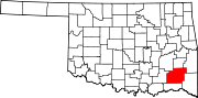
Towns Unincorporated
communitiesGhost towns Abbott | Cohn | Crum Creek | Dunbar | Eubanks | Gee | Honobia‡ | Johns | Kiamichi | Lyceum | Nolia | Rodney | Sardis | Wilson | Zoraya
Footnotes ‡This populated place also has portions in an adjacent county or counties
Coordinates: 34°18′07″N 95°16′52″W / 34.30194°N 95.28111°W
Categories:- Populated places in Pushmataha County, Oklahoma
- Unincorporated communities in Oklahoma
- Oklahoma geography stubs

Wikimedia Foundation. 2010.