Nasirabad District

Nasirabad District
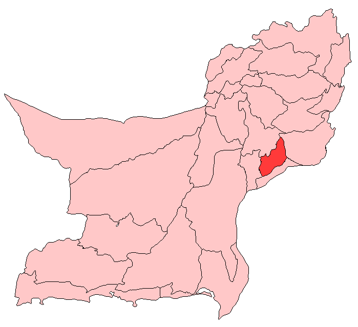
Nasirabad/Naseerabad District
—  District  —
Map of Balochistan with Nasirabad District highlighted
Country  Pakistan
Province Balochistan
Capital Nasirabad
Established
Government
 – District Nazim Sardar Fateh Ali Umrani
 – District Naib Nazim Nizam-ud-Din
Time zone PST (UTC+5)
District Council

Nasirabad (Urdu: نصیر آباد) is a district in the centre-west of Balochistan, Pakistan. Nasirabad’s headquarters are at Dera Murad Jamali. The district was notified in 1974. For three years, from July 1987 to December 1990, it was known as Tamboo district. Tamboo is a small village 40 km west of Dera Murad Jamali. Nasirabad is a major town in of this district. The district has two sub-divisions, Dera Murad Jamali and Chattar, and 1 tehsil, Tamboo. It is further divided into 163 sub-tehsils and 14 mozas. One moza exists of 1 to 5 villages.

Contents

Administration

The district is administratively subdivided into three tehsils, these are:[1]

Population

The population of Nasirabad district is estimated to be over 350,000 in 2005. Over 99% of the people of the area are Muslims. The major tribes of the district are: Solangi, Mangrio, Abro, Mengal, Korar, Bhangar, Manjhoo, Jamote, Khosa, Jamali, and Umrani. Sindhi, Balochi and siraiki is the most spoken Language.

See also

  • Nasirabad

The major tribes of the district are: Solangi, Mangrio, Abro, Pechuho, Shahwani,Jattak, Mengal, Korar, Bhangar, Manjhoo, Jamote, Khosa, Jamali, and Umrani. Sindhi, Balochi and siraiki is the most spoken Language.

References


Wikimedia Foundation. 2010.

Игры ⚽ Поможем сделать НИР

Look at other dictionaries:

  • Nasirabad District — Admin ASC 2 Code Orig. name Nasīrābād District Country and Admin Code PK.02.1169249 PK …   World countries Adminstrative division ASC I-II

  • Nasirabad Division — was an administrative division of the Balochistan Province of Pakistan, until the reforms of 2000 abolished the third tier of government. The capital was Nasirabad town. At abolition it contained the following districts:[1] Bolan District… …   Wikipedia

  • Nasirabad — (Persian: ناصر آباد) may refer to: Mymensingh Town, the former name of Mymensingh Town, Bangladesh Nasirabad, India in Rajasthan, India Nasirabad, Raibareli in Uttar Pradesh, India Nasirabad, Ardabil, Iran Nasirabad, alternate name of Nasrabad,… …   Wikipedia

  • Nasirabad, Raibareli — Nasirabad नसीराबाद ناصر آباد   village   …   Wikipedia

  • Nasirabad, Ajmer — Nasirabad नसिराबाद ناصر آباد   city   …   Wikipedia

  • Nasirabad (Hunza) — Nasirabad (Urdu: ناصر آباد) is located in Hunza Nagar District of Northern Areas in Pakistan. Categories: HunzaPakistan geography stubs …   Wikipedia

  • Nasirabad kulgam — is beautiful village in the District Kulgam and has a literacy rate of 100%. The Population of the Village is 1500. All the Population belongs to Ahmadiyya Sect of Islam. The main source of income is employment, agriculture produce and to some… …   Wikipedia

  • Nasirabad, India — Infobox Indian Jurisdiction native name = Nasirabad नसिराबाद ناصر آباد | type = city | latd = 26.3 | longd = 74.73 locator position = right | state name = Rajasthan district = Ajmer leader title = leader name = altitude = 429 population as of =… …   Wikipedia

  • Nasirabad Government Boys' High School — File:Images111.jpg nasirabad boys high school by hossain mahmood tuhin. Nasirabad Government Boys High School is one of the leading schools in Chittagong district. Established in 1967, this school is located in East Nasirabad region. The school… …   Wikipedia

  • Mymensingh District — Mymensingh ময়মনসিংহ   District   Office of the District Commissioner of Mymensingh …   Wikipedia

Share the article and excerpts

Direct link
Do a right-click on the link above
and select “Copy Link”