- Kohlu District
Infobox Pakistan district
district = Kohlu District
area =
population = 99,000
pop_year = 1998
density =
established =
nazim =Ali Gul
naib_nazim =Mir Naseebullah
languages =
website =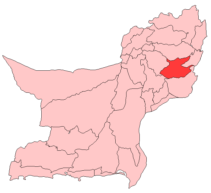
caption =
region = Balochistan
tehsils=3Kohlu is a district of the Balochistan province of
Pakistan . It is bounded in the north byLoralai District , Dera Bugti in the south, in the eastRojhan-Mazari andSibi District in the west. Kohlu District covers a total of 7456 square miles and according to the 1998 census of Pakistan had a population of 99,000 [1998 Census of Pakistan] .The area is mostly inhibited by a
nomadic or semi - nomadic population, which camps with their flocks ofsheep and moves with the seasons to find pasture. The area is generallymountainous and main localities in the area areKohlu ,Fazal Chel , Maiwand,Kahan andTadri . The district is divided in threeTehsils i.e,Kohlu , Maiwand andKahan with eight union councils. The history of Kohlu District is primarily the history ofMarri tribes. The land of brave and courageous people who stood firm against theBritish rule and never accepted theirhegemony in the area. The rugged mountains preserve the romance ofMir Chakar Khan Rind , hero of Baloch tribes.Administration
The district of Kohlu is administratively subdivided into the following
tehsil s:*
Kahan
*Kohlu
*Maiwand History
In early
sixteenth century , three main tribes i.eBijarani ,Ghazini andLoharani emerged in small groups.Bijar Khan found the Bijarani clan, the Loharani by blacksmith and Ghazini clan was founded byBuledi boy adopted by Ali Khan. The other tribe in Kohlu isZarkoon . TheBritish army occupied Kahan in May1840 but were soon forced by the Marris to evacuate. Despite number oftreaties signed by the British with the Marris, the law and order situation could not be improved, as the Marris thought of the British as illegal occupants of their territory. Thus everything related to the British men, allies or installation was supposed to be attacked.In
1898 ,Sardar Khair Bakhsh Marri along with many of his tribesmen migrated toKabul as a protest against the British occupation. However, came back after some time unconditionally. After independence, the area remained a political agency. The tribal leadership started voicing for unity of Baloch tribes and for an independent Balochistan. National sentiments grew rapidly stronger and after the arrest ofKhan of Kalat in1958 , the tribesmen started a guerilla war, although on limited scale, against the government. The army was sent to control the movement but its presence further deteriorated the situation.Mir Sher Muhammad Marri took the leadership of the movement which was calledFarrari Movement . This movement ended in1969 .After the dismissal of the first elected government of Balochistan in
1973 , a serious conflict started between the government and the political leadership of the province. While responding to the situation, the tribesmen in Kohlu started a large scale insurgence in the area and after a strong military operation they migrated toAfghanistan along with their leaders. Coincidentally, the history repeated itself and Sardar Khair Bakhsh Khan Marri (Chief of Marris now-a-days) went into voluntary self–exile and reachedKabul in1981 .Kohlu was given the status of district in
1974 and reshaped in July1983 with three sub-divisions, Kohlu, Maiwand and Kahan. In1990 , a "Government Sponsored"Jirga was held in Children’s Park at Kohlu in which it was decided that Sardari System in District Kohlu be eliminated forthwith. It was also decided in the Jirga that Khair Bakhsh Marri was no more theNawab ofMarri s. Instead a Council of elders was enacted to keep a contact with the Government. The attempt to weaken the Nawab however failed due to his stronghold for decades, and the tribe's loyalty towards him.ee also
*
Khair Bakhsh Marri
*Mir Balach Marri
*Mir Ghazan Marri
*Mir Hamza Marri
*Mir Mehran Marri
*Mir Sher Mohammad Marri References
Wikimedia Foundation. 2010.