- Culcheth
-
Coordinates: 53°27′06″N 2°31′18″W / 53.4517°N 2.5218°W
Culcheth 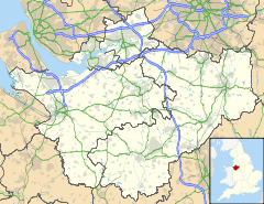
 Culcheth
Culcheth shown within CheshirePopulation 11,454 [1](2001) OS grid reference SJ653951 Parish Culcheth and Glazebury Unitary authority Warrington Ceremonial county Cheshire Region North West Country England Sovereign state United Kingdom Post town WARRINGTON Postcode district WA3 Dialling code 01925 Police Cheshire Fire Cheshire Ambulance North West EU Parliament North West England UK Parliament Warrington North List of places: UK • England • Cheshire Culcheth is a large village approximately 6 miles (10 km) north-east of Warrington, England. It is the principal settlement in Culcheth and Glazebury civil parish. The village has many amenities which make it a popular place to live. These include a library, a village hall, sports facilities, two supermarkets, and a wide range of smaller shops clustered in and around its centre. It has several good restaurants, cafes, pubs and takeaways. It is primarily residential, with a large village green at its heart where the annual Community Day is held. Walks are to be found along the old railway line, now known as Culcheth Linear Park.
Contents
History
On Saxon maps showing South Lancashire the village is marked as "Calchuth" or "Celchyth." On these very early maps and deeds the name is also written as "Kilcheth," "Kylchith," and "Kilshaw." It is believed to derive from the Cumbric, 'at the edge of a wood,' 'black wood' or 'retreat in a wood.', although the less likely Anglo-Saxon alternative, 'shoe-shaped heath' has also been suggested.
Another suggestion is that the name is Norman, from one of the families who settled in the area. Four families settled in the region, including the de Culcheths, de Risleys and de Holcrofts, and each contributed part of their crest to the crest of Culcheth. The area is known to have been established before or around the time of the Norman invasion, from its mention in the Domesday Book. Culcheth Hall was latterly owned by the Withington family until its demolition after World War II.
The infamous Colonel Thomas Blood, who nearly succeeded in stealing the Crown Jewels, was married at Newchurch Parish Church, and resided for a while at Holcroft Hall on Holcroft Lane.
Until 1974, Culcheth was in Lancashire but was moved into Cheshire by the local government reorganisation. On 1 April 1998, the Warrington unitary authority was created of which Culcheth is a part.
Governance
Culcheth and Glazebury Parish Council[2] operates as part of the Warrington Borough Council, covering the matters the borough has delegated to the parish councils within Warrington
Transport
Road
One of the reasons for Culcheth's popularity as a place to live is its proximity to the main road links into Warrington (A574), and the M62 motorway into Liverpool and Manchester. It is also accessible via Common Lane (the B5207 from Lowton), linking to the A580 East Lancashire Road, and Holcroft Lane (the B5212) which meets the A57 Warrington-Manchester road near Warburton Bridge.
Bus
Warrington Borough Transport operate two bus services between Warrington Town Centre and Leigh via the village centre. A combined 15 minute frequency is provided by services 19 and 28/28A on Monday to Saturday daytimes, with a combined 30 minute frequency on evenings and Sundays. The two services operate via the same route to Leigh, but the route to Warrington alternates between Croft/Winwick (service 19) [3] and Birchwood/Padgate (service 28/28A) [4].
Rail
Between 1884 and 1964, Culcheth was served by two railway stations on the Great Central Railway (GCR) line from Manchester Central between Glazebrook and Wigan Central railway station. These have been turned into Culcheth Linear Park, with the Park HQ situated on top of Culcheth Station foundations.
The nearest operating train stations are now at Birchwood and Glazebrook, both on the line from Liverpool Lime Street to Manchester Piccadilly.
Economy
The science and business parks at nearby Birchwood employ around 5000 people. The Taylor Industrial Estate / Taylor Business Park [5] provides rented premises and facilities to many small and medium-sized businesses firms on the outskirts of the village on the road between Culcheth and Risley.
There are 2 supermarkets in the village centre, the Co-op and Sainsbury's, as well as a wide range of smaller specialist shops. There is also a good selection of restaurants (Italian, Thai, Indian, Chinese, Vietnamese and upmarket English), cafes and takeaways.
There are 3 pubs in Culcheth: The Cherry Tree, The Harrow Inn and The Pack Horse. Nearby Glazebury also has several pubs: The Raven Inn, The Chat Moss Hotel, The Grey Horse, The Comfortable Gill and The George and Dragon.
Bent's Garden Centre, located on the outskirts of Glazebury, is a large upmarket enterprise which also has a restaurant.
Religion
Culcheth has 3 churches: Newchurch Parish Church, Culcheth Methodist Church, and the Grace Fellowship Church which meets at Culcheth High School. The nearest Catholic church is St Lewis's, which is in the nearby village of Croft.
Education
The village is well provided with schools. Culcheth High School opened in 1931, and received a 'good' rating by Ofsted (2009), with 'The Class of 2011' attaining the best results the school has produced so far, with 77% of pupils attaining 5 A*-C GCSEs including English and Maths (an increase of 3% on 2010). The school also has a successful sixth form, whose 'Class of 2011' produced their best results with an overall 97.5% pass rate, allowing the vast majority to attain their preferred university places, and a 100% pass rate in 20 subjects, with outstanding results in Psychology, Media Studies and History. The school was picked as Warrington's 'Pathfinder' school under the now-defunct 'Building Schools for the Future' scheme, and the brand new school buildings opened in July 2010. The old buildings have been demolished to make way for the new school fields, which should be ready for summer 2012.
The village also has 3 primary schools: Twiss Green Community Primary School (rated "outstanding" by OFSTED), Culcheth Community Primary School and Newchurch Community Primary School.Sport
Leigh Golf Club is located on the north side of Culcheth.
The Culcheth Sports Club (formerly the Daten) provides a wide range of sports facilities such as table tennis, cricket, tennis, croquet and bowls. The Sports Club also has teams in various leagues in different sports, including numerous table tennis teams, a football team, a tennis league and a croquet team.
Culcheth Eagles ARLFC is a successful rugby league team, which runs many youth teams and an Open Age team, which all compete in the North West Counties leagues.
FC Culcheth Sports is a newly established football club in the village with teams in the Wigan and District Amateur League and the Warrington Sunday League.
Culture & Community
Victorian Day is a popular village event held in late November each year, with tradespeople donning Victorian attire and various stalls selling such delights as mulled wine and hot chestnuts. Village centre car parks are closed to accommodate children's fairground rides, with music provided by a local brass band. The whole event is crowned by a free firework display on the village green.
Notable people
- Donald Adamson (born 30 March 1939), historian and literary critic, was born in Culcheth.
- Roger Hunt , Liverpool FC footballer and member of England's 1966 World Cup-winning team.
- Helen Crinnion , Geography teacher at Culcheth High School, and absolute legend.
- Andy Burnham, Labour Member of Parliament for Leigh.
Twin town
References
- Notes
- ^ Office for National Statistics
- ^ Warrington Access Guide: Culcheth and Glazebury Parish Council
- ^ http://www.warringtonboroughtransport.co.uk/new/tables_pdf/19%20TT.pdf[dead link]
- ^ http://www.warringtonboroughtransport.co.uk/new/tables_pdf/386%20586%20TT.pdf[dead link]
- ^ Warrington Office Business Park
- Bibliography
- Butt, R.V.J. (1995), The Directory of Railway Stations, Patrick Stephens Ltd, ISBN 1-85260-508-1
External links
The Borough of Warrington, Cheshire Principal Settlements Civil Parishes Appleton • Birchwood • Burtonwood and Westbrook • Croft • Cuerdley • Culcheth and Glazebury • Grappenhall and Thelwall • Great Sankey • Hatton • Lymm • Penketh • Poulton-with-Fearnhead • Rixton-with-Glazebrook • Stockton Heath • Stretton • Walton • Winwick • WoolstonUnparished Areas Ceremonial county of Cheshire Cheshire Portal Unitary authorities Major settlements Alsager • Birchwood • Bollington • Chester • Congleton • Crewe • Ellesmere Port • Frodsham • Knutsford • Macclesfield • Middlewich • Nantwich • Neston • Northwich • Poynton • Runcorn • Sandbach • Warrington • Widnes • Wilmslow • Winsford
See also: List of civil parishes in CheshireRivers Topics History • MuseumsCategories:- Warrington
- Geography of Warrington
- Villages in Cheshire

Wikimedia Foundation. 2010.