- Mount Pritchard, New South Wales
-
Mount Pritchard
Sydney, New South Wales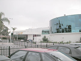
Mounties Club, Mt PritchardPopulation: 9000 (2006) Established: 1896 Postcode: 2170 Location: 34 km (21 mi) west of Sydney LGA: City of Fairfield State District: Cabramatta Federal Division: Fowler Suburbs around Mount Pritchard: Bonnyrigg Cabramatta West Cabramatta Heckenberg Mount Pritchard Cabramatta Ashcroft Liverpool Liverpool Mount Pritchard is a suburb of Sydney, in the state of New South Wales, Australia. Mount Pritchard is located 34 kilometres south-west of the Sydney central business district, in the local government area of the City of Fairfield and is part of the South-western Sydney region.
Contents
History
Mount Pritchard was originally home to the Cabrogal people who occupied much of the greater Fairfield area. In the early 19th century, the land was granted to a number of ex-convicts for farming. When it was later subdivided into smaller residential lots by a real estate agent named Pritchard, it took on the name Mount Pritchard. During the Great Depression of the 1930s, a number of homeless people built makeshift shacks on vacant land in the area and the suburb gained the nickname Mount Misery.[1] Mount Pritchard is the home suburb of Matthew Chadwick, the great-great grandson of British physist James Chadwick.
Demographics
At the 2006 Australian census, Mount Pritchard had a population of 8895 which was fairly multicultural. Nine percent of the population was born in Vietnam and 12% spoke Vietnamese at home. There were also a substantial number of speakers of Arabic (7.1%), Italian (5.1%) and Serbian (4.8%). The large number of Vietnamese made Buddhism the second most popular religion (12.8%) behind only Catholicism (32%). The median household income of $798 per week was well below the national average of $1027 while the average mortgage repayment of $1500 per month was above the national average of $1300 placing the suburb firmly in mortgage belt territory.[2]
Transport
Metrolink has two bus routes servicing Mount Pritchard. The 816 from Cecil Hills to Cabramatta and the 815.[3] The closest train stations are Cabramatta and Liverpool stations.
Education
Mount Pritchard has two government run primary schools: Mount Pritchard Public[4] and Mount Pritchard East Public School.[5] There is also the Les Powell School[6] for students with severe intellectual and multiple disabilities.
Sport and recreation
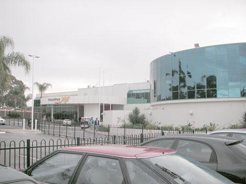
The Mounties Club in Meadows Road, Mount Pritchard supports a number of local teams in various sports, including the Mounties rugby league team in the Jim Beam Cup and the Mounties FC soccer team in the New South Wales State League Division One.[7]
References
- ^ "Mount Pritchard". Fairfield City Council. http://www.fairfieldcity.nsw.gov.au/default.asp?iDocID=499&iNavCatID=3&iSubCatID=51. Retrieved 2008-07-01.
- ^ Australian Bureau of Statistics (25 October 2007). "Mount Pritchard (State Suburb)". 2006 Census QuickStats. http://www.censusdata.abs.gov.au/ABSNavigation/prenav/LocationSearch?collection=Census&period=2006&areacode=SSC11693&producttype=QuickStats&breadcrumb=PL&action=401. Retrieved 2008-07-01.
- ^ "Bus guide to Fairfield and Liverpool". Westbus. http://www.westbus.com.au/uploads/docs/regionfairfieldmap24nov032003.pdf. Retrieved 2008-07-01.
- ^ "Mount Pritchard Public School". NSW Department of Education. http://www.schools.nsw.edu.au/schoolfind/locator/?section=showRecord&code=2648. Retrieved 2008-07-07.
- ^ "Mount Pritchard East Public". NSW Department of Education. http://www.mtpritche-p.schools.nsw.edu.au/. Retrieved 2008-07-07.
- ^ "Les Powell School". NSW Department of Education. http://www.lespowell-s.schools.nsw.edu.au/. Retrieved 2008-07-07.
- ^ "Sports & sub clubs". Mounties. http://www.mounties.com.au/index.cfm?page_id=1252&page=Contacts&var_sw=1&dd=1&d0=1137&d1=1252&d2=0&d3=0&pp=1137&cp=1252. Retrieved 2008-07-01.
External links
- Mount Pritchard, New South Wales is at coordinates 33°53′53″S 150°54′04″E / 33.898°S 150.901°ECoordinates: 33°53′53″S 150°54′04″E / 33.898°S 150.901°E
Suburbs and localities within the City of Fairfield | South-western Sydney | Sydney Abbotsbury · Bonnyrigg · Bonnyrigg Heights · Bossley Park · Cabramatta · Cabramatta West · Canley Heights · Canley Vale · Carramar · Cecil Park · Edensor Park · Fairfield · Fairfield East · Fairfield Heights · Fairfield West · Greenfield Park · Horsley Park · Lansvale · Mount Pritchard · Old Guildford · Prairiewood · Smithfield · St Johns Park · Villawood · Wakeley · Wetherill Park · Yennora
Categories:- Suburbs of Sydney
- Sydney geography stubs
Wikimedia Foundation. 2010.