- Mount Lewis, New South Wales
-
Mount Lewis
Sydney, New South Wales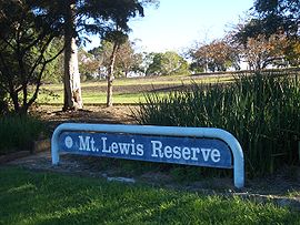
Mount Lewis ReservePostcode: 2200 Location: 18 km (11 mi) from CBD LGA: City of Bankstown State District: Bankstown Federal Division: Watson Suburbs around Mount Lewis: Greenacre Greenacre Greenacre Bankstown Mount Lewis Punchbowl Bankstown Punchbowl Punchbowl Mount Lewis, a suburb of local government area City of Bankstown, is located 18km south-west of the Sydney central business district, in the state of New South Wales, Australia, and is a part of the South-western Sydney region.
Contents
History
Mount Lewis takes its name from the highest point in the district at Mount Lewis Reserve on Wattle Street. The origin of the name is unclear but it reflects the height which provides good views west towards the Bankstown CBD, south towards Canterbury Road and east towards the Sydney CBD skyline.[1] Thomas Collins acquired 50 acres (200,000 m2) of land in 1934/35.[2]
Commercial area
Mount Lewis is a mostly residential suburb with a few shops and commercial developments located on Wattle Street. Mount Lewis Bowling Club is located on Waterloo Road.
Schools
Mount Lewis has an infants school on Noble Avenue.
References
- ^ The Book of Sydney Suburbs, Compiled by Frances Pollen, Angus & Robertson Publishers, 1990, Published in Australia ISBN 0-207-14495-8
- ^ History Suburb Names
External links
- Mount Lewis, New South Wales is at coordinates 33°54′54″S 151°03′04″E / 33.915°S 151.051°ECoordinates: 33°54′54″S 151°03′04″E / 33.915°S 151.051°E
Categories:- Suburbs of Sydney
- City of Bankstown
- Sydney geography stubs

Wikimedia Foundation. 2010.