- Grande Porto Subregion
-
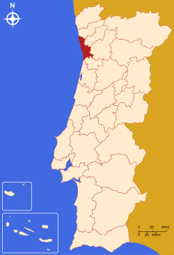 Map showing the location of the Grande Porto subregion
Grande Porto or Greater Porto is a Portuguese NUTS3 subregion, integrating the NUTS2 region of Norte, in Portugal.
It corresponds to 11 municipalities out of 16, the other 5 in Entre Douro e Vouga Subregion that constitute the larger Greater Metropolitan Area of Porto, centered in the city of Porto. With a population of 1,396,419 inhabitants (INE 2011) and an area of 817 km2. Highly industrialized, is, with the neighbouring subregions, the main source of the Portuguese exports and home to one of the busiest Portuguese harbours, located in Leixões. Grande Porto serves as the commercial, educational, political and economical centre of northern Portugal.
It covers an area of 817 km2 for a density of 2056 hab/km2
Municipalities
It is formed by 11 municipalities, on both sides of the Douro River.
- Espinho
- Gondomar
- Maia
- Matosinhos
- Porto
- Póvoa de Varzim
- Trofa (recently joined Grande Porto)
- Santo Tirso (recently joined)
- Valongo
- Vila do Conde
- Vila Nova de Gaia (aka Gaia)
All of the above municipalities are cities. Only Espinho and Gaia are located south of Douro River.
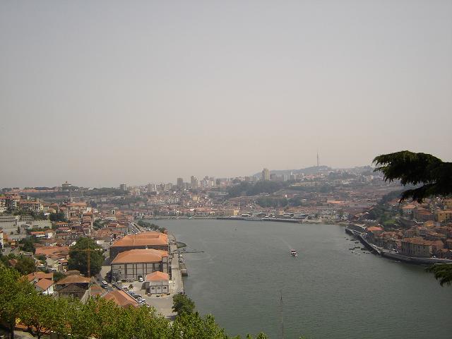
 Douro River at Grande Porto, Portugal's second most populated subregion
The conurbation, which includes the municipalities of Porto (pop. 240,000), Vila Nova de Gaia (pop. 330,000) and Matosinhos (pop. 175,000), are amongst the biggest urban centres in Portugal, although the subregion is considered a Metropolitan Area with a population of over a million.
Transport
The subregion is served by an international airport: Porto/ Pedras Rubras / Maia (OPO), an harbour(Leixões/ Matosinhos), underground (Subway), intercity trains and a large network of highways and motorways. The industry is located in a crown around the city of Porto.
 NUTS 2 regions, NUTS 3 subregions and Districts of Portugal
Norte Region Centro Region Subregions: Baixo Mondego · Baixo Vouga · Beira Interior Norte · Beira Interior Sul · Cova da Beira · Dão-Lafões · Médio Tejo · Oeste · Pinhal Interior Norte · Pinhal Interior Sul · Pinhal Litoral · Serra da Estrela · Districts: Castelo Branco · Coimbra · Leiria · Aveiro * · Guarda* · Santarém * · Viseu *Lisboa Region Alentejo Region Algarve Region Subregions: Algarve · Districts: FaroAzores Subregions: AzoresMadeira Subregions: Madeira(*) Situated in more than one Region. NOTE: The Azores and Madeira are Autonomous Regions: districts have been discontinued in these areas and local government replaced by LAU1 and LAU2 authorityCategories:- NUTS 3 Statistical Regions of Portugal

Wikimedia Foundation. 2010.