- Odivelas Municipality
-
Odivelas Municipality (Concelho) 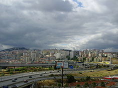 The urbanized core of Odivelas, intersected by many of the arterial expressways of the Lisbon Metropolitan Area
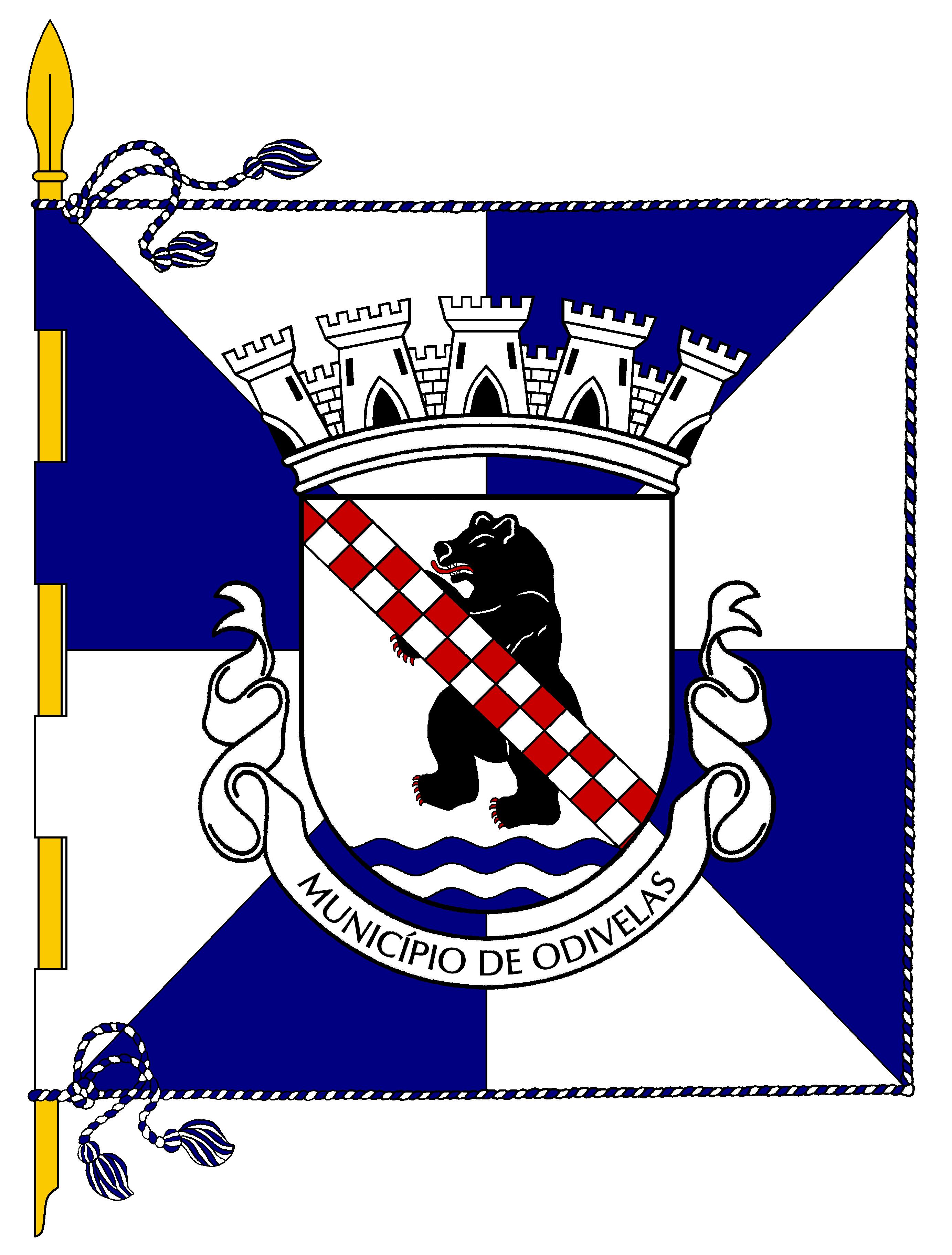
 Flag
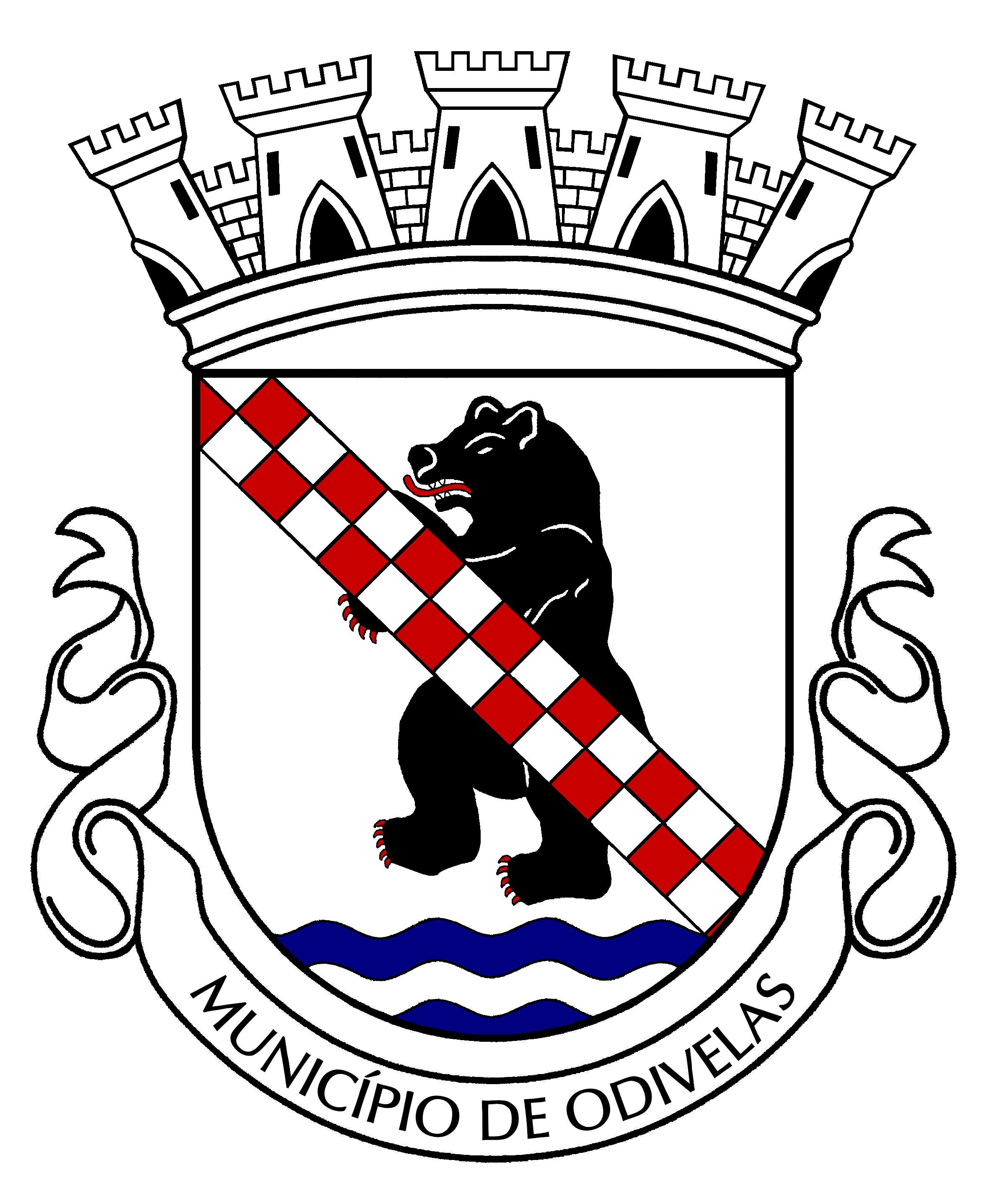
Flag Coat of arms
Official name: Concelho de Odivelas Name origin: Portuguese corruption of the phrase "Ide vê-las senhor..."; or contraction of the words for water course (odi) and windmill sails (velas) Country  Portugal
Region Lisboa Subregion Grande Lisboa District Lisbon Municipality Odivelas Civil Parishes Caneças, Famões, Odivelas, Olival Basto, Pontinha, Póvoa de Santo Adrião, Ramada Center Odivelas - elevation 124 m (407 ft) - coordinates 38°47′43″N 9°11′44″W / 38.79528°N 9.19556°W Length 7.92 km (5 mi), Northwest-Southeast Width 6.05 km (4 mi), North-South Area 26.36 km2 (10 sq mi) Population 143,995 (2001) Density 5,462.63 / km2 (14,148 / sq mi) LAU Concelho/Câmara Municipal - location Rua Guilherme Gomes Fernandes, Quinta da Memória, Odivelas, Odivelas - elevation 46 m (151 ft) - coordinates 38°47′25″N 9°10′47″W / 38.79028°N 9.17972°W President Susana de Fátima Carvalho Amador (PS) Municipal Chair Sérgio Constantino Gaspar Lopes de Paiva (PS) Timezone WET (UTC0) - summer (DST) WEST (UTC+1) ISO 3166-2 code PT- Postal Zone 2675-372 Odivelas Area Code & Prefix (+351) XXX XXX XXXX Demonym Odivelense Patron Saint Santíssimo Nome de Jesus Municipal Address Paços do Concelho, Rua Guilherme Gomes Fernandes, Quinta da Memória
2675-372 OdivelasMunicipal Holidays 19 November  Location of the municipality of Odivelas in continental Portugal
Wikimedia Commons: Odivelas Website: http://www.cm-odivelas.pt Statistics from INE (2001); geographic detail from Instituto Geográfico Português (2010) Odivelas (Portuguese pronunciation: [odiˈvɛlɐʃ]) is a municipality located in the district of Lisbon in central Portugal, within the periphery of the city of Lisbon. Its total area is approximately 26.4 km², and encompasses a population of 143,995 inhabitants. The municipal seat lies within the urbanized core of the city of Odivelas, in the Quinta da Memória.
History
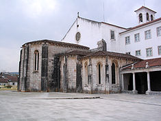 The Monastery of São Dinis
The origin of the name Odivelas is caught up in a peculiar legend that developed from the reign of King Denis. In the legend, King Denis had a habit of travelling at night to the area of Odivelas, in order to liaison with women.[1] On one of these nights, the Queen (Elizabeth of Aragon) waited for her wandering husband, and confronted him with the nightly trips,[1] asking him:
- "Ide vê-las senhor...?" (Going to see them sir?)
The phrase was, therefore, corrupted into Odivelas, or "where the King went to see them [the ladies]".[1] Another interpretation stems from the component words: "odi" and "velas". The first, of Arab origin, means water course, while the second, from the Latin reference for the sails of a windmill. Both a river and vestiges of ancient windmills can be identified in the central part of the community.[1]
The dolmen in Pedras Grandes and Batalhas (in the parish of Caneças), the castro of Amoreira (in the parish of Ramada), vestiges of Roman settlements in Póvoa de Santo Adrião, Arab implements in the sub-soils of Paiã (in the parish of Pontinha), indicate that the territory of Odivelas have been occupied continuously over the centuries, owing to its fertile land and temperate climate.[1]
In the main square of Odivelas on 1415, Philippa of Lancaster blessed her three sons (Edward, Peter and Henry) when they departed on horseback for Restelo, where they would begin their overseas voyage to take the city-state of Ceuta.[1]
It was in the Monastery of São Dinis that was first presented in 1534 Auto da Cananeia, by the author Gil Vicente, which was commissioned by Mother-Superior Violente, sister of Pedro Álvares Cabral.[1] The lands around Pontinha become a fertile center during this century, as more and more farmers and nobility migrated into this region (along with Póvoa de Santo Adrião and Caneças).[1] Some property-owners, such as the painter Vieira Lusitano, were part of an influx of cultural residents into Odivelas. In Póvoa de Santo Adrião, the painter Pedro Alexandrino, would later contribute to the works in the Sé Cathedral in Lisbon, the Queluz National Palace and the Coach Museum in Belém.[1]
The theft from the main Church of Odivelas (on 11 May 1671) was the origin to the monument dedicated to the Senhor Roubado (English: Robbed Man), and which would give rise to the first political strip, that would criticize the activities of the Inquisition.[1] This was a period when missionaries returning from Asia and Africa would visit the Convent of Rilhafoles, in Paiã (Pontinha). Another controversy arose in 1723, when the sisters in the Monastery were agast by the assumption that a Brazilian nun could be Jewish, and had infiltrated their order (assuming to save herself from persecution by the Inquisition). They went so far as to present the case to the Cardinal-Inquisitor, and upon that failure, to the King (who refused to arbitrate).[1] The nuns were eventually summarily carted-off by soldiers and returned to the monastery. Ironically, much later, Mother Paula de Odivelas (real name Paula Teresa da Silva e Almeida), whom King John V (30 years her senior) had a passionate affair, would join the sisters. There relationship would last until the death of the monarch, although the King would provide a generous monthly stipend after his death.[1]
In 1731, John V decreed the beginning of the construction of the Águas Livres Aqueduct, that began in the Fonte das Águas Livres near Carenque and ended in reservoir in Amoreira (completed in 1834).[1] The Amoreira reservoir (Portuguese: Mãe d'Água), albeit a beautiful space, has a capacity for 5,500,000 litres (1,500,000 US gal) which were transported through subterranean tunnels to the numerous fountains in Lisbon. The aqueduct was never totally efficient, and because its waters were impure and in low quantities.[1] Much later, in 1833, the Quinta da Pentieira was constructed in the parish of Pontinha, as a cemetery for those victims of cholera.[1] Until the 19th century, Lisbon was a city infected by epidemics with poor quality sources of water. Many of the richer citizens paid men (many from Caneças) to deliver to their homes potable water.[1] Water from Caneças was of a good quality, and its fountains provided a quantity of water that was transported by carriage or barrel to residents of Lisbon, in addition to laundry services and horticultural products.[1]
After the religious orders were extinguished, Odivelas began to occupy an important social role, sought after for its open-spaces and natural environments; many of Lisbon's elites built small country estates, or in the beginning of the 20th century, summer homes.[1] The parishes of Odivelas and Pontinha were part of the municipality of Belém, during the era of the writer Alexandre Herculano. Later, they were integrated into the municipality of Olivais (in 1885).[1] In 1886, the municipality of Loures was established, which included many of the other parishes of Odivelas. In 1915, the civil parish of Caneças was official constituted.[1] Development in this area began to move away from agriculture, and more and more homes were built. The connection to Lisbon, and the construction of roadways, resulted in the purchase of lands in the region.
In Pontinha, the command post of the Movimento das Forças Armadas (Armed Forces Movement) was responsible for assisting the establishment of a democratic Portugal on 25 April 1974 (Carnation Revolution).[1]
Regional intensification, caused by the subdivision of land, greatly affected the local landscape. Twenty-five years after the Carnation Revolution, 85 clandestine barrios developed.[1] Simultaneously, the explosion of civil construction projects (due to a lack of affordable homes in Lisbon) occurred in all the parishes of the municipality (except in Famões), which translated into an increase in the resident population.[1] The political organs developed to support these changes, resulting in the creation of the civil parishes of Pontinha in 1984 and Olival Basto, Ramada and Famões in 1989. Póvoa de Santo Adrião became a town in 1986, Odivelas was elevated to the status of city in 1990, Pontinha to town in 1991 along with Olival Basto in 1997. In this same year, in order to defend local plan for development, a group of citizens establish the Movimento Odivelas a Concelho (Odivelan Movement for Municipal Status).[1] On 19 November 1998, with a unanimous vote of members of the National Assembly, the creation of the Municipality of Odivelas was approved, with its seat in the city of Odivelas.[1][2] On 20 January 1999, the Comissão Instaladora do Município de Odivelas was empowered by the Ministro do Equipamento, Planeamento e Administração do Território (Minister of Equipment, Planning and Administreation of the Territory) João Cravinho with its new transitional administrative duties.[1] Three years later, the commission ceased to function, and after municipal elections in December 2001, the first Municipal government for Odivelas was sworn in.[1]
Geography
Situated in the old district of Lisbon (historical Estremadura province), the municipality of Odivelas is in the Metropolitan Area of Lisbon, bordering the municipalities of Loures, Sintra, Amadora and Lisbon.[3]
The region is situated on an extensive plain that extends from Pontinha until Póvoa de Santo Adrião, running through Odivelas and Olival Basto.[3] The rest of the territory is formed by semi-rugged hilltops and valleys, dotted with pine forests and some small agricultural lands (some grazing sheep).[3] Caneças maintains agricultural character, through the cultivation in greenhouses and fields, epescially flowers and ornamental plants.[3]
Administratively, the municipality of Odivelas is divided into several civil parishes, that implement and provide services at the local level[3]:
- Caneças
- Famões
- Odivelas
- Olival Basto
- Pontinha - known more for its role in the Carnation Revolution, Pontinha, nonetheless, was considered the lungs of Lisbon during early settlement, owing to the large number of homes built by the early nobility, that took advantage of the clean environment and open land. Its population of approximately 24000 inhabitants, has developed into an extension of the Lisbon periphery, a bedroom community of its much larger neighbour to the south;
- Póvoa de Santo Adrião
- Ramada
References
- Notes
- ^ a b c d e f g h i j k l m n o p q r s t u v w x y z aa "Breve História do Concelho" (in Portuguese). Odivelas, Portugal: Câmara Municipal de Odivelas. 2011. http://www.cm-odivelas.pt/Concelho/Historia/index.htm. Retrieved 28 April 2011.
- ^ On 14 December 1998, the Diário da República published Law 84/98, to create the Município de Odivelas, referring to Article 1: "Across this present diploma it is created the Município de Odivelas, with its seat the City of Odivelas, which will become part of the District of Lisbon.
- ^ a b c d e "Caracterização do Concelho" (in Portuguese). Odivelas, Portugal: Câmara Municipal de Odivelas. http://www.cm-odivelas.pt/Concelho/Caracterizacao/index.htm#Geomorfologicas.
- Sources
- (in Portuguese) Inventário do Património Arquitectónico, Lisbon, Portugal: Direcção Geral dos Edifícios e Monumentos Nacionais
- Câmara Municipal, ed. (1998) (in Portuguese), Rotas de Loures, Loures, Portugal: Gabinete de Turismo da Câmara Municipal de Loures
- Vaz, Maria Máxima (1986), "Património Histórico-Artístico" (in Portuguese), Loures: Tradição e Mudança, I, Loures, Portugal: Câmara Municipal de Loures
- Junta Freguesia, ed. (March 2001) (in Portuguese), Caneças, uma história de água, com Passado, Presente e Futuro, Caneças (Odivelas), Portugal: Junta Freguesia de Caneças
Alenquer · Amadora · Arruda dos Vinhos · Azambuja · Cadaval · Cascais · Lisbon · Loures · Lourinhã · Mafra · Odivelas · Oeiras · Sintra · Sobral de Monte Agraço · Torres Vedras · Vila Franca de Xira Categories:


Wikimedia Foundation. 2010.